filter
-
Brand
- By Category
- Direction
- Date Range
387Events
Pictures
Events
Editorial
- 2023-06-16
- 1
Editorial
- 2023-06-16
- 1
Editorial
- 2023-06-15
- 1
Editorial
- 2023-06-15
- 1
Editorial
- 2023-06-15
- 1
Editorial
- 2023-06-15
- 1
Editorial
- 2023-06-15
- 1

Editorial
- 2023-06-15
- 1

Editorial
- 2023-06-15
- 1

Editorial
- 2023-06-15
- 1

Editorial
- 2023-06-15
- 1

Editorial
- 2023-06-15
- 1
Editorial
- 2023-06-15
- 1

Editorial
- 2023-06-15
- 1
Editorial
- 2023-06-15
- 1

Editorial
- 2023-06-15
- 1

Editorial
- 2023-06-15
- 1
Editorial
- 2023-06-15
- 1
Editorial
- 2023-06-15
- 1

Editorial
- 2023-06-15
- 1

Editorial
- 2023-06-15
- 1

Editorial
- 2023-06-15
- 1

Editorial
- 2023-06-15
- 1
Editorial
- 2023-06-15
- 1

Editorial
- 2023-06-15
- 1

Editorial
- 2023-06-15
- 1
Editorial
- 2023-06-15
- 1
Editorial
- 2023-06-15
- 1

Editorial
- 2023-06-15
- 1
Editorial
- 2023-06-15
- 1
Editorial
- 2023-06-15
- 1

Editorial
- 2023-06-15
- 1
Editorial
- 2023-06-15
- 1

Editorial
- 2023-06-15
- 1

Editorial
- 2023-06-15
- 1

Editorial
- 2023-06-15
- 1

Editorial
- 2023-06-15
- 1

Editorial
- 2023-06-15
- 1

Editorial
- 2023-06-14
- 1

Editorial
- 2023-06-14
- 1

Editorial
- 2023-06-07
- 1

Editorial
- 2023-03-17
- 1

Editorial Self-portrait. Date/Period: Between 1771 and 1775. Drawing. Pen and brown ink on moderately thick, moderately textured, cream laid paper. Height: 540 mm (21.25 in); Width: 416 mm (16.37 in).
- 2022-12-25
- 1
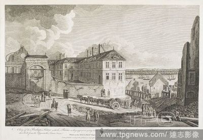
Editorial Soldiers, figures and horses and a cart in a road by the Bishop's House in Quebec; ruins nearby; water and ships in the distance; trees on the opposite shore. London : Publish'd according to Act of Parliament Sepr 1 1761 by Rich'd Short & Sold by Thos ...
- 2022-12-24
- 1
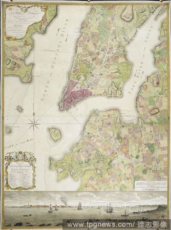
Editorial Plan of the City of New York, in North America: surveyed in the years 1766 & 1767. Plan of the City of New York, in North America: surveyed in the years 1766 & 1767. To His Excellency Sir Henry Moore, Bart ... This Plan of the City of New York and its ...
- 2022-12-24
- 1

Editorial A map of Florida. FLORIDA from the Latest Authorities. [London] : By T. Jefferys, Geographer to His MAJESTY, [1763.]. Copperplate engraving. Source: Maps K.Top.122.80. Language: English.
- 2022-12-24
- 1

Editorial A sketch of the action between the British forces and the American provincials, on the heights of the peninsula of Charlestown, the 17th of June 1775. MAPS and Plans, chiefly of fortifications or surveys for miltary purposes. 17th century-18th century....
- 2022-12-24
- 1

Editorial A plan of the town and harbour of St. Augustin. PLAN of the TOWN and HARBOUR of ST. AUGUSTIN. [London] : T. Jefferys, [1763.]. Copperplate engraving. Source: Maps K.Top.122.86.1. Language: English.
- 2022-12-24
- 2
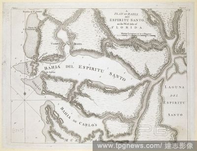
Editorial A plan of Bahia del Espiritu Santo . A PLAN OF BAHIA DEL ESPIRITU SANTO, on the West side of FLORIDA. [London] : [T. Jefferys], [1763.]. Copperplate engraving. Source: Maps K.Top.122.87.
- 2022-12-24
- 1

Editorial A plan of the City and Environs of Philadelphia. A PLAN of the City and Environs of PHILADELPHIA. London : Publish'd according to Act of Parl.t March 12.th 1777 by W. Faden Successor to the late Mr. Jefferys Geographer to the KING Charing Cross, [March...
- 2022-12-24
- 1
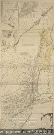
Editorial A map of the Provinces of New York and New Jersey; with part of Pensilvania (Pennsylvania), and the Province of Quebec . The Provinces of NEW YORK, and NEW JERSEY; with part of PENSILVANIA, and the Province of QUEBEC. London : Printed for Robt Sayer an...
- 2022-12-24
- 1

Editorial Ships sailing through Tappan Zee on the Hudson River in the foreground, with rocky banks on both sides and mountains and woods in the background. A View in Hudson's River of the Entrance of what is called the Topan Sea = Vue sur la Riviere d'Hudson, de...
- 2022-12-24
- 1
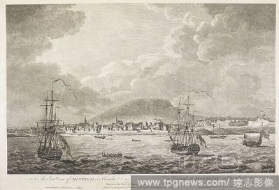
Editorial Ships on the St Lawrence River men rowing boats nearby; the city of Montreal in the distance. An East View of MONTREAL, in Canada. [London] : Published according to Act of Parliament Novr 11 1762 by Thos Jefferys at Charing Cross., [November 11 1762]. ...
- 2022-12-24
- 2
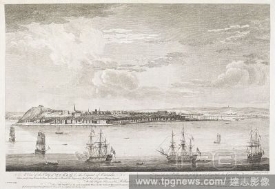
Editorial View of Quebec in the distance; ships and small boats in the foreground; the St Lawrence River stretching across the middle ground. A View of the City of QUEBEC, the Capital of Canada, : Taken partly from Pointe des Peres, and partly on Board the Vangu...
- 2022-12-24
- 1
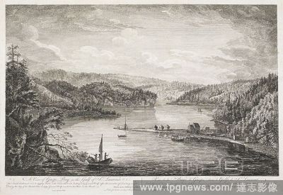
Editorial Landscape with a view over an expanse of water with forests on surrounding banks, three men in a boat in the left foreground. A boatyard on the right outside the house on beach in which General Wolfe resided, three huge containers of fish beside, a gro...
- 2022-12-24
- 1

Editorial A plan of the Harbour and Settlement of Pensacola. PLAN of the HARBOUR and SETTLEMENT of PENSACOLA. [London] : T. Jefferys sculp., [1763.]. Copperplate engraving. Source: Maps K.Top.122.95. Language: English.
- 2022-12-24
- 1
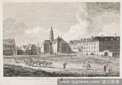
Editorial Horses and a cart, figures, a horse, rider and a dog on a road in front of the Jesuits College and Church in Quebec. A View of the Jesuits College and Church. London : Publish'd according to Act of Parliament Sep 1 1761, by Richd Short & Sold by Thos J...
- 2022-12-24
- 1
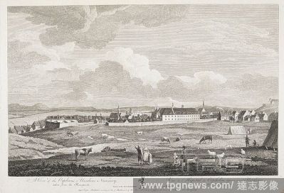
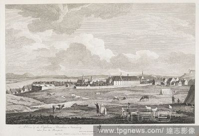
Editorial Figures, cattle and sheep in the foreground; tents to the right-hand side; Quebec and the Orphan's Nursery in the middle ground; ships on the St Lawrence River in the distance. A View of the Orphan's or Urseline Nunnery taken from the Ramparts. [London...
- 2022-12-24
- 1

Editorial View of a river with soldiers in a sailboat and three rowing boats, a settlement on the banks on the left with a crude wooden crucifix facing the river, forests surrounding, stretching into the distance . A View of Miramichi, a French Settlement in t...
- 2022-12-24
- 1
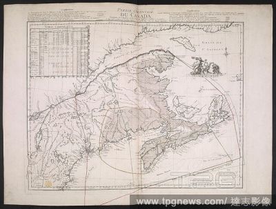
Editorial A French copy of an English map, published during the American Revolutionary War, showing the eastern part of Canada. Geographical detail extends from Cape Breton in the east down the Saint Lawrence River as far as Montr??al, and from the coast of Labr...
- 2022-12-24
- 1

Editorial A map of the Western parts of the Colony of Virginia as far as the Mississippi. MAP of the Western parts of the COLONY of VIRGINIA, as far as the Mississipi. [London] : [Thomas Jefferys], [1754.]. Copperplate engraving, hand colour in outline. Source: ...
- 2022-12-24
- 1

Editorial Two figures stand on top of a cliff looking at the Great Falls, with the Passaic River in the foreground, and the sun breaking among clouds above the forest in the background. A View of the Falls on the Passaick, or second River, in the Province of New...
- 2022-12-24
- 1
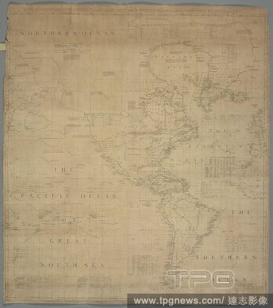
Editorial A chart of North and South America. A CHART of NORTH and SOUTH AMERICA, including the ATLANTIC and PACIFIC OCEANS, with the nearest COASTS of EUROPE, AFRICA, and ASIA. [London] : Publish'd according to Act of Parliament Feb. 19. 1753 by T. Jefferys Geo...
- 2022-12-24
- 1
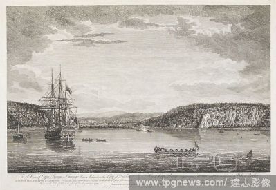
Editorial A large sailing ship on the St Lawrence River; men in rowing boats nearby; a tree-lined shore in the middle ground; buildings of Cap-Rouge in the distance. View of Cape Rouge or Carouge, nine Miles above the City of Quebec on the North Shore of the RIV...
- 2022-12-24
- 1

Editorial A large sailing ship by Percé Rock in the Gulf of St Lawrence; other boats nearby . View of the Pierced Island, a remarkable Rock in the Gulf of St Laurence. : Two Leagues to the Southward of Gaspé Bay. London : Publish'd according to Act of Parliam...
- 2022-12-24
- 1
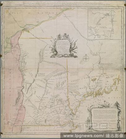
Editorial An Accurate Map of His Majesty's Province of New Hampshire in New England. [London] : [Thomas Jefferys], 21st. Octr. 1761. Source: Maps K.Top.120.25. Language: English.
- 2022-12-24
- 1
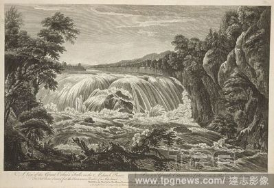
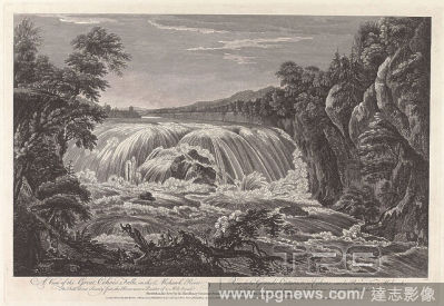
Editorial A group of figures stand by a fallen tree in the foreground looking at the waterfall behind, with cliffs and trees on both banks of the Mohawk River and forests in the background . A View of the Great Cohoes Falls, on the Mohawk River = Vue de la Grand...
- 2022-12-24
- 1

Editorial A map of the Western parts of the Colony of Virginia. MAP of the Western parts of the COLONY of VIRGINIA, as far as the Mississipi. [London] : [Thomas Jefferys], [1754.]. Copperplate engraving, hand colour in outline. Source: Maps K.Top.122.46. Languag...
- 2022-12-24
- 1
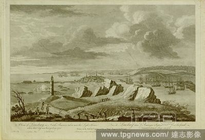
Editorial Soldiers in battle in the foreground; a lighthouse on the left; French ships in the middle ground to the right-hand side; the British fleet in the distance Gabarus Bay; the town of Louisbourg at the centre; mountains in the distance. A View of Louisbur...
- 2022-12-24
- 1
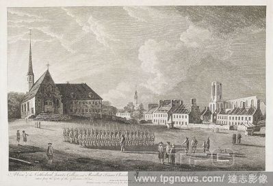
Editorial Soldiers and figures in a square in front of Quebec Cathedral; the Jesuits College and Recollect Friars Church to the right. A View of the Cathedral, Jesuits College, and Recollect Friars Church, taken from the Gate of the Governors House. [London] : P...
- 2022-12-24
- 1
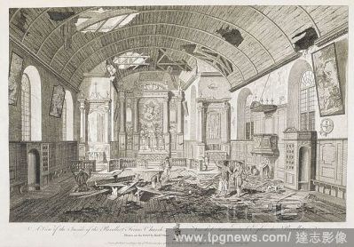
Editorial The damaged interior of the Recollect Friars Church in Quebec; holes in the ceiling; a friar praying on the left-hand side; figures standing and looking at the damage; a dog on the right-hand side; broken floorboards throughout the scene . London : Pu...
- 2022-12-24
- 1

Editorial Figures and a dog on a damaged street; stones and wood on the ground; ruined buildings on either side. A View of the Treasury, and Jesuits College. London : Publish'd according to Act of Parliament, Septr 1 1761, by Richd Short & Sold by Thos Jefferys ...
- 2022-12-24
- 1
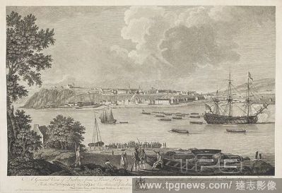
Editorial Soldiers and figures standing on the shore at Lévis looking across the St Lawrence River to Quebec; ships on the water. A General View of Quebec from Point Levy, To the Honble Sr CHARLES SAUNDERS Vice Admiral of the Blue and Knight of the Most Honoura...
- 2022-12-24
- 1
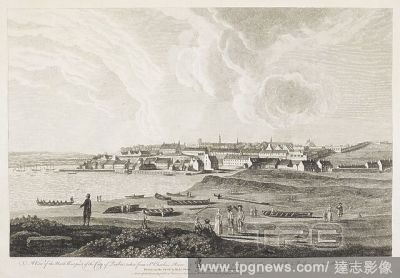
Editorial Figures standing by the shore of the St Lawrence River; boats grounded and on the water; the city of Quebec in the distance. A View of the North West part of the City of Quebec, taken from St Charles's River. London : Publish'd according to Act of Parl...
- 2022-12-24
- 1

Editorial A chart of the entrance into Saint Mary's River. A Chart of the Entrance into Saint Mary's River taken by Capt. W. Fuller ... 1769. (Plan of Amelia Island. A Chart of the Mouth of Nassau River). London : T. Jefferys, 1770. Source: Maps K.Top.122.84. La...
- 2022-12-24
- 1

Editorial The coastline in Pensacola seen from the sea, with ships in the foreground, boats moored on the beach, and houses a church and a fort in the background. A North View of Pensacola, on the Island of Santa Rosa. [London] : [Thomas Jefferys], [1763]. Engra...
- 2022-12-24
- 1

Editorial A map of the Western parts of the Colony of Virginia. MAP of the Western parts of the COLONY of VIRGINIA, as far as the Mississipi. [London] : [Thomas Jefferys], [1754.]. Copperplate engraving, hand colour in outline. Source: Maps K.Top.122.46. Languag...
- 2022-12-24
- 1
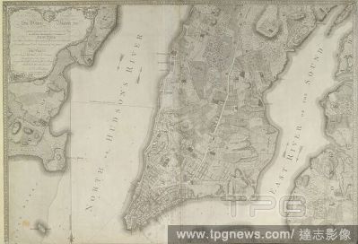
Editorial Plan of the City of New York ... surveyed in the years 1766 & 1767... A South West View of the City of New York, taken from the Government Island. . Plan of the City of New York, in North America: surveyed in the years 1766 & 1767. To His Excellency Si...
- 2022-12-24
- 3
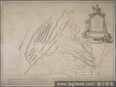
Editorial A map of Virginia. A New and Accurate MAP OF VIRGINIA wherein most of the COUNTIES are laid down from ACTUAL SURVEYS. : With A Concise Account of the Number of Inhabitants, the Trade, Soil, and Produce of that PROVINCE. LONDON : February 1770 Published...
- 2022-12-24
- 1

Editorial Plan of the City of New York, in North America: surveyed in the years 1766 & 1767... A South West View of the City of New York, taken from the Government Island. . Plan of the City of New York, in North America: surveyed in the years 1766 & 1767. To Hi...
- 2022-12-24
- 1
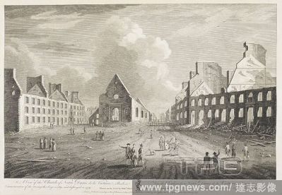
Editorial Men, women, soldiers and a dog in the street; ruined buildings throughout the scene; the ruins of the church of Notre Dame de la Victoire in the middle distance. A View of the Church of Notre Dame de la Victoire; Built in Commemoration of the raising t...
- 2022-12-24
- 1

Editorial Figures on the shore of a lake in the foreground, with haymakers working on the fields beyond on the left. A village, Single Brethren House, Gemeinhaus, waterworks, gardens and Moravian Chapel on the right; woods in the background. A View of Bethlem, t...
- 2022-12-24
- 1

Editorial Sailing ships and two figures launching a boat in Esopus Island on the Hudson River in the foreground, with the Catskill mountains and woods in the background. A View in Hudson's River of Pakepsey & the Catts-Kill Mountains = Vue sur la Riviere d'Hudso...
- 2022-12-24
- 1
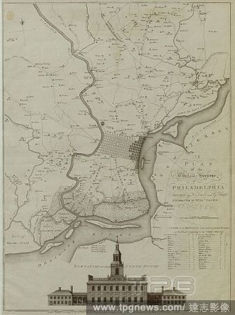
Editorial A plan of the City and Environs of Philadelphia. A PLAN of the City and Environs of PHILADELPHIA. London : Publish'd according to Act of Parl.t March 12.th 1777 by W. Faden Successor to the late Mr. Jefferys Geographer to the KING Charing Cross, [March...
- 2022-12-24
- 1
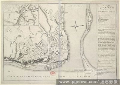
Editorial Quebec. A Plan of Quebec, the Capital of New France or Can. Charing Cross[, London] : Thos. Jefferys, Oct. 9th. Source: Maps.70775.(8),. Language: English.
- 2022-12-24
- 1

Editorial A plan of the Bay and Island of Mobile. PLAN of the BAY and ISLAND of MOBILE. [London] : [T. Jefferys], [1763.]. Copperplate engraving. Source: Maps K.Top.122.93. Language: English.
- 2022-12-24
- 1

Editorial A map of Nova Scotia and Cape Breton. Geographical detail extends from Cape Breton in the east down the Saint Lawrence River as far as Montr??al, and from the coast of Labrador in the north to Boston Harbour in the south. A NEW MAP of NOVA SCOTIA and C...
- 2022-12-24
- 1
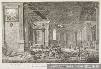
Editorial Men and soldiers standing in the ruined interior of the Jesuits Church in Quebec; holes in the ceiling; broken floorboards. A View of the Inside of the Jesuits Church. [London] : Publish'd according to Act of Parliament by Rich'd Short & Sold by Thos J...
- 2022-12-24
- 1
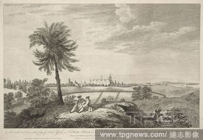
Editorial Two men sit on a hillock under a palm tree, with a view of New York across fields and wooden fences beyond, including the Prison on the left, the City Hall and New College in the middle and Staten Island on the right. The Hudson River can be seen in th...
- 2022-12-24
- 1

Editorial North America, still image, Maps, 1766, Jefferys, Thomas (d. 1771).
- 2022-12-24
- 1

Editorial Soldiers, figures, a horse and rider, cattle and a cart on a road; ruins and the Bishop's Palace behind; children playing on ruins to the left. A View of the Bishop's House with the Ruins, as they appear in going up the Hill from the Lower; to the Uppe...
- 2022-12-24
- 1
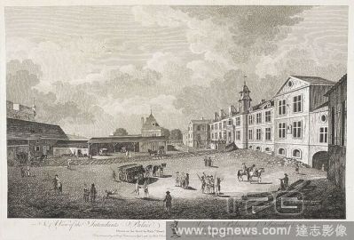
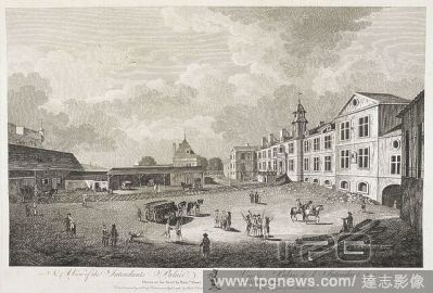
Editorial Men, women, soldiers, horses and a dog in the street near the Intendants Palace in Quebec; figures sitting on plans of wood in the lower right-hand corner. A View of the Intendants Palace. [London] : Publish'd according to Act of Parliament, Septr 1 17...
- 2022-12-24
- 1
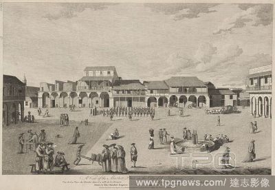
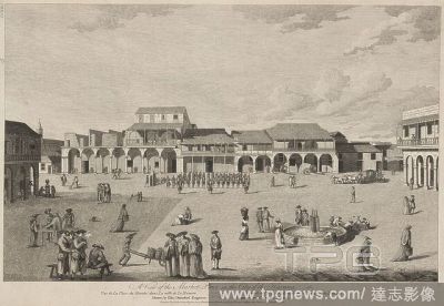
Editorial A commanding officer and his squad in the market square (Plaza Vieja) in Havana (La Habana), with children playing around a fountain, and priests, soldiers and women carrying baskets in the foreground. Figures in the balconies of the porticoed houses e...
- 2022-12-24
- 1

Editorial Horses and a cart, figures, a horse, rider and a dog on a road in front of the Jesuits College and Church in Quebec. A View of the Jesuits College and Church. London : Publish'd according to Act of Parliament Sep 1 1761, by Richd Short & Sold by Thos J...
- 2022-12-24
- 1

Editorial Soldiers, figures and horses and a cart in a road by the Bishop's House in Quebec; ruins nearby; water and ships in the distance; trees on the opposite shore. London : Publish'd according to Act of Parliament Sepr 1 1761 by Rich'd Short & Sold by Thos ...
- 2022-12-24
- 1
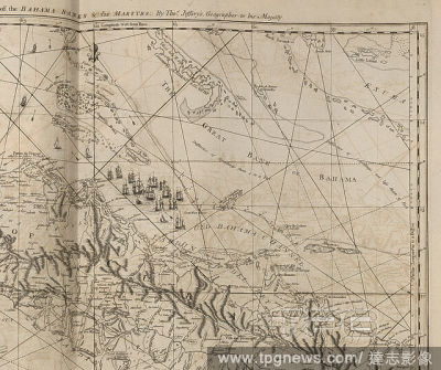
Editorial The part of the Bahama banks, from The West-India atlas.
- 2022-12-24
- 1
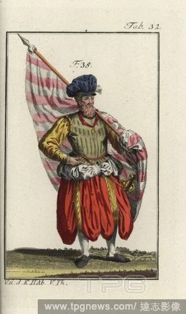
Editorial German standard-bearer in baggy long breeches 1588.
- 2022-01-18
- 1

Editorial Young French woman, 1581.
- 2022-01-18
- 1
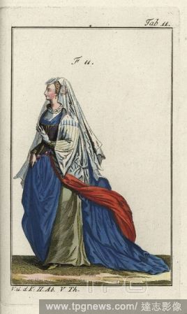
Editorial Woman of Rome in formal attire 1581.
- 2022-01-18
- 1

Editorial Nobleman from the Dutch provinces, 1586, and a Dutch merchant?s wife, 1640.
- 2022-01-18
- 2
 Loading