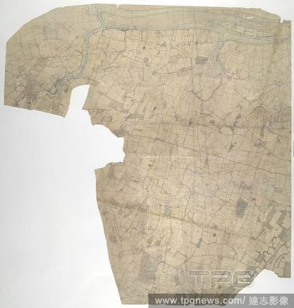
EditorialMilton, Kent. 19th century map. This original protraction of the Swale in Kent extends from Milton to Conyer Creek, and comprises the first plottings from the field book of the area. Ruled-black sheet lines indicate the edges of the area that were copi...
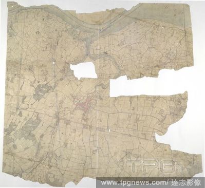
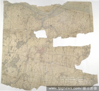
EditorialFaversham, Kent. 18th century map. This is a plan of the Kentish flatlands surrounding Faversham, to the south of The Swale. Ruled red-ink lines radiating from observation stations and intersecting across the map, indicate angular measurements taken by...
EditorialFaversham, Kent. 18th century map. This is a plan of the Kentish flatlands surrounding Faversham, to the south of The Swale. Ruled red-ink lines radiating from observation stations and intersecting across the map, indicate angular measurements taken by...
EditorialMilton, Kent. 19th century map. This original protraction of the Swale in Kent extends from Milton to Conyer Creek, and comprises the first plottings from the field book of the area. Ruled-black sheet lines indicate the edges of the area that were copi...


 Loading