
filter
-
Brand
- By Category
- Direction
- Date Range
104Events
Pictures
Events

Editorial PEOPLE: Marie Portolano - Telematin - Marseille 08/05/2014
- 2024-05-08
- 3

Editorial Rome, the Chamber's Foreign and Defense Committees Hear From the Secretary General of Defense and National Director of Armaments, Italy - 11 Apr 2024
- 2024-04-11
- 1
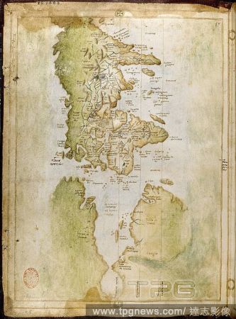
Editorial North Atlantic coast of America. Portolano. Italy [Naples?]; circa 1508. [Whole chart] An outline of the east coasts of North and South America. The volume appears to be a copy of one of the early portolani of Visconti Maggiola, of Genoa, and the earli...
- 2022-12-24
- 1
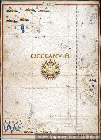
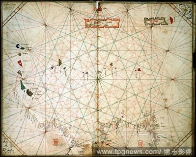
Editorial Chart of the Atlantic Ocean. Portolano. Spain; before 1600. [Whole chart] Chart of the Atlantic Ocean, with Ireland, Portugal, and part of the west coast of Africa, including the Azores, Madeira, Canary Islands, and Cape Verde Islands. The western Atla...
- 2022-07-22
- 1
Editorial West Africa; Cape Verde Islands. Portolano. Italy; 1468. [Whole chart] Chart of the coast of west Africa, south of Cape Blanco, with the Cape Verde Islands. Probably made for Prospero Camulio de Medicis, Bishop of Caithness Image taken from Portolano ...
- 2022-07-22
- 1
Editorial Chart of the Eastern Atlantic. Portolano. Italy; 1463. [Whole chart] Chart of the west coasts of Spain, Portugal, and Africa to the Canary Islands, including Madeira and the Azores Image taken from Portolano. Originally published/produced in Italy; 1...
- 2022-07-22
- 1

Editorial Map of the Canary Islands.
- 2022-07-22
- 1

Editorial CELEBRITES : Soiree de lancement du Sidaction 2022 - Paris - 07/03/2022
- 2022-03-08
- 6

Editorial Return of the last Italian soldiers from Kabul and completion of the evacuation of Afghan civilians, Ciampino airport, Rome, Italy - 31 Aug 2021
- 2021-09-04
- 3

Editorial Return of the last Italian soldiers from Kabul and completion of the evacuation of Afghan civilians, Ciampino airport, Rome, Italy
- 2021-09-01
- 3

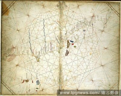
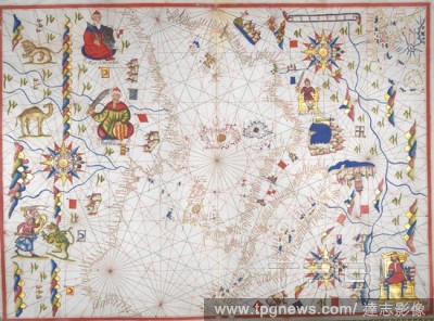
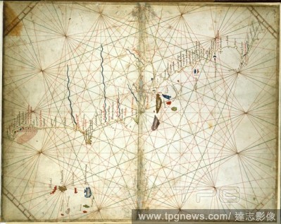
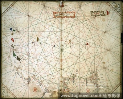
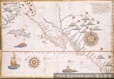
Editorial Chart of South East Asia. Portolano. France [Marseilles]; 1613. [Whole chart] Chart of the coasts of Bengal, Siam, Sumatra, Java, China, and the islands of the South China Seas and North Pacific Ocean Image taken from Portolano. Originally published/...
- 2020-09-29
- 1

Editorial Mediterranean Sea and Black Sea. Portolano. Spain; before 1600. [Whole chart] Chart of the Eastern Mediterranean Sea, from Greece to Turkey, and the Black Sea Image taken from Portolano. Originally published/produced in Spain; before 1600. . Source: ...
- 2020-09-28
- 1

Editorial Map showing small part of Banda Besar (Lonthoir) and Hatta (Rosengain.) The Bnda islands, part of the Indonesian province of Maluku. DUTCH PORTOLANO, containing forty-nine coloured maps and views. 17th century. Source: Add. 34184, f.70.
- 2020-09-28
- 1

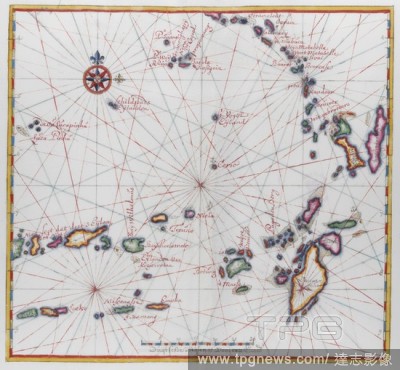
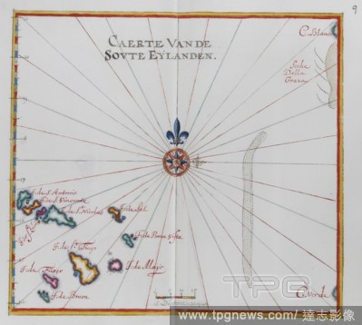
Editorial Pictorial map of three of the Banda islands. DUTCH PORTOLANO, containing forty-nine coloured maps and views. 17th century. Source: Add. 34184, f.64.
- 2020-09-28
- 1
Editorial Western Mediterranean Sea. Portolano. Spain; before 1600. [Whole chart] Chart of the western Mediterranean Sea, from the south coast of Spain, and North Africa, to the west coast of Greece. The chart includes the western part of the Baltic Sea Image t...
- 2019-01-24
- 1

Editorial Mediterranean and Black Seas. Portolano. Italy [Venice]; 1473. [Whole opening] Charts of the coasts of the Eastern Mediterranean Sea and the Black Sea Image taken from Portolano. Originally published/produced in Italy [Venice]; 1473. . Source: Egerto...
- 2019-01-24
- 1
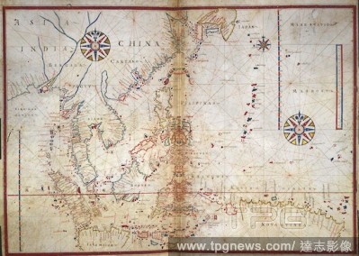
Editorial Chart of South East Asia. Portolano. France [Marseilles]; 1613. [Whole chart] Chart of the coasts of Bengal, Siam, Sumatra, Java, China, and the islands of the South China Seas and North Pacific Ocean Image taken from Portolano. Originally published/...
- 2019-01-24
- 1

Editorial Western coast of Europe. Portolano. Spain; before 1600. (Whole chart) Chart of the western coast of Europe, from the British Isles, France, Spain, Portugal, and part of the Mediterranean Sea with northern coast of Africa including Madeira. Decorated wi...
- 2019-01-24
- 1

Editorial Central America and West Indies. Portolano. Spain; before 1600. [Whole chart] Chart of the coast of the southern coast of North America, Central America and the West Indies, and the northern coast of South America Image taken from Portolano. Original...
- 2019-01-24
- 1

Editorial North Atlantic coast of America. Portolano. Italy [Naples?]; circa 1508. [Whole chart] An outline of the east coasts of North and South America. The volume appears to be a copy of one of the early portolani of Visconti Maggiola, of Genoa, and the earli...
- 2019-01-24
- 1
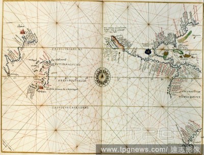
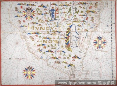
Editorial Pacific Ocean. Portolano. Italy, circa 1540. [Whole map] Map of the Pacific Ocean showing the Straits of Magellan, and the discoveries of Cortes in Gulf of California. Executed for the Gaudagni family of Florence Image taken from Portolano. Originall...
- 2019-01-24
- 1
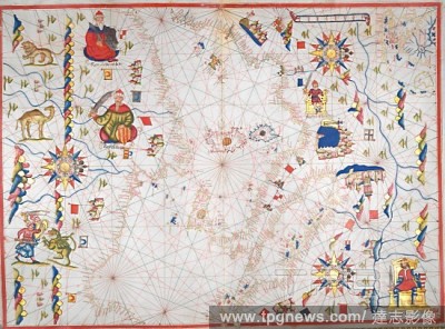
Editorial Chart of the Persian Gulf. Portolano. Italy; 1578. [Whole chart] Chart of the Eastern Mediterranean Sea, the Red Sea, and Persian Gulf, with part of the east coast of Africa, and Arabia Image taken from Portolano. Originally published/produced in Ita...
- 2019-01-24
- 1
Editorial Mediterranean Sea and Black Sea. Portolano. Spain; before 1600. [Whole chart] Chart of the Eastern Mediterranean Sea, from Greece to Turkey, and the Black Sea Image taken from Portolano. Originally published/produced in Spain; before 1600. . Source: ...
- 2019-01-24
- 1

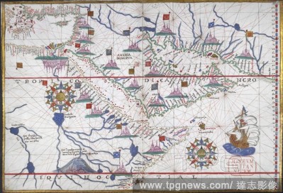
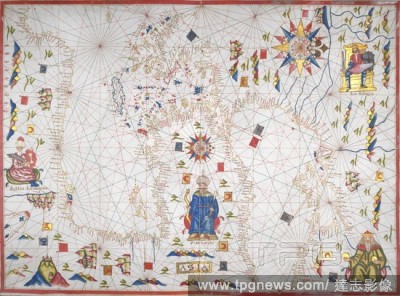
Editorial Southern coast of South America. Portolano. Spain; before 1600. [Whole chart] Chart of the southern coast of South America. In the centre, the King of Spain wearing armour holds a sword and banner Image taken from Portolano. Originally published/prod...
- 2019-01-23
- 1
Editorial Chart of the Eastern Atlantic. Portolano. Italy; 1463. [Whole chart] Chart of the west coasts of Spain, Portugal, and Africa to the Canary Islands, including Madeira and the Azores Image taken from Portolano. Originally published/produced in Italy; 1...
- 2019-01-23
- 1

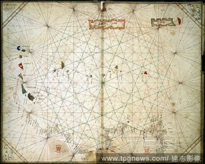
Editorial Chart of the North Pacific. Portolano. Italy; 1578. [Whole chart] Chart of the north Pacific Ocean, from the east coast of Mongolia [China] and Japan, to the west coast of North America Image taken from Portolano. Originally published/produced in Ita...
- 2019-01-23
- 1
Editorial Chart of the Atlantic Ocean. Portolano. Spain; before 1600. [Whole chart] Chart of the Atlantic Ocean, with Ireland, Portugal, and part of the west coast of Africa, including the Azores, Madeira, Canary Islands, and Cape Verde Islands. The western Atla...
- 2018-12-06
- 1
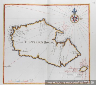
Editorial Map of the island of Bouro, Indonesia. DUTCH PORTOLANO, containing forty-nine coloured maps and views. 17th century. Source: Add. 34184, f.76.
- 2018-12-06
- 1
Editorial Western Mediterranean Sea. Portolano. Spain; before 1600. [Whole chart] Chart of the western Mediterranean Sea, from the south coast of Spain, and North Africa, to the west coast of Greece. The chart includes the western part of the Baltic Sea Image t...
- 2018-12-06
- 1

Editorial Molucca (Maluku) Islands, E. Indies, Indonesia. DUTCH PORTOLANO, containing forty-nine coloured maps and views. 17th century. Source: Add. 34184, f.88.
- 2018-12-06
- 1
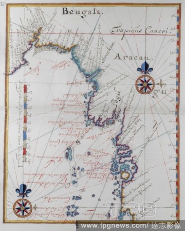
Editorial India: Maps of the Dutch East Indies. 'Bengala.'. DUTCH PORTOLANO, containing forty-nine coloured maps and views. 17th century. Source: Add. 34184, f.36.
- 2018-12-06
- 1

Editorial Mediterranean and Black Seas. Portolano. Italy [Venice]; 1473. [Whole opening] Charts of the coasts of the Eastern Mediterranean Sea and the Black Sea Image taken from Portolano. Originally published/produced in Italy [Venice]; 1473. . Source: Egerto...
- 2018-12-06
- 1
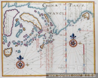
Editorial Map showing part of the coast of China, and islands. DUTCH PORTOLANO, containing forty-nine coloured maps and views. 17th century. Source: Add. 34184, f.50.
- 2018-12-06
- 1
Editorial Map of the coast of Burma. DUTCH PORTOLANO, containing forty-nine coloured maps and views. 17th century. Source: Add. 34184, f.36.
- 2018-12-06
- 1
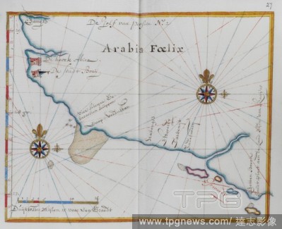
Editorial Arabia. DUTCH PORTOLANO, containing forty-nine coloured maps and views. 17th century. Source: Add. 34184, f.24.
- 2018-12-06
- 1
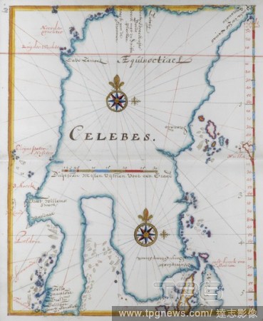
Editorial Island of Celebes. DUTCH PORTOLANO, containing forty-nine coloured maps and views. 17th century. Source: Add. 34184, f.62.
- 2018-12-06
- 1

Editorial Chart of South East Asia. Portolano. France [Marseilles]; 1613. [Whole chart] Chart of the coasts of Bengal, Siam, Sumatra, Java, China, and the islands of the South China Seas and North Pacific Ocean Image taken from Portolano. Originally published/...
- 2018-12-06
- 1
Editorial Western coast of Europe. Portolano. Spain; before 1600. (Whole chart) Chart of the western coast of Europe, from the British Isles, France, Spain, Portugal, and part of the Mediterranean Sea with northern coast of Africa including Madeira. Decorated wi...
- 2018-12-06
- 1

Editorial Souhern India and sri lanka. DUTCH PORTOLANO, containing forty-nine coloured maps and views. 17th century. Source: Add. 34184, f.34.
- 2018-12-06
- 1

Editorial T' Siompa [Chiampa]. Cambodia. South Vietnam. DUTCH PORTOLANO, containing forty-nine coloured maps and views. 17th century. Source: Add. 34184, f.42.
- 2018-12-06
- 1
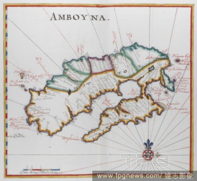
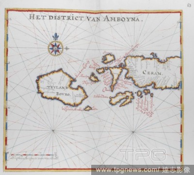
Editorial Map of Amboyna, Island in the Indian Ocean. DUTCH PORTOLANO, containing forty-nine coloured maps and views. 17th century. Source: Add. 34184, f.72.
- 2018-12-06
- 1

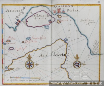
Editorial Arabia. The Arabian desert. DUTCH PORTOLANO, containing forty-nine coloured maps and views. 17th century. Source: Add. 34184, f.30.
- 2018-12-06
- 1

Editorial Arabia. Yemen. DUTCH PORTOLANO, containing forty-nine coloured maps and views. 17th century. Source: Add. 34184, f.22.
- 2018-12-06
- 1
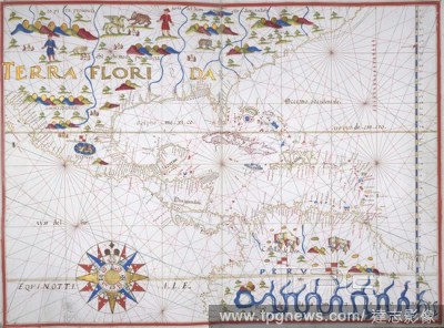
Editorial Central America and West Indies. Portolano. Spain; before 1600. [Whole chart] Chart of the coast of the southern coast of North America, Central America and the West Indies, and the northern coast of South America Image taken from Portolano. Original...
- 2018-12-06
- 1
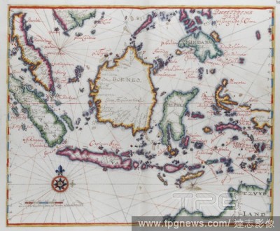
Editorial Map showing Borneo, Clebes (Sulawesi), Java and other Indonesian islands. DUTCH PORTOLANO, containing forty-nine coloured maps and views. 17th century. Source: Add. 34184, f.61.
- 2018-12-06
- 1
Editorial Timorlant, etc. DUTCH PORTOLANO, containing forty-nine coloured maps and views. 17th century. Source: Add. 34184, f.92.
- 2018-12-06
- 1
Editorial Map showing the islands of Bouro and Ceram (Seram), Indonesia. DUTCH PORTOLANO, containing forty-nine coloured maps and views. 17th century. Source: Add. 34184, f.82.
- 2018-12-06
- 1
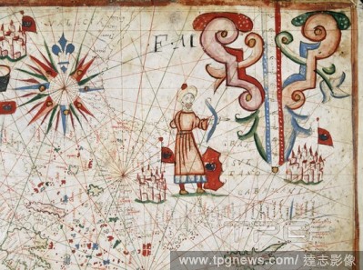
Editorial Grand Sultan and Constantinople. Portolano. Italy; circa 1580. (Detail] Top RH of chart; the Eastern Mediterranean, with Constantinople, and the Grand Sultan holding a bow Image taken from Portolano. Originally published/produced in Italy; circa 1580...
- 2018-12-06
- 1
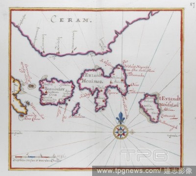
Editorial Island of Ceram (Seram), Indonesia. DUTCH PORTOLANO, containing forty-nine coloured maps and views. 17th century. Source: Add. 34184, f.86.
- 2018-12-06
- 1

Editorial Map of the Kingdom of Siam. DUTCH PORTOLANO, containing forty-nine coloured maps and views. 17th century. Source: Add. 34184, f.38.
- 2018-12-06
- 2
Editorial W. Coast of Africa from Cape Bianco to Cape Santa Anna. Portolano by Grazioso Benincasa, of Ancona. Venice, 1473. Source: Egerton 2855, ff.6v-7.
- 2018-12-06
- 2

Editorial Map showing two of the Banda islands. DUTCH PORTOLANO, containing forty-nine coloured maps and views. 17th century. Source: Add. 34184, f.68.
- 2018-12-06
- 1

Editorial (Whole folio) Map of the British Isles. Portolano. Italy [Venice]; 1473. Source: Egerton 2855, f.8. Language: Italian.
- 2018-12-06
- 1
Editorial Chart of the part of the west coast of Portugal from Lisbon, and the west coast of Africa to Cape Blanco; with Madeira and the Canary Islands. Portolano. Italy; 1469. Source: Add. 31315, ff.5v-6. Language: Italian.
- 2018-12-06
- 1
Editorial West Africa; Cape Verde Islands. Portolano. Italy; 1468. [Whole chart] Chart of the coast of west Africa, south of Cape Blanco, with the Cape Verde Islands. Probably made for Prospero Camulio de Medicis, Bishop of Caithness Image taken from Portolano ...
- 2018-12-06
- 1

Editorial Map of the southern part of the island of Kyushu, Japan. DUTCH PORTOLANO, containing forty-nine coloured maps and views. 17th century. Source: Add. 34184, f.98.
- 2018-12-06
- 1
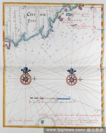
Editorial Map showing a very small part of the coast of China. DUTCH PORTOLANO, containing forty-nine coloured maps and views. 17th century. Source: Add. 34184, f.52.
- 2018-12-06
- 1

Editorial Maps showing Dassen Island, a South African island, and the coast opposite. . DUTCH PORTOLANO, containing forty-nine coloured maps and views. 17th century. Source: Add. 34184, f.10.
- 2018-12-06
- 1
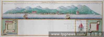
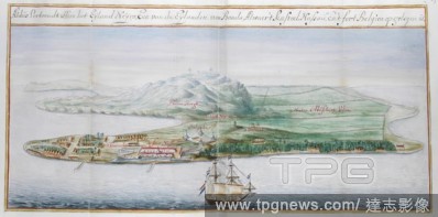
Editorial Coloured view of Amboyna. DUTCH PORTOLANO, containing forty-nine coloured maps and views. 17th century. Source: Add. 34184, f.74.
- 2018-12-06
- 1
Editorial The West Indies and S. America. Portolano. Italy [Naples?]; circa 1508. [Whole chart] The West Indies and South America, from the mouths of the Magdalena to Trinidad. The volume appears to be a copy of one of the early portolani of Visconti Maggiola, o...
- 2018-12-06
- 1
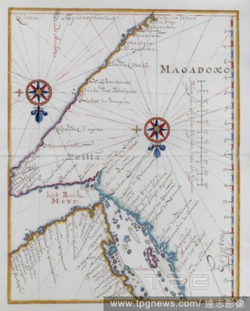
Editorial Map of Magadoxo, Zanzibar. DUTCH PORTOLANO, containing forty-nine coloured maps and views. 17th century. Source: Add. 34184, f.20.
- 2018-12-06
- 1

Editorial Map of the island of Java. DUTCH PORTOLANO, containing forty-nine coloured maps and views. 17th century. Source: Add. 34184, f.56.
- 2018-12-06
- 1

Editorial Map of Cochin-China, Asia. DUTCH PORTOLANO, containing forty-nine coloured maps and views. 17th century. Source: Add. 34184, f.44.
- 2018-12-06
- 1
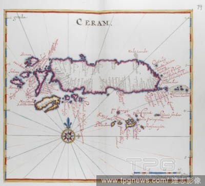
Editorial Map of the island of Ceram (Seram), Indonesia. DUTCH PORTOLANO, containing forty-nine coloured maps and views. 17th century. Source: Add. 34184, f.78.
- 2018-12-06
- 1
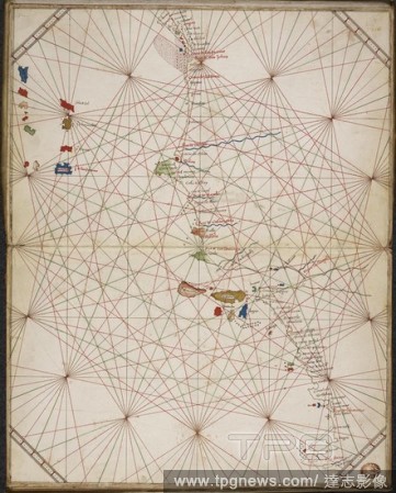
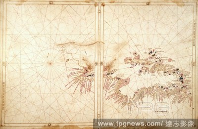
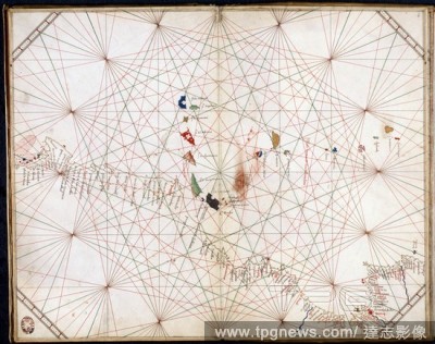
Editorial Chart of the Indian Ocean. Portolano. Italy; 1578. [Whole chart] Chart of the Indian Ocean; from the Arabian Sea to the Bay of Bengal and South China Sea, including Sumatra, Java and part of Borneo Image taken from Portolano. Originally published/pro...
- 2018-12-06
- 1
Editorial Azores and Canary Islands. Portolano. Italy [Venice]; 1473. [Whole chart] Chart of the Azores and Canary Islands, with the Atlantic coast from Cape Mondego to south of Cape Bianco Image taken from Portolano. Originally published/produced in Italy [Ve...
- 2018-12-06
- 1
Editorial Southern coast of South America. Portolano. Spain; before 1600. [Whole chart] Chart of the southern coast of South America. In the centre, the King of Spain wearing armour holds a sword and banner Image taken from Portolano. Originally published/prod...
- 2018-12-06
- 1

Editorial Chart of the coasts of western Europe, from the British Isles to Portugal. Portolano. Italy; 1469. Source: Add. 31315, ff.4v-5. Language: Italian.
- 2018-12-06
- 1
Editorial Chart of the Eastern Atlantic. Portolano. Italy; 1463. [Whole chart] Chart of the west coasts of Spain, Portugal, and Africa to the Canary Islands, including Madeira and the Azores Image taken from Portolano. Originally published/produced in Italy; 1...
- 2018-12-06
- 1
Editorial Map of Mombasa, East Africa. DUTCH PORTOLANO, containing forty-nine coloured maps and views. 17th century. Source: Add. 34184, f.18.
- 2018-12-06
- 1

Editorial Map of the Shetland Islands. DUTCH PORTOLANO, containing forty-nine coloured maps and views. 17th century. Source: Add. 34184, f.3.
- 2018-12-06
- 1
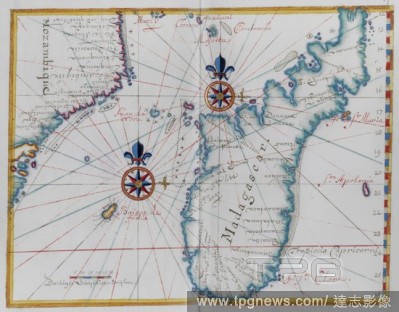
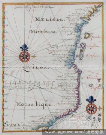
Editorial Map of part of the coast of Mozambique and the island of Madagascar. DUTCH PORTOLANO, containing forty-nine coloured maps and views. 17th century. Source: Add. 34184, f.16.
- 2018-12-06
- 1

Editorial [Whole opening] Chart of the Mediterranean and Adriatic seas, from Sicily to the Black Sea. Portolano. Italy [Venice]; 1473. . Source: Egerton 2855, ff.3v-4. Language: Italian.
- 2018-12-06
- 2
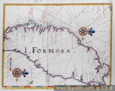
Editorial Island of Formosa (Taiwan). DUTCH PORTOLANO, containing forty-nine coloured maps and views. 17th century. Source: Add. 34184, f.96.
- 2018-12-06
- 1
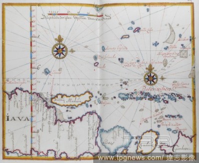
Editorial Map of the Islands of Java; Madura; Bali and other islands. DUTCH PORTOLANO, containing forty-nine coloured maps and views. 17th century. Source: Add. 34184, f.58.
- 2018-12-06
- 1
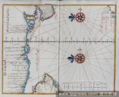
Editorial Arabia: Map of the Arabian Sea. DUTCH PORTOLANO, containing forty-nine coloured maps and views. 17th century. Source: Add. 34184, f.32.
- 2018-12-06
- 1
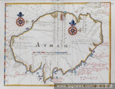
Editorial Map of the island of Aynam. . DUTCH PORTOLANO, containing forty-nine coloured maps and views. 17th century. Source: Add. 34184, f.49.
- 2018-12-06
- 1
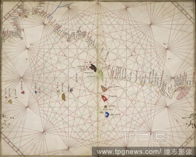
Editorial Chart of the North Pacific. Portolano. Italy; 1578. [Whole chart] Chart of the north Pacific Ocean, from the east coast of Mongolia [China] and Japan, to the west coast of North America Image taken from Portolano. Originally published/produced in Ita...
- 2018-12-06
- 1
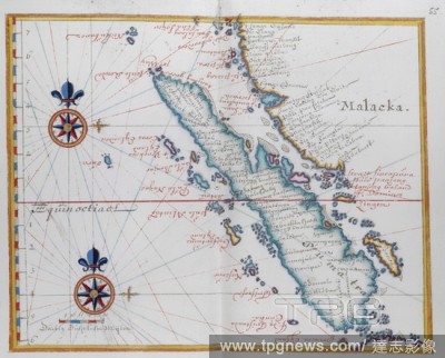
Editorial Map showing Malacca and Sumatra, western Indonesia, part of the Sunda islands. DUTCH PORTOLANO, containing forty-nine coloured maps and views. 17th century. Source: Add. 34184, f.54.
- 2018-12-06
- 1
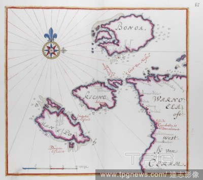
Editorial Map showing part of the Island of Ceram (Seram) and Bonoa (Pulau Boano) and Pulau Kelang and Pulau Manipa. DUTCH PORTOLANO, containing forty-nine coloured maps and views. 17th century. Source: Add. 34184, f.84.
- 2018-12-06
- 1
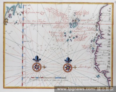
Editorial Map of Formosa (Taiwan.). DUTCH PORTOLANO, containing forty-nine coloured maps and views. 17th century. Source: Add. 34184, f.94.
- 2018-12-06
- 2
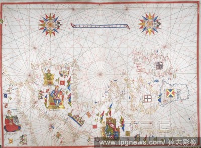
Editorial Map of the Cape Verde Islands. DUTCH PORTOLANO, containing forty-nine coloured maps and views. 17th century. Source: Add. 34184, f.8.
- 2018-12-06
- 2
Editorial Arabia. Coast. DUTCH PORTOLANO, containing forty-nine coloured maps and views. 17th century. Source: Add. 34184, f.26.
- 2018-12-06
- 1
Editorial View of one of the Banda islands. DUTCH PORTOLANO, containing forty-nine coloured maps and views. 17th century. Source: Add. 34184, f.66.
- 2018-12-06
- 1

Editorial Chart of the Persian Gulf. Portolano. Italy; 1578. [Whole chart] Chart of the Eastern Mediterranean Sea, the Red Sea, and Persian Gulf, with part of the east coast of Africa, and Arabia Image taken from Portolano. Originally published/produced in Ita...
- 2018-12-06
- 1

Editorial Arabia. Coastal area and gulf. DUTCH PORTOLANO, containing forty-nine coloured maps and views. 17th century. Source: Add. 34184, f.28.
- 2018-12-06
- 1
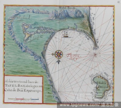
Editorial Map of the Cape of Good Hope. Table Bay, South Africa. DUTCH PORTOLANO, containing forty-nine coloured maps and views. 17th century. Source: Add. 34184, f.12.
- 2018-12-06
- 1
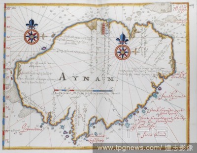
Editorial Island of Aynam (Hainan) island, near the S.W, coast of China. DUTCH PORTOLANO, containing forty-nine coloured maps and views. 17th century. Source: Add. 34184, f.48.
- 2018-12-06
- 1

Editorial Map of the world. Portolano. Italy; 1578. Source: Harley 3450, No. 1. Language: Italian.
- 2018-12-06
- 1

Editorial Mediterranean Sea and Black Sea. Portolano. Spain; before 1600. [Whole chart] Chart of the Eastern Mediterranean Sea, from Greece to Turkey, and the Black Sea Image taken from Portolano. Originally published/produced in Spain; before 1600. . Source: ...
- 2018-12-06
- 1
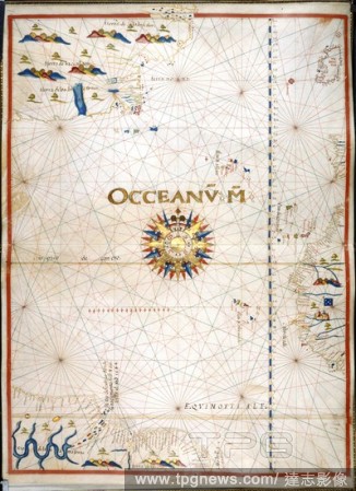
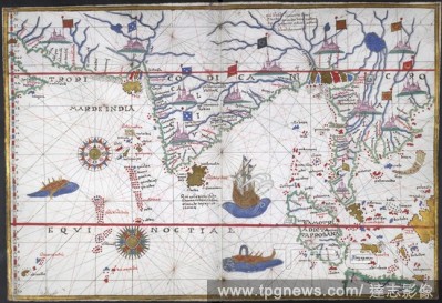
Editorial West Coast of Africa. Portolano. Spain; before 1600. [Whole chart] Chart of the west coast of Africa from the Cape Verde Islands, and the South Atlantic Ocean Image taken from Portolano. Originally published/produced in Spain; before 1600. . Source: ...
- 2018-12-06
- 1
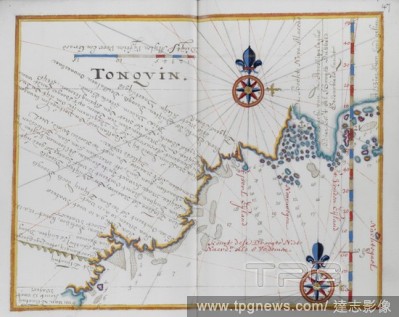
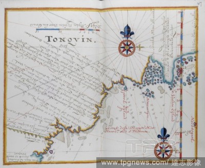
Editorial Map of Tonquin, China. DUTCH PORTOLANO, containing forty-nine coloured maps and views. 17th century. Source: Add. 34184, f.46.
- 2018-12-06
- 1

Editorial Cambodia. DUTCH PORTOLANO, containing forty-nine coloured maps and views. 17th century. Source: Add. 34184, f.40.
- 2018-12-06
- 1
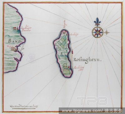
Editorial Map showing small part of Banda Besar (Lonthoir) and Hatta (Rosengain.) The Bnda islands, part of the Indonesian province of Maluku. DUTCH PORTOLANO, containing forty-nine coloured maps and views. 17th century. Source: Add. 34184, f.70.
- 2018-12-06
- 1
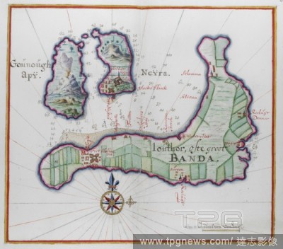
Editorial Pictorial map of three of the Banda islands. DUTCH PORTOLANO, containing forty-nine coloured maps and views. 17th century. Source: Add. 34184, f.64.
- 2018-12-06
- 1
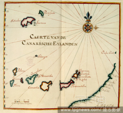
Editorial Map of the Canary Islands.
- 2018-12-06
- 1
 Loading