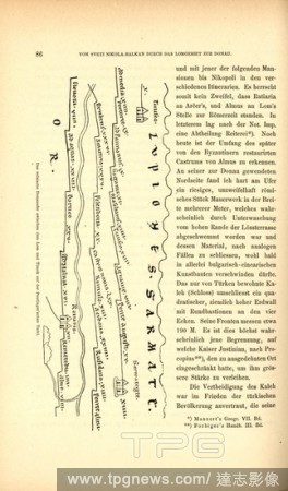
EditorialThe M?sische Danube bank between Lom and Timok on the Peutinger table, Tabula Peutingeriana to the Danube in Bulgaria, Fig. 18, p. 86, 1879, F. Kanitz: Donau-Bulgarien und der Balkan: historisch-geographisch-ethnographische Reisestudien aus den Jahren ...
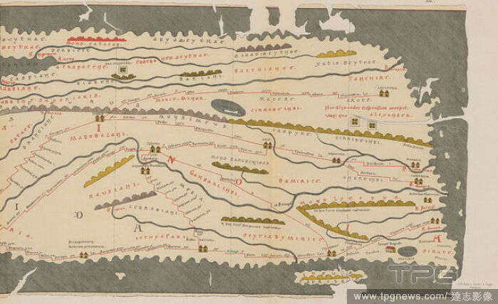
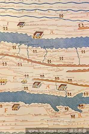
EditorialTabula Peutingeriana or Peutinger Table. An illustrated itinerarium (ancient Roman road map) showing the layout of the road network of the Roman Empire. Painted on parchment, it is a medieval copy (13th century) of an original map of the 4th century. D...
EditorialTabula Peutingeriana or Peutinger Table. An illustrated itinerarium (ancient Roman road map) showing the layout of the road network of the Roman Empire. Painted on parchment, it is a medieval copy (13th century) of an original map of the 4th century. D...


 Loading