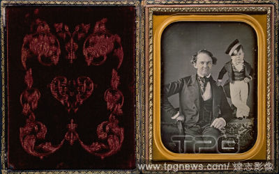
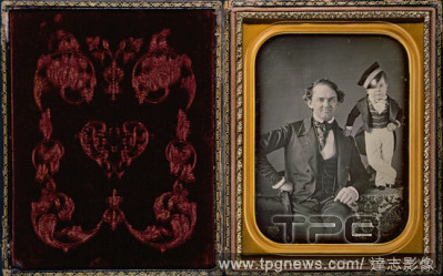
EditorialP.T. Barnum and General Tom Thumb. Date/Period: Ca. 1850. Half-plate daguerreotype. Photograph. Height: 154 mm (6.06 in); Width: 248 mm (9.76 in).
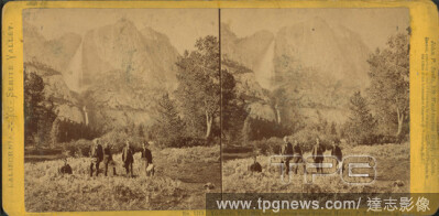
EditorialYo-Semite Fall, (2,634 feet high), from near Sentinel House; P.T. Barnum and Party., still image, Stereographs, 1870, Soule, John P. (1827-1904).
EditorialYo-Semite Fall, (2,634 feet high), from near Sentinel House; P.T. Barnum and Party., still image, Stereographs, 1870, Soule, John P. (1827-1904).
EditorialYo-Semite Fall, (2,634 feet high), from near Sentinel House; P.T. Barnum and Party., still image, Stereographs, 1870, Soule, John P. (1827-1904).
EditorialYo-Semite Fall, (2,634 feet high), from near Sentinel House; P.T. Barnum and Party., still image, Stereographs, 1870, Soule, John P. (1827-1904).
EditorialYo-Semite Fall, (2,634 feet high), from near Sentinel House; P.T. Barnum and Party., still image, Stereographs, 1870, Soule, John P. (1827-1904).
EditorialYo-Semite Fall, (2,634 feet high), from near Sentinel House; P.T. Barnum and Party., still image, Stereographs, 1870, Soule, John P. (1827-1904).
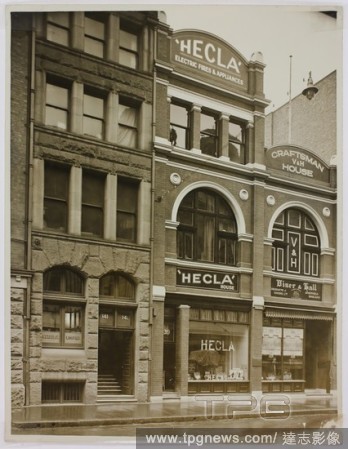
EditorialPhotograph - Hecla Electrics Pty Ltd Shopfront, circa 1940, Black and white photograph of a row of shops circa 1940. The central shop displays the Hecla name in and above shop window. The street number is clearly visible as well as shops on either side...
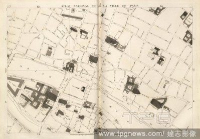
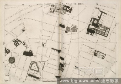
EditorialNational Atlas of 13. the city of Paris 1, Map of Paris, no. 13, p. 22, Verniquet, E. ; Bartholome, P.T. ; Mathieu, A.J., 1796, Edm? Verniquet, P.T. Bartholome, A.J. Mathieu: Atlas du plan g?n?ral de la ville de Paris. Paris: chez l'auteur, 1796 = l'an IV.
EditorialNational Atlas of 13. the city of Paris 4, Map of Paris, no. 37, p. 46, Verniquet, E. ; Bartholome, P.T. ; Mathieu, A.J., 1796, Edm? Verniquet, P.T. Bartholome, A.J. Mathieu: Atlas du plan g?n?ral de la ville de Paris. Paris: chez l'auteur, 1796 = l'an IV.
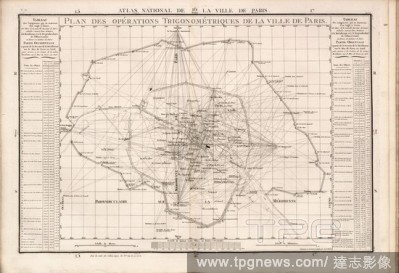
EditorialPlan of Trigonometric Operations of the City of Paris, Map of Paris, no. 70, S. 78, Verniquet, Edm?; Bartholome, P.T.; Mathieu, A.J., 1796, Edm? Verniquet, P.T. Bartholome, A.J. Mathieu: Atlas du plan g?n?ral de la ville de Paris. Paris: chez l'auteur,...
EditorialNational Atlas of 13. the city of Paris 2, Map of Paris, no. 21, p. 30, Verniquet, E. ; Bartholome, P.T. ; Mathieu, A.J., 1796, Edm? Verniquet, P.T. Bartholome, A.J. Mathieu: Atlas du plan g?n?ral de la ville de Paris. Paris: chez l'auteur, 1796 = l'an IV.
EditorialNational Atlas of 13. the city of Paris 3, Map of Paris, no. 29, p. 38, Verniquet, E. ; Bartholome, P.T. ; Mathieu, A.J., 1796, Edm? Verniquet, P.T. Bartholome, A.J. Mathieu: Atlas du plan g?n?ral de la ville de Paris. Paris: chez l'auteur, 1796 = l'an IV.
EditorialP.T. Barnum and General Tom Thumb. Date/Period: Ca. 1850. Half-plate daguerreotype. Photograph. Height: 154 mm (6.06 in); Width: 248 mm (9.76 in).


 Loading