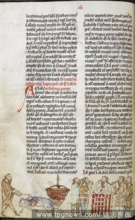
EditorialMiniature shows the kingship ritual in Tirconnell of killing of the white mare, the bath of a king in a stew of mare's meat and eating of the meat by the king's supporters. . Topographia Hiberniae, Expugnatio Hibernica, Itinerarium Kambriae; De purgato...
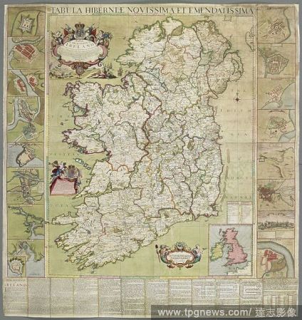
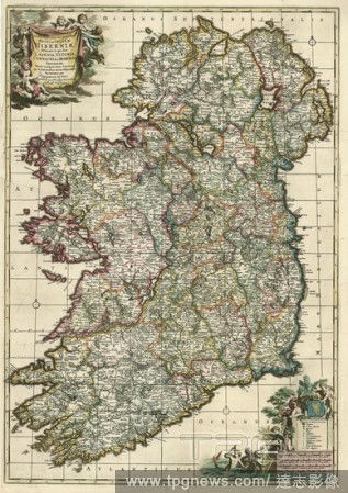
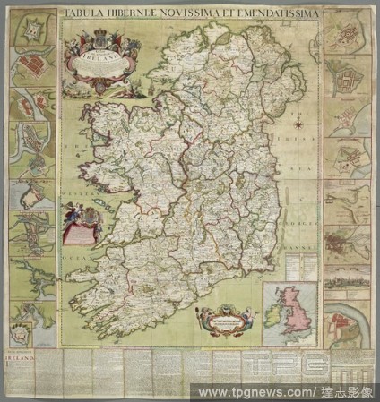
EditorialA map of Ireland, dated 1708. Tabula Hiberniae novissima et emendatissima. A Mapp of the Kingdom of Ireland newly corrected & improved by actuall observations. Divided into its Provinces Counties & Baronies ... also a short description of the Kingdom. ...
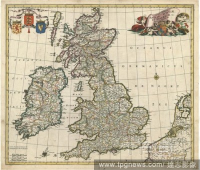
EditorialMagnae Britanniae et Hiberniae Tabula, Print made by Willem Janszoon Blaeu, 1571 - 1638, 1634, Line engraving; verso: Letterpress on medium, slightly textured, cream laid paper, Sheet: 19 7/8 ? 23 1/4 inches (50.5 ? 59.1 cm) and Plate: 15 3/8 ? 19 3/4 ...
EditorialMap, Novissima et accuratissima regni en insulae Hiberniae delineatio, in qua sunt Lagenia, Ultonia, Connachia, et Momonia, provinciae, divisae in triginta duos comitatus qui et sunt divisi in omnes subjacentes baronnatus, Petrus Schenk (1693-1775), Co...
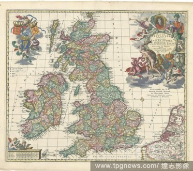
EditorialMap, Magnae Britanniae tabula; comprehendens Angliae, Scotiae, ac Hiberniae regna, in omnes suascujusque provincias peraccurat? et distinct? divisa, Nicolaes Jansz. Visscher (1618-1679), Copperplate print.
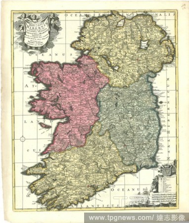
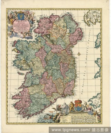
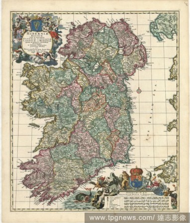
EditorialMap, Hiberniae regnum tam in praecipuas Ultoniae, Connaciae, Lageniae, et Momoniae, quam in minores earundem provincias et ditiones subjacentes peraccurat? divisum, Nicolaes Jansz. Visscher (1618-1679), Copperplate print.
EditorialMap, Novissima ac prae caeteris aliis accuratissima Regni et Insulae Hiberniae delineatio, in qua sunt Lagenia, Ultonia, Connachia, et Momonia provinciae, divisae in triginta duos comitatus qui et sunt divisi in omnes subjacentes baronnatus, Frederick ...
EditorialMap, Hiberniae regnum tam in praecipuas Ultoniae, Connaciae, Lageniae, et Momoniae, quam in minores earundem provincias et ditiones subjacentes peraccurat? divisum, Nicolaes Jansz. Visscher (1618-1679), Copperplate print.
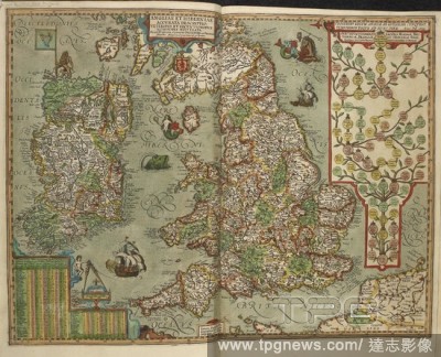
EditorialMap of England and Ireland drawn in 1606. . Angliae et Hiberniae accurata descriptio, veteribus et recentioribus nominibus illustrata... Angliae et Hiberniae accurata descriptio, veteribus et recentioribus nominibus illustrata: et ad D. Gvliel. Camdeni...
EditorialA map of Ireland, dated 1708. Tabula Hiberniae novissima et emendatissima. A Mapp of the Kingdom of Ireland newly corrected & improved by actuall observations. Divided into its Provinces Counties & Baronies ... also a short description of the Kingdom. ...
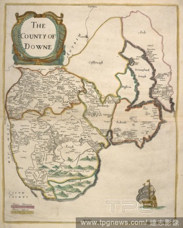
EditorialA map of County Down. Hiberniae Delineatio quoad hactenus licuit perfectissima studio Guilienlmi Petty, etc. [With coloured portrait of Sir W. Petty, dated 1683]. [London], [1685]. Source: Maps C.21.e.6, page 27. Language: English.
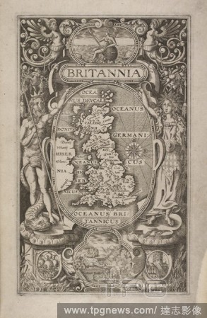
EditorialA map of Britain, and images of Britannia. A small view of Stonehenge. Britannia; sive florentissimorum regnorum Angliae Scotiae, Hiberniae, et insularum adjacentium ex intima antiquitate chorographica descriptio ... Guilielmo Camdeno authore. [With ma...
EditorialA map of England and Wales with an alphabetical table of all the cities and market towns in England and Wales. [Angliae totius tabula cum distantijs notioribus in Itinerantium usum accommodata. Johannes Adams ... descripsit. An Alphabetical Table of al...
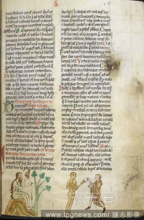
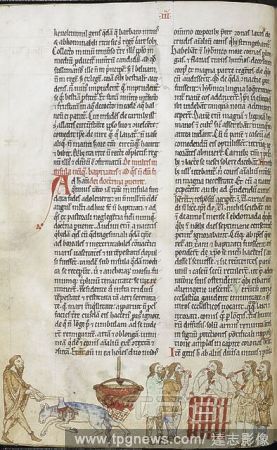
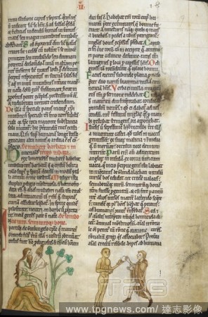
EditorialTwo episodes from a legend of the priest of Ulster and the wolf. Gerald of Wales, Topographia Hiberniae ( Topographia Hibernica ). c 1196-1223. Source: Royal 13 B. VIII folio 18. Language: Latin.
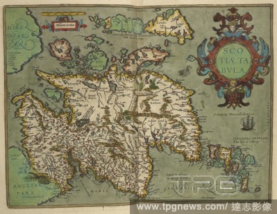
EditorialMap of Scotland (Scotiatabvla) drawn in 1601. . Angliae et Hiberniae accurata descriptio, veteribus et recentioribus nominibus illustrata... England. Angliae et Hiberniae accurata descriptio, veteribus et recentioribus nominibus illustrata: et ad D. Gv...
EditorialMiniature of the naked bearded woman of Limerick seated on a rock with a spindle, near the naked man-ox of Wicklow, who is being given a round object by another man. Topographia Hiberniae, Expugnatio Hibernica, Itinerarium Kambriae; De purgatorio sanct...
EditorialMiniature shows the kingship ritual in Tirconnell of killing of the white mare, the bath of a king in a stew of mare's meat and eating of the meat by the king's supporters. . Topographia Hiberniae, Expugnatio Hibernica, Itinerarium Kambriae; De purgato...
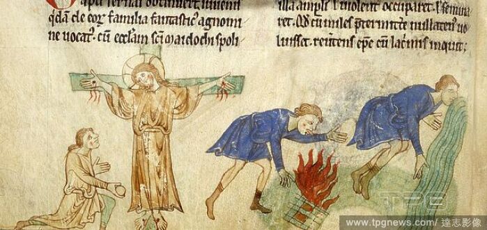
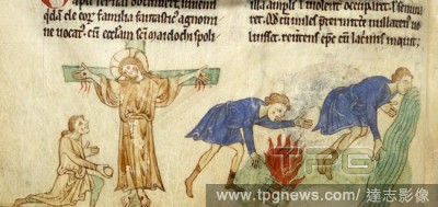
EditorialDetail of miniatures of a man kneeling by the crucified Christ at the Crucifix of Dublin, an archer who crossed the hedge of Brigid, blowing on her fire and a man drinking from a river, in the lower margin of the folio. Topographia Hiberniae. England, ...
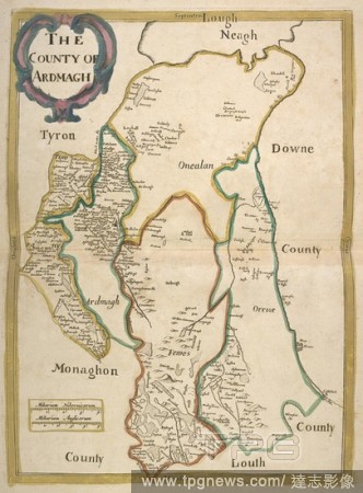
EditorialA map of County Armagh. Hiberniae Delineatio quoad hactenus licuit perfectissima studio Guilienlmi Petty, etc. [With coloured portrait of Sir W. Petty, dated 1683]. [London], [1685]. Source: Maps C.21.e.6, page 28. Language: English.
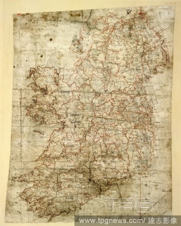
EditorialMap of Ireland. Petty Papers, Vol. XVI. Ireland [Dublin]; between 1655 and 1665. {Whole map]. Map of Ireland, produced for Sir William Petty's Hiberniae Delineatio, published in 1684, the first printed atlas of Ireland. Image taken from the Petty Pape...
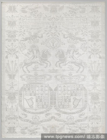
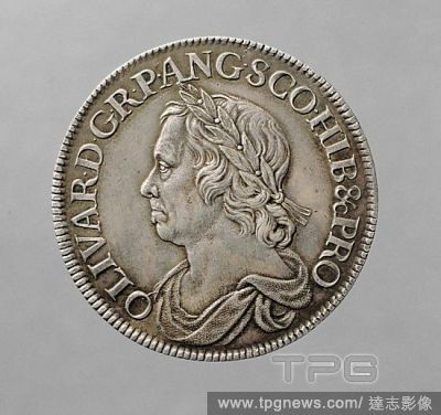
EditorialHalf-crown silver coin of Oliver Cromwell, 1658. The Latin inscription reads: OLIVAR.D.G.RP.ANG.SCO.ET.HIB&cPRO (OLIVARIUS DEI GRATIA REIPUBLICAE ANGLIAE SCOTIAE ET HIBERNIAE ET CETERORUM PROTECTOR), meaning "Oliver, by the Grace of God Protector of ...


 Loading