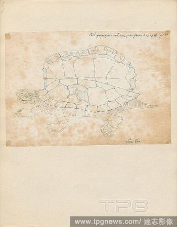
EditorialTestudo geographica, Print, The northern map turtle (Graptemys geographica), or common map turtle, is an aquatic turtle in the family Emydidae. It is endemic to North America., 1700-1880.
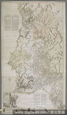
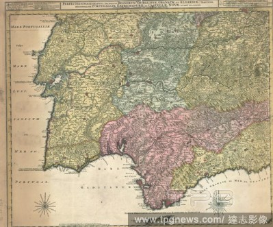
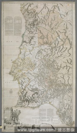
EditorialA map or chart of the Algarve and the Kingdom of Portugal. MAPPA ou CARTA GEOGRAPHICA DOS REINOS DE PORTUGALE ALGARVE. London : [Thomas Jefferys], 1762. Source: Maps K.Top.74.60.2.TAB. Language: Portuguese.
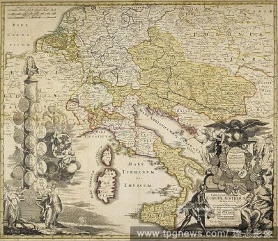
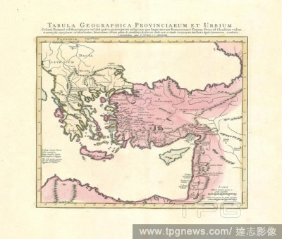
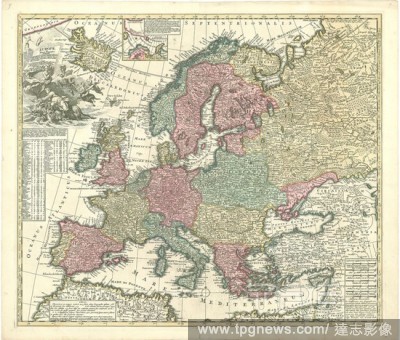
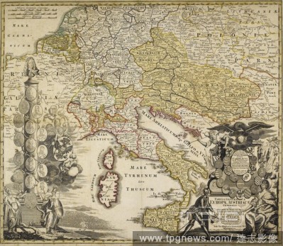
EditorialColoured map of Europe. Tabula Geographica Europae Austriacae Generalis a J. C. Homanno. Noribergae, [1730?]. Johann Christoph HOMANN. Source: Maps*27720.(1).
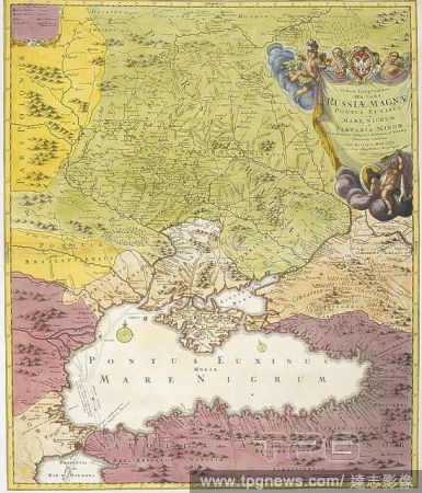
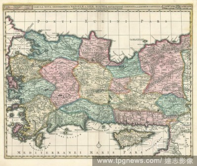
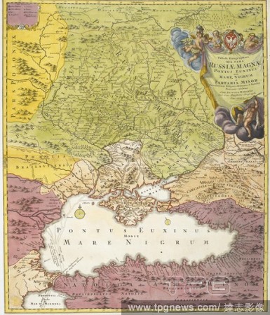
EditorialA map dated 1720, drawn between the years of 'The Great Northern War' (1700–1721), before Peter I created the Russian empire. Indicated on the map in bold lettering are the names: Russiae Minoris (Ukraine); Russiae Maximae (Russia); Poloniae; Podolia...
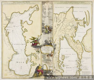
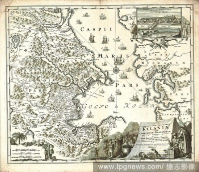
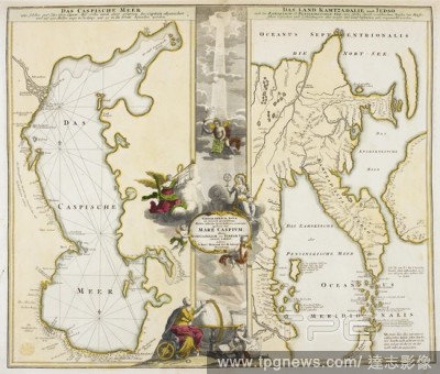
EditorialA map of the Caspian Sea. Das Caspische Meer. Das Land Kamtzadaliae sonst Jedso. Geographica nova ex Oriente gratiosissima, duabus tabulis specialissimis contenta, quarum una Mare Caspium, altera Kamtzadaliam seu Terram Jedso curiose? exhibet Editore ...
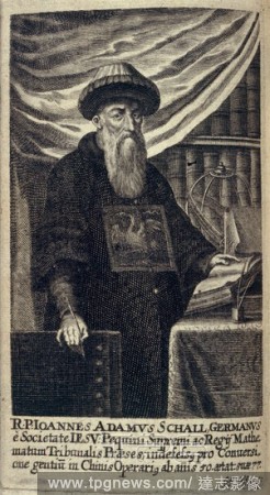
EditorialJohann Adam Von Schall. Historica Relatio de ortu et progressu Fidei Ortho. A. Hanckwitz: Ratisbon, 1672. A portrait of Johann Adam Von Schall (1591 - 1669). German missionary, in China, and astronomer. Image taken from Historica Relatio de ortu et pr...
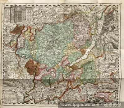
EditorialNova et accurata AGRITIGURINI cum confinys Tabula Geographica, Map Zurich, S. 1431, J. Heinrich Freytag, 1742, Hans Heinrich Bluntschli: Memorabilia Tigurina, oder Merckw?rdigkeiten, der Stadt und Landschafft Z?rich, in alphabetischer Ordnung enthalten...
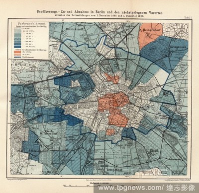
EditorialPopulation increase and decrease in Berlin and the nearest suburbs 1, Population change in Berlin and suburbs between the censuses of December 1, 1885 and December 1, 1890, Signed: Publisher of Julius Springer; After a card by Jul. Straube; Geographica...
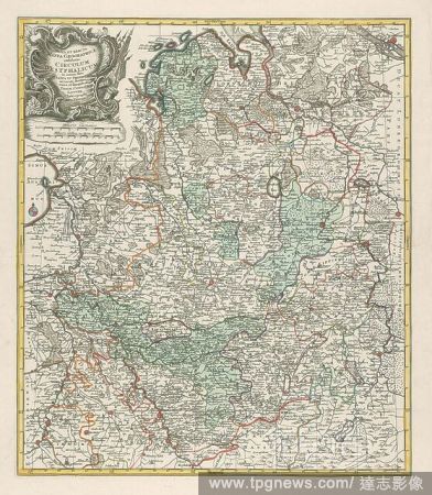
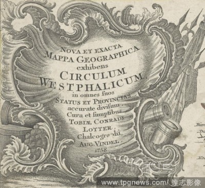
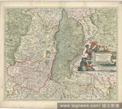
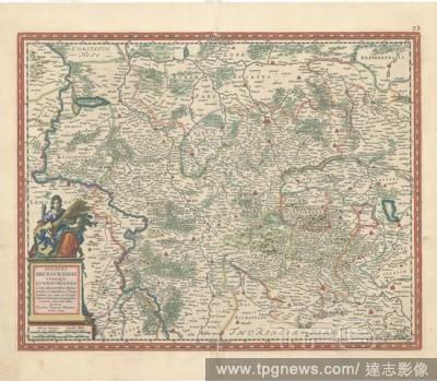
EditorialRocaille cartouche with weapons Nova et exacta Mappa Geographica exhibits Circulum Westphalicum (...) (title on object), Rocaille cartouche with title, flags and guns behind it. Detail of a map of the Westphalian Kreits in Germany, ornament, cartouche,...
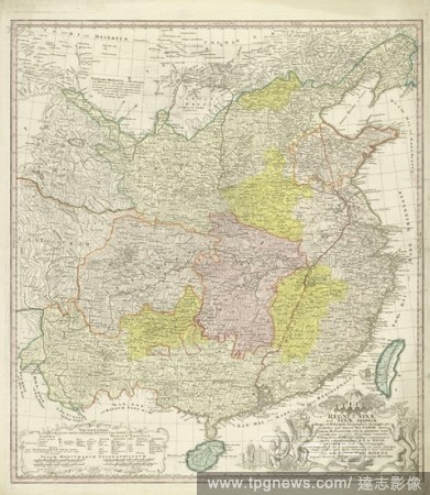
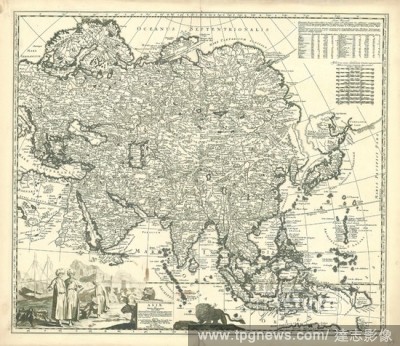
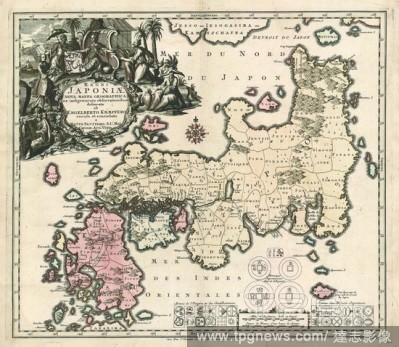
EditorialMap of China, Regni Sinae vel Sinae propriae Mappa et descriptio geographica (title on object), parts differently colored. Bottom right the title surrounded by dragons and plant motifs and some Chinese figures. Below left explanation of the layout of t...
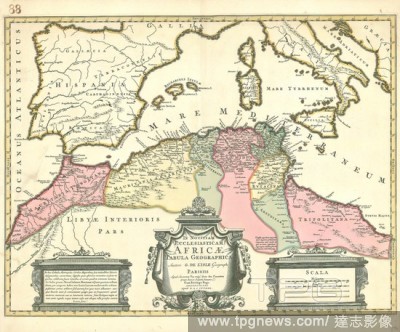
EditorialMap, Tabula geographica provinciarum et urbium Colonia Romana vel Municipii jure vel alia qu?vis praerogativ? insignium quae imperatorum Romanorum a Trajana Decio ad Claudium vultus in nummis suis expresserunt, Guillaume Delisle (1675-1726), Copperplat...
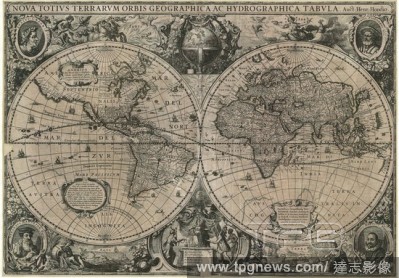
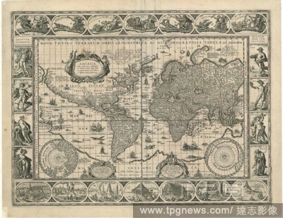
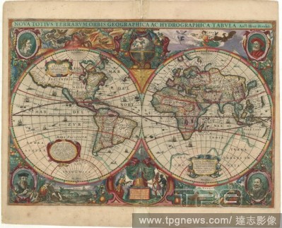
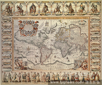
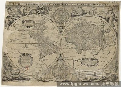
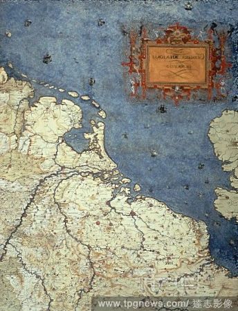
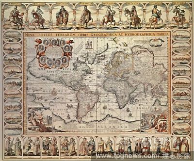
EditorialMap, Nova totius terrarum orbis geographica ac hydrographica tabula auct. Guiljelmo Blaeuw J.a vanden Ende sculpsit, Willem Jansz Blaeu (1571-1638), Josua van den Ende, Copperplate print.
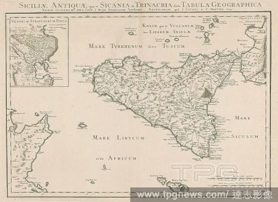
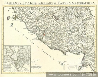
EditorialMap, Regionum Italiae mediarum tabula geographica pernoscendis historiae Romanae primordiis praesertim utilis, sed ut cui multa sequioris aevi addita, Guillaume Delisle (1675-1726), Copperplate print.
EditorialMap, Nova totius terrarum orbis geographica ac hydrographica tabula auct. Guiljelmo Blaeuw J.a vanden Ende sculpsit, Willem Jansz Blaeu (1571-1638), Josua van den Ende, Copperplate print.
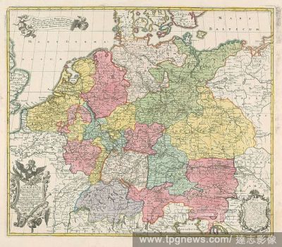
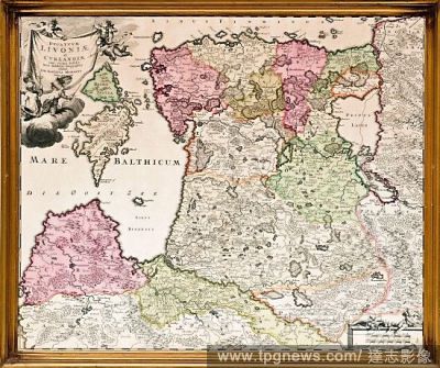
EditorialMap, Mappa geographica exactissima continens Imperatoris H?reditarium Dominium Silesiam, nec non eiusdem Provincias interiores Ducatus, Comitatus, Baronatus etc., Petrus Schenk (1693-1775), Copperplate print.
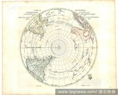
EditorialMap, Tabula geographica hemisphaerii australis ad emendatiora quae adhuc prodierunt exempla ... I.C.R. delin, Johann Christoph Rhode (1713-1786), Copperplate print.
EditorialMap, Europae in tabula geographica delineatio ad mentem novissimorum eorumque optimorum geographorum emendata ... opera A.F. Z?rneri ..., Adam Friedrich Z?rner (1680-1742), Copperplate print.
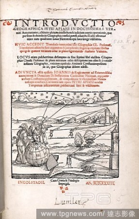
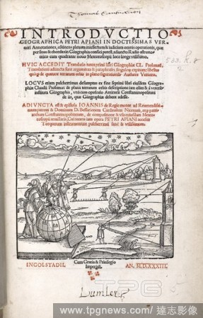
EditorialSurveying. Introductio geographica Petri Apiani in Verneri an. Ingolstadii, 1533. Cross-staff used for computing lunar distance and height of buildings. Image taken from Introductio geographica Petri Apiani in Verneri annotationes Originally publishe...
EditorialSurveying. Introductio geographica Petri Apiani in Verneri an. Ingolstadii, 1533. Cross-staff used for computing lunar distance and height of buildings. Image taken from Introductio geographica Petri Apiani in Verneri annotationes Originally publishe...
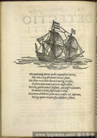
EditorialA ship. Descriptio ac Delineatio Geographica Detectionis F. H. Gerardi, Amsterdami, 1612. Illustration and text. Image taken from Descriptio ac Delineatio Geographica Detectionis Freti, sive transitus ad occasum recens investigati ab H. Hudsono etc. ...
EditorialA map or chart of the Algarve and the Kingdom of Portugal. MAPPA ou CARTA GEOGRAPHICA DOS REINOS DE PORTUGALE ALGARVE. London : [Thomas Jefferys], 1762. Source: Maps K.Top.74.60.2.TAB. Language: Portuguese.
EditorialJohann Adam Von Schall. Historica Relatio de ortu et progressu Fidei Ortho. A. Hanckwitz: Ratisbon, 1672. A portrait of Johann Adam Von Schall (1591 - 1669). German missionary, in China, and astronomer. Image taken from Historica Relatio de ortu et pr...
EditorialColoured map of Europe. Tabula Geographica Europae Austriacae Generalis a J. C. Homanno. Noribergae, [1730?]. Johann Christoph HOMANN. Source: Maps*27720.(1).
EditorialA map dated 1720, drawn between the years of 'The Great Northern War' (1700–1721), before Peter I created the Russian empire. Indicated on the map in bold lettering are the names: Russiae Minoris (Ukraine); Russiae Maximae (Russia); Poloniae; Podolia...
EditorialA map of the Caspian Sea. Das Caspische Meer. Das Land Kamtzadaliae sonst Jedso. Geographica nova ex Oriente gratiosissima, duabus tabulis specialissimis contenta, quarum una Mare Caspium, altera Kamtzadaliam seu Terram Jedso curiose? exhibet Editore ...
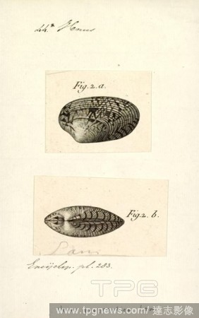
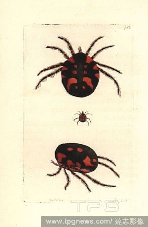
EditorialRed water mite, Hydrachna geographica. Illustration drawn and engraved by Richard Polydore Nodder. Handcoloured copperplate engraving from George Shaw and Frederick Nodder's "The Naturalist's Miscellany," London, 1805.


 Loading