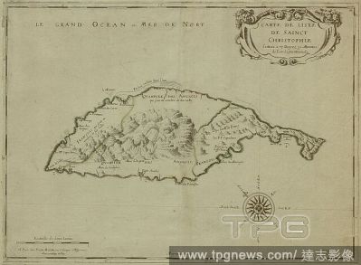
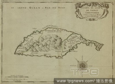
EditorialA map of Saint Christopher Island. Carte de l'Isle de Sainct Christophle ... Paris : P. Mariette, 1667. Source: Maps K.Top.123.77. Language: French.
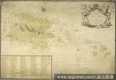
EditorialA geometrical plan of the isle of St. Christophle (St. Kitts). PLAN Geometral de l'Isle de ST. CHRISTOPHLE. about 1780?. Source: Maps K.Top.123.79.2 TAB. Language: French.
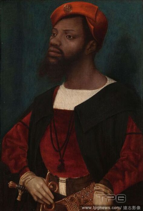
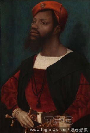
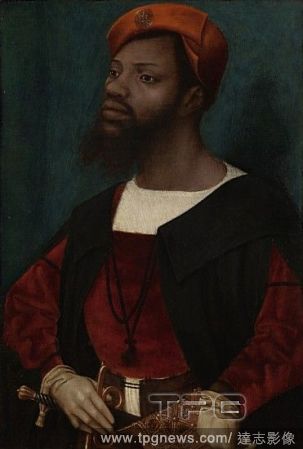
EditorialPortrait of an African Man (Christophle le More?). Portrait of an African Man. Dating: c. 1525 - c. 1530. Place: Mechelen. Measurements: support: h 30.8 cm ? w 21.2 cm; painted surface: h 30 cm ? w 20.3 cm.
EditorialPortrait of an African Man (Christophle le More?). Portrait of an African Man. Dating: c. 1525 - c. 1530. Place: Mechelen. Measurements: support: h 30.8 cm ? w 21.2 cm; painted surface: h 30 cm ? w 20.3 cm.
EditorialPortrait of an African Man (Christophle le More?). Portrait of an African Man. Dating: c. 1525 - c. 1530. Place: Mechelen. Measurements: support: h 30.8 cm ? w 21.2 cm; painted surface: h 30 cm ? w 20.3 cm.
EditorialA geometrical plan of the isle of St. Christophle (St. Kitts). PLAN Geometral de l'Isle de ST. CHRISTOPHLE. about 1780?. Source: Maps K.Top.123.79.2 TAB. Language: French.
EditorialA map of Saint Christopher Island. Carte de l'Isle de Sainct Christophle ... Paris : P. Mariette, 1667. Source: Maps K.Top.123.77. Language: French.


 Loading