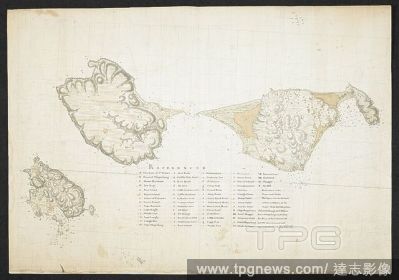
EditorialChart of the Islands of St Pierre and Miquelon, just off the coast of Newfoundland. SIXTY-SEVEN Charts and maps illustrating the voyages and surveys of Capt. James Cook, R.N., and other discoverers; circ. 1760- 1780. 1763. Source: Add. 31360, no.21.
EditorialA plan of the Islands of St. Peter's, Langly, and Miquelong. A PLAN of the ISLANDS of ST. PETERS, LANGLY and MIQUELON. [St John's?] : James Cook, [1763.]. Source: Maps K.Top.119.111. Language: English.
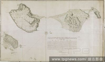
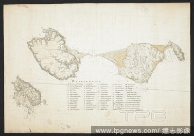


 Loading