filter
-
Brand
- By Category
- Direction
- Date Range
185Events
Pictures
Events
Editorial
- 2023-10-31
- 2

Editorial
- 2023-06-16
- 1

Editorial
- 2023-06-15
- 1
Editorial
- 2023-06-15
- 1
Editorial
- 2023-06-15
- 1
Editorial
- 2023-06-15
- 1
Editorial
- 2023-06-15
- 1
Editorial
- 2023-06-15
- 1
Editorial
- 2023-06-15
- 1
Editorial
- 2023-06-15
- 1

Editorial
- 2023-06-15
- 1
Editorial
- 2023-06-15
- 1

Editorial
- 2023-06-15
- 1
Editorial
- 2023-06-15
- 1
Editorial
- 2023-06-15
- 1

Editorial
- 2023-06-15
- 1

Editorial
- 2023-06-15
- 1

Editorial
- 2023-06-15
- 1
Editorial
- 2023-06-15
- 1

Editorial
- 2023-06-15
- 1
Editorial
- 2023-06-15
- 1
Editorial
- 2023-06-15
- 1
Editorial
- 2023-06-15
- 1
Editorial
- 2023-06-15
- 1
Editorial
- 2023-06-15
- 1
Editorial
- 2023-06-15
- 1

Editorial
- 2023-06-15
- 1

Editorial
- 2023-06-15
- 1

Editorial
- 2023-06-15
- 1

Editorial
- 2023-06-15
- 1
Editorial
- 2023-06-14
- 1
Editorial
- 2023-06-14
- 1

Editorial
- 2023-06-14
- 1
Editorial
- 2023-06-14
- 1

Editorial
- 2023-06-14
- 1
Editorial
- 2023-06-14
- 1
Editorial
- 2023-06-14
- 1

Editorial
- 2023-06-14
- 1

Editorial
- 2023-06-14
- 1
Editorial
- 2023-06-14
- 1
Editorial
- 2023-06-14
- 1
Editorial
- 2023-06-14
- 1
Editorial
- 2023-06-14
- 1

Editorial
- 2023-06-14
- 1

Editorial
- 2023-06-14
- 1
Editorial
- 2023-06-14
- 1

Editorial
- 2023-06-14
- 1

Editorial
- 2023-06-14
- 1
Editorial
- 2023-06-14
- 1
Editorial
- 2023-06-14
- 1

Editorial
- 2023-06-14
- 1
Editorial
- 2023-06-07
- 1

Editorial
- 2023-06-07
- 1
Editorial
- 2023-06-07
- 1
Editorial
- 2023-06-07
- 1
Editorial
- 2023-06-07
- 1
Editorial
- 2023-06-07
- 1

Editorial
- 2023-06-07
- 1

Editorial
- 2023-06-07
- 1
Editorial
- 2023-06-07
- 1

Editorial
- 2023-06-07
- 1
Editorial
- 2023-06-07
- 1

Editorial [Female Nude].
- 2022-07-21
- 1
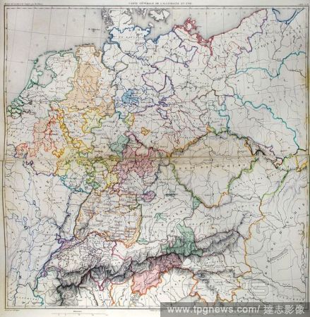
Editorial General map of Germany in 1789. Atlas de l'Histoire du Consulat et de l'Empire. History of the Consulate and the Empire of France under Napoleon by Marie Joseph Louis Adolphe Thiers (1797-1877). Drawings by Dufour, engravings by Dyonnet. Edited in Pari...
- 2022-01-18
- 1
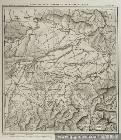
Editorial Napoleonic map. Territory between the German rivers Inn and Isar, tributaries of the Danube. Atlas de l'Histoire du Consulat et de l'Empire. History of the Consulate and the Empire of France under Napoleon by Marie Joseph Louis Adolphe Thiers (1797-187...
- 2021-10-09
- 4
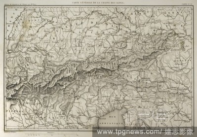
Editorial Map of mountain range of the Alps. Atlas de l'Histoire du Consulat et de l'Empire. History of the Consulate and the Empire of France under Napoleon by Marie Joseph Louis Adolphe Thiers (1797-1877). Drawings by Dufour, engravings by Dyonnet. Edited in P...
- 2021-10-09
- 7
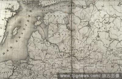
Editorial Napoleonic map. Russia. Detail of the Baltic States and the Gulf of Finland. Atlas de l'Histoire du Consulat et de l'Empire. History of the Consulate and the Empire of France under Napoleon by Marie Joseph Louis Adolphe Thiers (1797-1877). Drawings by ...
- 2021-10-09
- 5
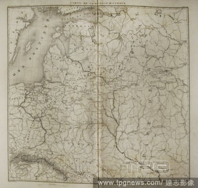
Editorial Napoleonic map of European Russia. Atlas de l'Histoire du Consulat et de l'Empire. History of the Consulate and the Empire of France under Napoleon by Marie Joseph Louis Adolphe Thiers (1797-1877). Drawings by Dufour, engravings by Dyonnet. Edited in P...
- 2021-10-09
- 3
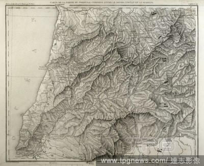
Editorial Napoleonic map. Portugal, detail of the territory between the Douro river, Atlantic Ocean and Guadiana river. Atlas de l'Histoire du Consulat et de l'Empire. History of the Consulate and the Empire of France under Napoleon by Marie Joseph Louis Adolphe...
- 2021-10-09
- 1
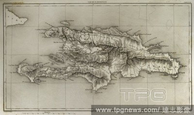
Editorial Napoleonic map. Island of Santo Domingo. Napoleon re-established slavery on the island, sending thousands of soldiers in 1802. Half of the French troops died because of yellow fever. Atlas de l'Histoire du Consulat et de l'Empire. History of the Consul...
- 2021-10-09
- 9
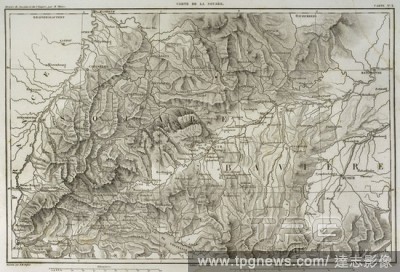
Editorial Map of Swabia (southwestern Germany). Atlas de l'Histoire du Consulat et de l'Empire. History of the Consulate and the Empire of France under Napoleon by Marie Joseph Louis Adolphe Thiers (1797-1877). Drawings by Dufour, engravings by Dyonnet. Edited i...
- 2021-10-09
- 8
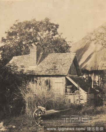
Editorial La Remise ? Outils, Ch?teau d'Argentelle. Dated: late 1840s. Dimensions: sheet (trimmed to image): 21.9 x 17.8 cm (8 5/8 x 7 in.) mount: 33.2 x 24.1 cm (13 1/16 x 9 1/2 in.). Medium: salted paper print from paper negative.
- 2021-06-04
- 1

Editorial Portrait of a Man. Dated: late 1840s. Dimensions: overall: 14.5 x 11.3 cm (5 11/16 x 4 7/16 in.). Medium: salted paper print from collodion negative.
- 2021-06-04
- 1

Editorial The Bean Sorters. Dated: c. 1857. Dimensions: overall: 23.4 x 18.3 cm (9 3/16 x 7 3/16 in.). Medium: paper negative.
- 2021-06-04
- 1
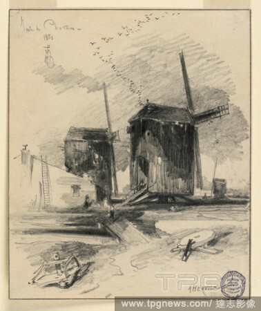
Editorial Windmills, Louis Adolphe Hervier, French, 1818 - 1879, Graphite, charcoal on paper, A lane leads over a brook to a house and two windmills. A third one is in the right background. Framing pencil, ink lines., France, 1851, Drawing, Drawing.
- 2021-02-21
- 1

Editorial Vanity Fair: Royalty; 'Faute-de-Mieux-Premier', M. Louis Adolphe Thiers, January 6, 1872, unknown artist, 1872, Chromolithograph.
- 2021-02-21
- 1
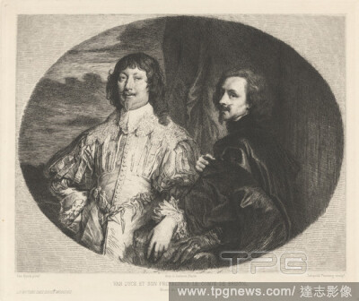
Editorial Van Dyck et Son Protecteur le Comte de Bristol, Leopold Flameng, 18311911, French, after Sir Anthony Van Dyck, 15991641, Flemish, active in Britain (162021; 163234; 163541), Printed by Louis Adolphe Salmon, 18061895, French, undated, Etching and drypoi...
- 2021-02-21
- 1
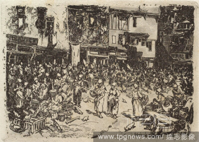
Editorial Louis Adolphe Hervier, French, 18181879, Market in Normandy, 1848, Etching and aquatint on laid paper, image: 3 3/8 x 4 3/4 in. (8.6 x 12.1 cm).
- 2021-02-19
- 1
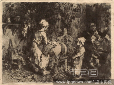
Editorial Louis Adolphe Hervier, French, 18181879, Interieur de Ferme, 1854, Etching, aquatint, drypoint and roulette on wove paper, image: 4 7/16 x 5 7/8 in. (11.2 x 15 cm).
- 2021-02-19
- 1

Editorial Louis Adolphe Hervier, French, 18181879, Barque ? mar?e basse (Boulogne-sur-Mer), 1863, Etching and roulette on laid paper, image: 7 15/16 x 10 5/8 in. (20.2 x 27 cm).
- 2021-02-19
- 1

Editorial Louis Adolphe Hervier, French, 18181879, Sheet of Studies with Portraits of Women and Children, 1854, Pen and ink with washes over pencil on wove paper, Overall: 8 1/16 x 5 7/8 in. (20.4 x 14.9 cm).
- 2021-02-19
- 1
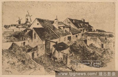
Editorial Louis Adolphe Hervier, French, 18181879, Windmills in Montmartre, c. 1854, Etching on paper, image: 4 7/8 x 7 1/2 in. (12.4 x 19 cm).
- 2021-02-19
- 1
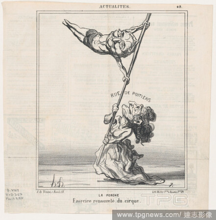
Editorial Pole-vault: An exercise taken from the circus, from 'News of the day, ' published in Le Charivari, March 9, 1870.
- 2021-02-19
- 1

Editorial Louis Adolphe Hervier, French, 18181879, Fishing Boat, c. 1854, Etching, aquatint and drypoint on paper, plate: 4 5/8 x 5 7/8 in. (11.7 x 15 cm).
- 2021-02-19
- 1
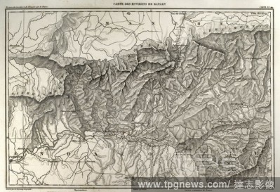
Editorial Napolenic map. Surrounding of the town of Bailen (province of Jaen, Andalusia, Spain). During the War of Spanish Independence it took place a battle in Bailen, the first defeat of the French army, 19 th July, 1808. Atlas de l'Histoire du Consulat et de...
- 2020-12-01
- 2
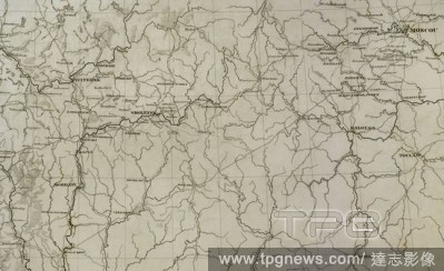
Editorial Napoleonic map. European Russia. Territory in the vicinity of Moscow. Atlas de l'Histoire du Consulat et de l'Empire. History of the Consulate and the Empire of France under Napoleon by Marie Joseph Louis Adolphe Thiers (1797-1877). Drawings by Dufour,...
- 2020-12-01
- 2
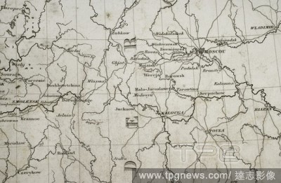
Editorial Napoleonic map. Russia. Area of Moscow. Atlas de l'Histoire du Consulat et de l'Empire. History of the Consulate and the Empire of France under Napoleon by Marie Joseph Louis Adolphe Thiers (1797-1877). Drawings by Dufour, engravings by Dyonnet. Edited...
- 2020-12-01
- 1
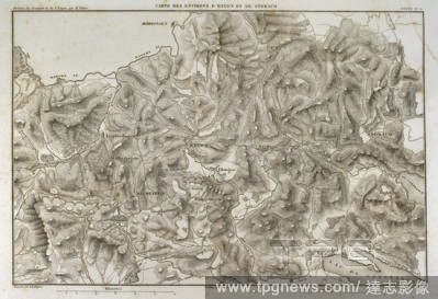
Editorial Napoleonic map. Surroundings of the cities of Engen and Stokach, in present-day Germany. Atlas de l'Histoire du Consulat et de l'Empire. History of the Consulate and the Empire of France under Napoleon by Marie Joseph Louis Adolphe Thiers (1797-1877). ...
- 2020-12-01
- 2
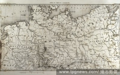
Editorial Map of north Germany. Atlas de l'Histoire du Consulat et de l'Empire. History of the Consulate and the Empire of France under Napoleon by Marie Joseph Louis Adolphe Thiers (1797-1877). Drawings by Dufour, engravings by Dyonnet. Edited in Paris, 1864.
- 2020-11-26
- 1
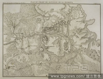
Editorial Napoleonic map. Battle of Borodino, 7 September 1812, during the French invasion of Russia. Battlefield. Napoleonic Wars. Confrontation between French and Russian armies. French tactical victory. Atlas de l'Histoire du Consulat et de l'Empire. History ...
- 2020-09-29
- 2
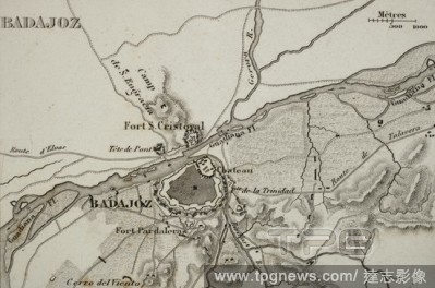
Editorial Napoleonic map. City of Badajoz, Extremadura, Spain. Peninsular War. Badajoz was sieged four times between 1811 and 1812 (Napoleonic Wars). Atlas de l'Histoire du Consulat et de l'Empire History of the Consulate and the Empire of France under Napoleon ...
- 2020-09-29
- 1

Editorial [Female Nude].
- 2020-09-11
- 1

Editorial Louise-Marie-Julie.
- 2020-09-11
- 1

Editorial [Pont d'Ouilly on the Orne River, Normandy].
- 2020-09-11
- 1
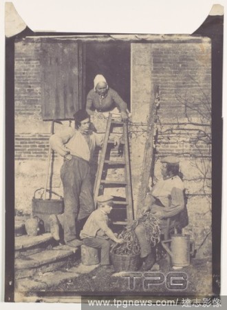
Editorial Shelling Beans, Argentelle.
- 2020-09-11
- 1

Editorial The Laundry.
- 2020-09-11
- 1
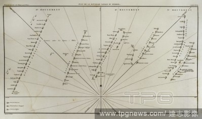
Editorial Plane of Ferrol Expedition (Battle of Brion). It takes place on the Sunday closest to August 25th in the Brion's Mounts, in 1800. It was a part of the War of the Second Coalition. There fought the troops stationed in Ferrol and invading English troops ...
- 2020-09-11
- 2
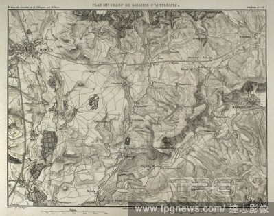
Editorial Napoleonic map. Battle of Austerlitz or Battle of the Three Emperors (2nd December 1805). Part of War of the Third Coalition (Napoleonic Wars). French Victory. Atlas de l'Histoire du Consulat et de l'Empire. History of the Consulate and the Empire of F...
- 2020-09-11
- 3
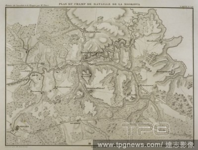
Editorial Napoleonic map. Battle of Borodino, 7 September 1812, during the French invasion of Russia. Battlefield. Napoleonic Wars. Confrontation between French and Russian armies. French tactical victory. Atlas de l'Histoire du Consulat et de l'Empire. History ...
- 2020-09-11
- 2
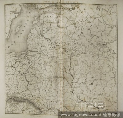
Editorial Napoleonic map of European Russia. Atlas de l'Histoire du Consulat et de l'Empire. History of the Consulate and the Empire of France under Napoleon by Marie Joseph Louis Adolphe Thiers (1797-1877). Drawings by Dufour, engravings by Dyonnet. Edited in P...
- 2020-09-11
- 1
 Loading