filter
-
Brand
- By Category
- Direction
- Date Range
118Events
Pictures
Events

Editorial Baxter Dury performing at South Facing Festival 2024
- 2024-07-29
- 1

Editorial Baxter Dury performing at South Facing Festival 2024
- 2024-07-29
- 27

Editorial Baxter Dury Performs at South Facing Festival at Crystal Palace Bowl, London
- 2024-07-28
- 22

Editorial Football - Men's Argentina Training
- 2024-07-24
- 11

Editorial .Live At Leeds In The Park 2024
- 2024-05-27
- 6

Editorial .Live At Leeds In The Park 2024
- 2024-05-26
- 1

Editorial Live At Leeds In The Park 2024
- 2024-05-26
- 1

Editorial MLB: Spring Training-Chicago Cubs at Los Angeles Angels
- 2024-03-17
- 1

Editorial MLB: Spring Training-Chicago Cubs at Los Angeles Angels
- 2023-06-15
- 1

Editorial MLB: Spring Training-Chicago Cubs at Los Angeles Angels
- 2023-04-24
- 2

Editorial NOEX
- 2023-03-30
- 1

Editorial NOEX
- 2023-03-07
- 6

Editorial Chris de Burgh on tour, Theatre Royal Dury Lane, London, UK
- 2023-02-15
- 25

Editorial A plan of the city of Philadelphia, with an inset in the upper left of a chart of Delaware Bay and River. A PLAN OF THE CITY OF PHILADELPHIA, the CAPITAL of PENNSYLVANIA from an ACTUAL SURVEY. LONDON : Publish'd as the Act directs, 4.th November 1776, ...
- 2022-12-24
- 1
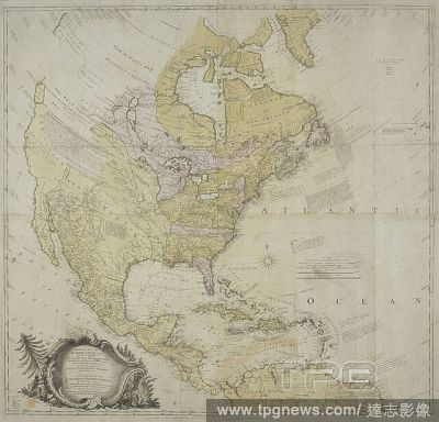
Editorial A map of North America . A GENERAL MAP OF NORTH AMERICA; In which is Express'd The several New Roads, Forts, Engagements, &c, taken from Actual Surveys and Observations Made in the Army employ'd there, From the Years 1754, to 1761: drawn by the late JO...
- 2022-12-24
- 1
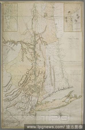
Editorial A map of the Province of New York, with part of Pensilvania, and New England. A MAP OF THE Province OF New-York, with Part of PENSILVANIA, AND NEW ENGLAND. [London] : Publish'd as the Act directs June 10th 1775, by A. Dury, Dukes Court St Martins Lane ...
- 2022-12-24
- 1
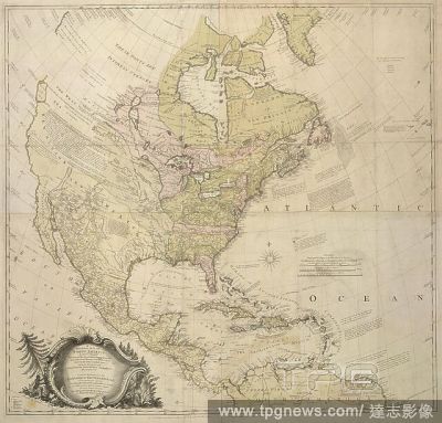
Editorial A map of North America. A GENERAL MAP OF NORTH AMERICA; In which is Express'd The several New Roads, Forts, Engagements, &c, taken from Actual Surveys and Observations Made in the Army employ'd there, From the Years 1754, to 1761: drawn by the late JOH...
- 2022-12-24
- 1

Editorial A plan of Boston and its environs. A PLAN OF BOSTON, and its ENVIRONS. : shewing the true SITUATION of HIS MAJESTY'S ARMY. AND ALSO THOSE OF THE REBELS. LONDON : Publish'd as the Act directs, 12th March, 1776 by Andrew Dury, Duke's Court, St. Martins L...
- 2022-12-24
- 1

Editorial Boston and its Environs. The North American Atlas. London; Andrew Dury, Duke's Court, St. Martins Lan. Source: Maps.1.Tab.44.(17), 38-39.
- 2022-12-24
- 1

Editorial Map of Nova Scotia, or Acadia, with the Islands of Cape Breton and St John's. [London], A. Dury, 1768. Source: Maps K.Top.119.59.1.2.TAB. Language: English.
- 2022-12-24
- 1

Editorial Portrait of Dom Augusto, Duke of Leuchtenberg. Date/Period: Ca. 1835. Painting. Oil on canvas.
- 2022-07-22
- 1

Editorial Russians Celebrating Easter In Greece, Athens - 20 Apr 2022
- 2022-04-22
- 1

Editorial 1776, Rennell, Dury Wall Map of Bihar and Bengal, India.
- 2022-01-19
- 1

Editorial 1777, Rennell, Dury Wall Map of Delhi and Agra, India.
- 2022-01-18
- 1
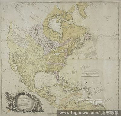
Editorial A map of North America . A GENERAL MAP OF NORTH AMERICA; In which is Express'd The several New Roads, Forts, Engagements, &c, taken from Actual Surveys and Observations Made in the Army employ'd there, From the Years 1754, to 1761: drawn by the late JO...
- 2022-01-18
- 1
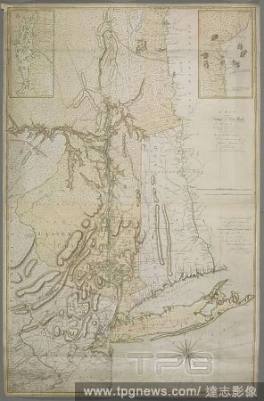
Editorial A map of the Province of New York, with part of Pensilvania, and New England. A MAP OF THE Province OF New-York, with Part of PENSILVANIA, AND NEW ENGLAND. [London] : Publish'd as the Act directs June 10th 1775, by A. Dury, Dukes Court St Martins Lane ...
- 2022-01-18
- 1
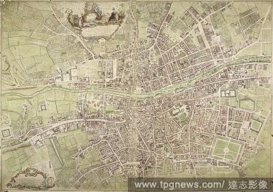
Editorial A map of Dublin. An exact Survey of the City and Suburbs of Dublin ... by Johyn Rocque ... A. Dury Sculpt. [Dublin] : J. Rocque, 1756. Source: Maps K.Top.53.13.a.11 Tab. End. Language: English.
- 2022-01-18
- 1

Editorial A map of North America. A GENERAL MAP OF NORTH AMERICA; In which is Express'd The several New Roads, Forts, Engagements, &c, taken from Actual Surveys and Observations Made in the Army employ'd there, From the Years 1754, to 1761: drawn by the late JOH...
- 2022-01-18
- 1
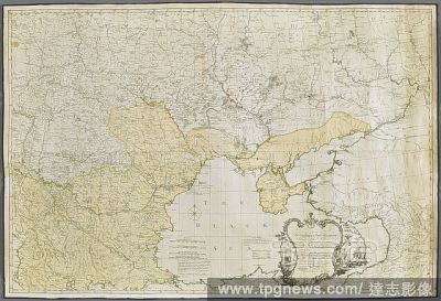
Editorial A map of the present Seat of War, between the Russians, Poles and Turks . To His Excellency the Count of Czernichen Commander in Chief of her Majesty the Empress of all the RUSSIAS Fleet and Gallies Lieutenant General of her Armies, one of the Lords of...
- 2022-01-18
- 1
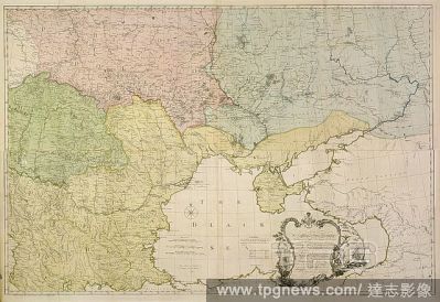
Editorial An 18th century map of Eastern Europe. To His Excellency the Count of Czernichew... this. London, 1770. Source: Maps.Roll.507,. Language: English.
- 2022-01-18
- 1
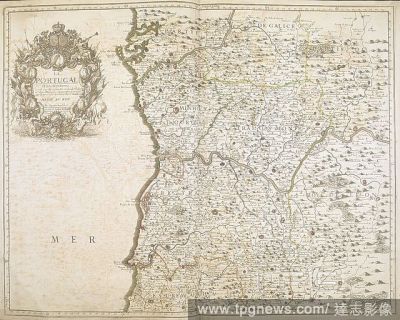
Editorial A map of Portugal and its borders. Includes a title cartouche with medallions and profiles of Louis XIV and his heirs, surmounted with the royal arms of France and Navarre. LE PORTUGAL : et Ses Frontieres. London : Printet for A Dury Geogr, 1762. Sourc...
- 2022-01-18
- 1

Editorial A map of Portugal. Le Portugal et ses Frontie?res ... Par G. Bailleux. Paris : A. Dury, 1762. Source: Maps K.Top.74.55.
- 2022-01-18
- 1

Editorial A plan of the city of Philadelphia, with an inset in the upper left of a chart of Delaware Bay and River. A PLAN OF THE CITY OF PHILADELPHIA, the CAPITAL of PENNSYLVANIA from an ACTUAL SURVEY. LONDON : Publish'd as the Act directs, 4.th November 1776, ...
- 2022-01-18
- 1
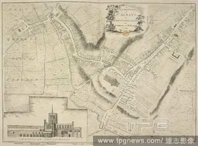
Editorial A plan of the town of St. Albans, Hertfordshire. A Plan of the Town of St. Albans ... [London] : A. Dury, 1766. Source: Maps K.Top.15.48. Language: English.
- 2022-01-18
- 1

Editorial A plan of Boston and its environs. A PLAN OF BOSTON, and its ENVIRONS. : shewing the true SITUATION of HIS MAJESTY'S ARMY. AND ALSO THOSE OF THE REBELS. LONDON : Publish'd as the Act directs, 12th March, 1776 by Andrew Dury, Duke's Court, St. Martins L...
- 2022-01-18
- 1

Editorial Boston and its Environs. The North American Atlas. London; Andrew Dury, Duke's Court, St. Martins Lan. Source: Maps.1.Tab.44.(17), 38-39.
- 2022-01-18
- 1
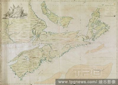
Editorial Map of Nova Scotia, or Acadia, with the Islands of Cape Breton and St John's. [London], A. Dury, 1768. Source: Maps K.Top.119.59.1.2.TAB. Language: English.
- 2022-01-18
- 1

Editorial Belgium Soccer Press Conference Zulte Waregem Francky Dury, Waregem, Belgium - 17 Dec 2021
- 2021-12-18
- 24

Editorial Soccer Jpl D19 Zulte Waregem Vs Union Sg, Waregem, Belgium - 15 Dec 2021
- 2021-12-16
- 6

Editorial Covid-19 booster programme accelerated to limit the spread of Omicron variant, London, UK - 06 Dec 2021
- 2021-12-06
- 1

Editorial Soccer Jpl D17 Anderlecht Vs Zulte Waregem, Brussels, Belgium - 05 Dec 2021
- 2021-12-06
- 2

Editorial Soccer Jpl D16 Zulte Waregem Vs Beerschot Va, Waregem, Belgium - 28 Nov 2021
- 2021-11-29
- 1

Editorial Soccer Jpl D15 Sv Zulte Waregem Vs Kaa Gent, Waregem, Belgium - 20 Nov 2021
- 2021-11-21
- 2

Editorial Soccer Jpl D14 Kas Eupen Vs Zulte Waregem, Eupen, Belgium - 06 Nov 2021
- 2021-11-07
- 2

Editorial BELGIUM: SOCCER JPL D14 KAS EUPEN VS ZULTE WAREGEM
- 2021-11-07
- 2

Editorial Soccer Jpl D13 Zulte Waregem Vs Krc Genk, Waregem, Belgium - 31 Oct 2021
- 2021-10-31
- 2

Editorial BELGIUM: SOCCER JPL D13 ZULTE WAREGEM VS KRC GENK
- 2021-10-31
- 2

Editorial Soccer Jpl D12 Kv Mechelen Vs Zulte Waregem, Mechelen, Belgium - 23 Oct 2021
- 2021-10-24
- 1

Editorial BELGIUM: SOCCER JPL D12 KV MECHELEN VS ZULTE WAREGEM
- 2021-10-24
- 1

Editorial Soccer Jpl D11 Sv Zulte Waregem Vs Royal Antwerp Fc, Waregem, Belgium - 16 Oct 2021
- 2021-10-17
- 5

Editorial BELGIUM: SOCCER JPL D11 SV ZULTE WAREGEM VS ROYAL ANTWERP FC
- 2021-10-17
- 5

Editorial Soccer Jpl D10 Seraing Vs Zulte Waregem, Seraing, Belgium - 03 Oct 2021
- 2021-10-04
- 1

Editorial BELGIUM: SOCCER JPL D10 SERAING VS ZULTE WAREGEM
- 2021-10-04
- 1

Editorial Soccer Jpl D9 Zulte Waregem Vs Kv Kortrijk, Waregem, Belgium - 25 Sep 2021
- 2021-09-26
- 2

Editorial BELGIUM: SOCCER JPL D9 ZULTE WAREGEM VS KV KORTRIJK
- 2021-09-26
- 1

Editorial Soccer Jpl D1 Union Saint-Gilloise Vs Zulte-Waregem, Brussels, Belgium - 18 Sep 2021
- 2021-09-19
- 1

Editorial BELGIUM: SOCCER JPL D7 ZULTE WAREGEM VS CERCLE BRUGGE
- 2021-09-12
- 1

Editorial BELGIUM: SOCCER JPL D6 KV OOSTENDE VS SV ZULTE WAREGEM
- 2021-08-30
- 1

Editorial BELGIUM: SOCCER JPL D5 SV ZULTE WAREGEM VS SPORTING CHARLEROI
- 2021-08-23
- 1

Editorial BELGIUM: SOCCER JPL D5 SV ZULTE WAREGEM VS SPORTING CHARLEROI
- 2021-08-22
- 1

Editorial Soccer Jpl D4 Zulte Waregem Vs Club Brugge, Waregem, Belgium - 15 Aug 2021
- 2021-08-17
- 1

Editorial BELGIUM: SOCCER JPL D4 ZULTE WAREGEM VS CLUB BRUGGE
- 2021-08-16
- 1

Editorial Soccer Jpl D2 Zulte Waregem Vs Standard De Liege, Waragem, Belgium - 01 Aug 2021
- 2021-08-02
- 1

Editorial Soccer Photoshoot D1 Zulte Waregem, Waregem, Belgium - 15 Jul 2021
- 2021-07-15
- 1

Editorial BELGIUM: SOCCER PHOTOSHOOT D1 ZULTE WAREGEM
- 2021-07-15
- 1

Editorial BELGIUM: SOCCER JPL SV ZULTE WAREGEM FIRST TRAINING
- 2021-06-09
- 2

Editorial BELGIUM: SOCCER JPL D34 ZULTE WAREGEM VS KAA GENT
- 2021-04-19
- 1

Editorial BELGIUM: SOCCER JPL D34 ZULTE WAREGEM VS KAA GENT
- 2021-04-19
- 1

Editorial BELGIUM: SOCCER JPL D29 CLUB BRUGGE VS ZULTE WAREGEM
- 2021-03-07
- 1

Editorial BELGIUM: SOCCER JPL D27 ZULTE-WAREGEM VS STANDARD DE LIEGE
- 2021-02-22
- 1

Editorial BELGIUM: SOCCER JPL D20 WAASLAND-BEVEREN VS ZULTE WAREGEM
- 2021-01-17
- 1

Editorial BELGIUM: SOCCER JPL D19 ZULTE WAREGEM VS CERCLE BRUGGE
- 2020-12-27
- 1

Editorial BELGIUM: SOCCER JPL D17 ZULTE WAREGEM VS STVV
- 2020-12-20
- 2
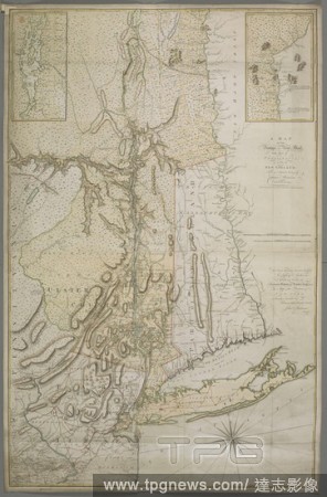
Editorial A map of the Province of New York, with part of Pensilvania, and New England. A MAP OF THE Province OF New-York, with Part of PENSILVANIA, AND NEW ENGLAND. [London] : Publish'd as the Act directs June 10th 1775, by A. Dury, Dukes Court St Martins Lane ...
- 2020-12-04
- 1

Editorial BELGIUM: SOCCER JPL D14 KAA GENT VS ZULTE WAREGEM
- 2020-11-30
- 1

Editorial BELGIUM: SOCCER JPL D12 CERCLE BRUGGE VS ZULTE WAREGEM
- 2020-11-09
- 1

Editorial BELGIUM: SOCCER JPL D10 KV OOSTENDE VS ZULTE WAREGEM
- 2020-10-26
- 1

Editorial BELGIUM: SOCCER JPL D9 ZULTE-WAREGEM VS ANTWERP
- 2020-10-18
- 1

Editorial BELGIUM: SOCCER JPL D7 STANDARD VS ZULTE WAREGEM
- 2020-09-27
- 1

Editorial BELGIUM: SOCCER JPL D5 ZULTE WAREGEM VS CHARLEROI
- 2020-09-14
- 1

Editorial BELGIUM: SOCCER JPL D4 RE MOUSCRON VS ZULTE-WAREGEM
- 2020-08-30
- 1

Editorial BELGIUM: SOCCER JPL DAY 01 SV ZULTE WAREGEM VS KRC GENK
- 2020-08-10
- 1

Editorial BELGIUM: SOCCER PHOTOSHOOT JPL ZULTE WAREGEM
- 2020-07-16
- 1

Editorial CORONAVIRUS
- 2020-03-17
- 1

Editorial BELGIUM: SOCCER JPL D26 ZULTE WAREGEM VS RE MOUSCRON
- 2020-02-17
- 2

Editorial Portrait of Dom Augusto, Duke of Leuchtenberg. Date/Period: Ca. 1835. Painting. Oil on canvas.
- 2019-11-18
- 1
 Loading