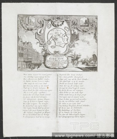
EditorialThe very famous island of Mad-head, lying in the sea of shares,' 1720. This fampus cartographical political satire was published in the aftermath of the collapse of the French Compagnie de la Louisiane ou d'Occident, and of similar English and Dutch o...
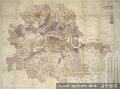
EditorialBooth's map of poverty levels in London, 1891. Descriptive map of London poverty 1889. London, England. Charles Booth, a shipowner, sought to refute socialist allegations that a quarter of London’s population lived in poverty. He thought this exagger...
EditorialBooth's map of poverty levels in London, 1891. Descriptive map of London poverty 1889. London, England. Charles Booth, a shipowner, sought to refute socialist allegations that a quarter of London’s population lived in poverty. He thought this exagger...
EditorialThe very famous island of Mad-head, lying in the sea of shares,' 1720. This fampus cartographical political satire was published in the aftermath of the collapse of the French Compagnie de la Louisiane ou d'Occident, and of similar English and Dutch o...
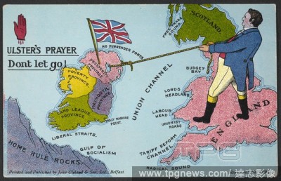
EditorialUlster's prayer: Ireland and Home Rule. A postcard showing John Bull steadying Ireland as it drifts away from Britain towards 'Home Rule Rocks'. A collection of cartographical picture postcards formed by Sir Richard Cave. [Various imprints], [1914-15]....
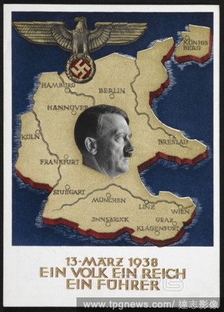
EditorialPortrait of Adolf Hitler, over a map of Germany. An Eagle and swastika emblem. A collection of cartographical picture postcards illustrating the political situation in Europe. Colour image. Source: Maps.C.1.a.9.(38). Language: German.
EditorialBooth's map of poverty levels in London, 1891. Descriptive map of London poverty 1889. London, England. Charles Booth, a shipowner, sought to refute socialist allegations that a quarter of London’s population lived in poverty. He thought this exagger...


 Loading