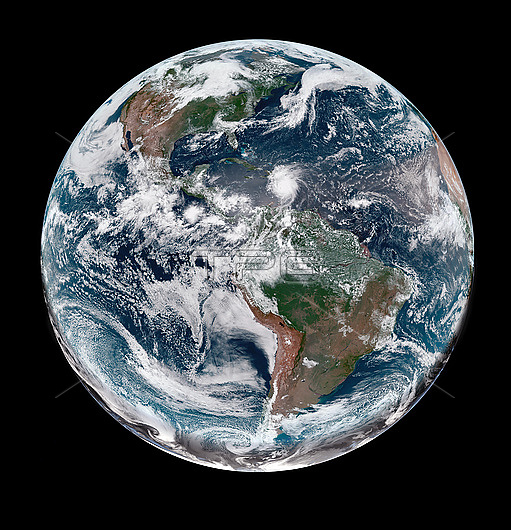
Satellite image of Earth as Hurricane Beryl, seen centre-right, just north of Venezuela, moves over the Caribbean Sea on 1st July 2024. Hurricane Beryl made landfall on Carriacou, Grenada, on the afternoon of the 1st July as a category 4 storm with sustained winds of 240 kilometres per hour. On the 2nd July Beryl peaked as a category 5 hurricane, the earliest in the Atlantic hurricane season that a hurricane has reached category 5 since records began. As of 25th July 2024, 64 confirmed deaths have been attributed to Beryl, as well as estimated damages of over 6 billion US dollars. Image obtained by the Advanced Baseline Imager (ABI) on the Geostationary Operational Environmental Satellite 16 (GOES-16).
| px | px | dpi | = | cm | x | cm | = | MB |
Details
Creative#:
TOP29909527
Source:
達志影像
Authorization Type:
RM
Release Information:
須由TPG 完整授權
Model Release:
N/A
Property Release:
N/A
Right to Privacy:
No
Same folder images:

 Loading