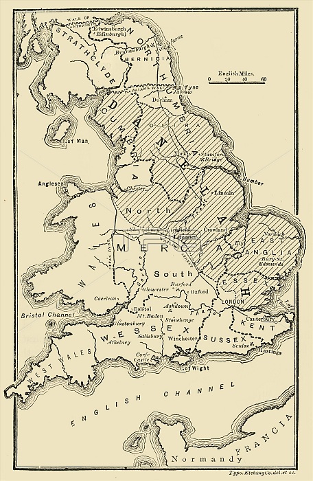
'Map of England, Showing the Anglo-Saxon Kingdoms and the Danish Districts (The Latter Shaded)', (c9th century), 1890. The Heptarchy is a collective name applied to the seven kingdoms of Anglo-Saxon settlement of Britain in the 5th century. During the 9th century, about half of England was under Danish rule. From "Cassell's Illustrated Universal History, Vol. III - The Middle Ages", by Edmund Ollier. [Cassell and Company, Limited, London, Paris and Melbourne, 1890. ]
| px | px | dpi | = | cm | x | cm | = | MB |
Details
Creative#:
TOP24764377
Source:
達志影像
Authorization Type:
RM
Release Information:
須由TPG 完整授權
Model Release:
No
Property Release:
No
Right to Privacy:
No
Same folder images:
EnglandcloseupartscountrydistrictDenmarkDanishbookBritishmedievalantiquelocationcenturyBritaindiagramliteratureconceptdivisionclose-upB&WkingdomMONOCHROMEShadedDay19thcenturyblack&whiteblackandwhiteB/WMiddleAgesnineteenthcenturyhistoryhistoricThePrintCollectorAngloSaxonAnglo-SaxonTGNengravingmapUnknownCassellsEdmundCoCassell&CoEdmundOllierOllierCassellandCompanyLtdCassell&CompanyCassell&Cassell'sIllustratedUniversalHistoryHeptarchy
&&&&19thAgesAngloAnglo-SaxonB&WB/WBritainBritishCassellCassellCassellCassellCassell'sCassellsCoCoCollectorCompanyCompanyDanishDayDenmarkEdmundEdmundEnglandHeptarchyHistoryIllustratedLtdMONOCHROMEMiddleOllierOllierPrintSaxonShadedTGNTheUniversalUnknownandandantiqueartsblackblackbookcenturycenturycenturycloseclose-upconceptcountrydiagramdistrictdivisionengravinghistorichistorykingdomliteraturelocationmapmedievalnineteenthupwhitewhite

 Loading