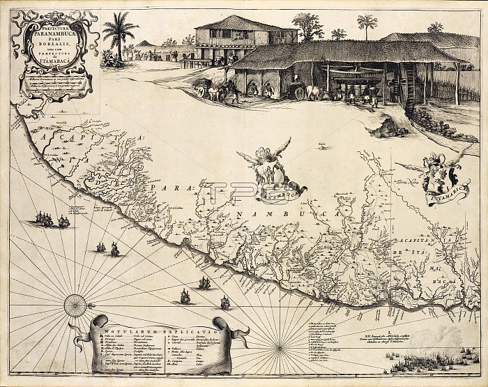
A section of the Brazilian coastline, one the first maps of Brazil based on Dutch rather than Portuguese interests. Kaspar van Baerle was commissioned to document the coastal provinces of Brazil. The resulting work, Rerum per octennium in Brasilia, was published by Johannes Blaeu in 1647, and contained many maps of the region. The scene at upper right depicts the commercially important sugar cane industry, which used Africans as slave labor.
| px | px | dpi | = | cm | x | cm | = | MB |
Details
Creative#:
TOP22165084
Source:
達志影像
Authorization Type:
RM
Release Information:
須由TPG 完整授權
Model Release:
N/A
Property Release:
No
Right to Privacy:
No
Same folder images:
altascropsugarplantationmalemanpeoplepersonafricanslavesslavelaborslaveeconomicinterestcommercialindustrysugarcanesugarcanererumperoctenniuminbrasilia17thcentury1600s1647blaeujohannesblaeukasparvanbaerlebaerledutchsouthamericacoastcoastlinechartmapbrazilianbrazilsceneengravingdrawingartartworkoldmapantiquemaphistoryhistoricalhistoric
1600s164717thafricanaltasamericaantiqueartartworkbaerlebaerleblaeublaeubrasiliabrazilbraziliancanecenturychartcoastcoastlinecommercialcropdrawingdutcheconomicengravinghistorichistoricalhistoryinindustryinterestjohanneskasparlabormalemanmapmapmapoctenniumoldpeopleperpersonplantationrerumsceneslaveslaveslavessouthsugarsugarsugarcanevan

 Loading