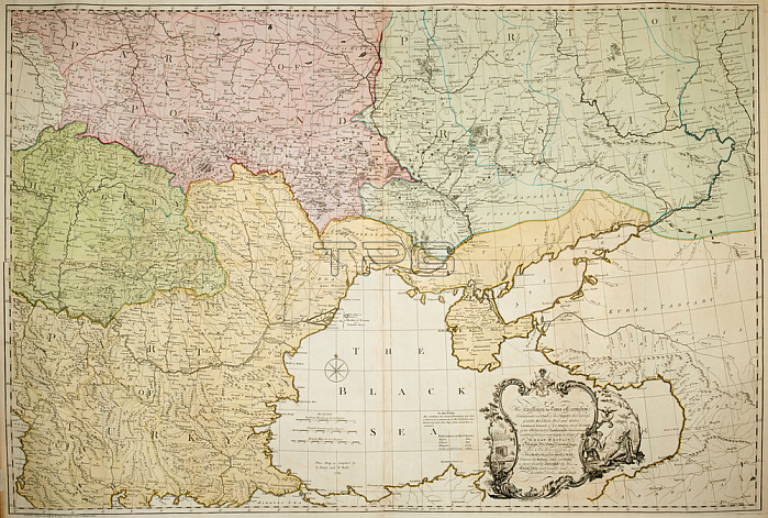
An 18th century map. Indicated in bold on the map is: Partition of Ploand; Hungary; Part of Russia; and; Partition of Turkey. 1 map: hand col ; 82 x 124 cm.; Scale [ca. 1: 1 500 000]. British miles 69 1/2 to a degree 110 [= 110 mm].London: Printed and sold by A. Dury at Dukes Court St Martins L: ane; [ca. 1770].From: Andrew Dury; To His Excellency the Count of Czernichew. this map of the present seat of war between the Russians; Poles and Turks is most humbly inscribed by His Excellency's most Obedt Servt Andrew Dury.Maps. Roll. 507London; British Library.
| px | px | dpi | = | cm | x | cm | = | MB |
Details
Creative#:
TOP20493242
Source:
達志影像
Authorization Type:
RM
Release Information:
須由TPG 完整授權
Model Release:
No
Property Release:
No
Right to Privacy:
No
Same folder images:
Restriction:
Additional permissions needed for non-editorial use.

 Loading