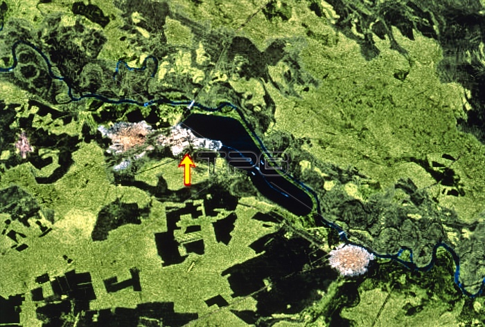
Chernobyl. Coloured radar image of the area around the Chernobyl nuclear power facility, Ukraine. The large blue area at centre is the power station's 12km-long cooling pond, fed by the River Pripyat. The power station complex is at the left end of the pond. The arrow points to the site of the four RBMK-type nuclear reactors. One of these reactors overheated and suffered a meltdown and then exploded on 26 April 1986. An exclusion zone of 30km radius around the site includes the town of Chernobyl (lower right) and Tostyy-Les (centre left). This image was gathered by the second Space Radar Laboratory (SRL-2) during Shuttle Mission STS-68 of 30 September to 11 October 1994.
| px | px | dpi | = | cm | x | cm | = | MB |
Details
Creative#:
TOP10227964
Source:
達志影像
Authorization Type:
RM
Release Information:
須由TPG 完整授權
Model Release:
N/A
Property Release:
N/A
Right to Privacy:
No
Same folder images:

 Loading