EditorialChart of the North Atlantic Ocean from Florida on the west to Iceland, Ireland and the Iberian peninsula on the east. Queen Mary Atlas. 1558. Source: Add. 5415 A, ff.19v-20.
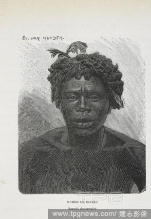
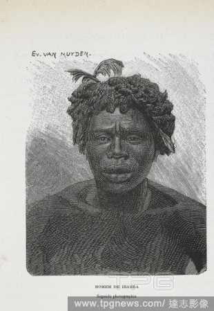
EditorialHomem de Iramba. A man from Iramba, the Singida Region of central Tanzania. Dahomey and the Dahomans: being the journals of two missions to the King of Dahomey. London, 1851. Source: 10097.d.21.
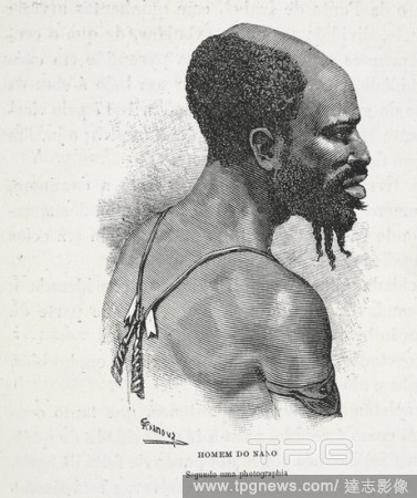
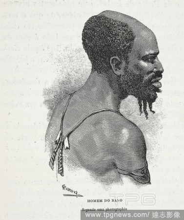
EditorialHomem do Nano. An African male. Dahomey and the Dahomans: being the journals of two missions to the King of Dahomey. London, 1851. Source: 10097.d.21.
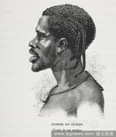
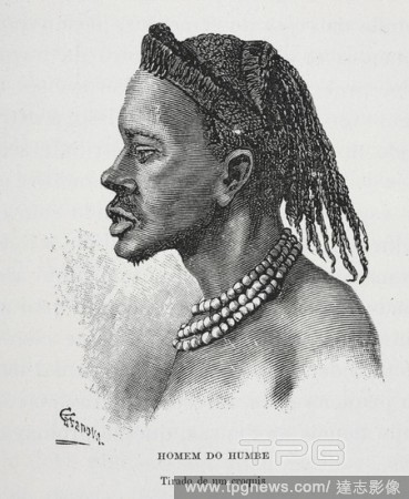
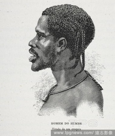
EditorialHomem do Humbe. An African male. Dahomey and the Dahomans: being the journals of two missions to the King of Dahomey. London, 1851. Source: 10097.d.21.
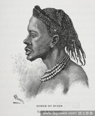
EditorialHomem do Humbe. An African man wearing beads. Dahomey and the Dahomans: being the journals of two missions to the King of Dahomey. London, 1851. Source: 10097.d.21.
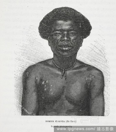
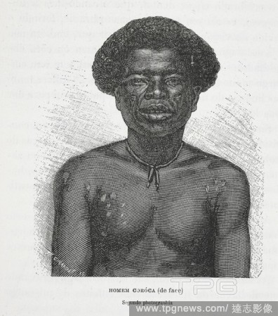
EditorialHomem coróca (de face). An African man. Dahomey and the Dahomans: being the journals of two missions to the King of Dahomey. London, 1851. Source: 10097.d.21.
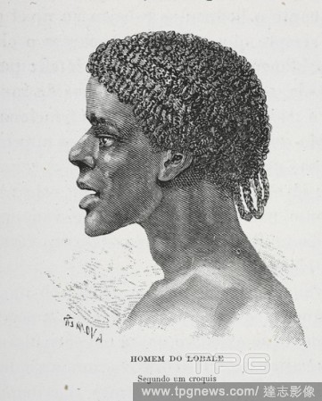
EditorialHomem do Lobale. An African man. Dahomey and the Dahomans: being the journals of two missions to the King of Dahomey. London, 1851. Source: 10097.d.21.
EditorialGuy-Manuel de Homem-Christo, left, and Thomas Bangalter, better known as Daft Punk, in Los Angeles, May 12, 2013. (Chad Batka/The New York Times)
EditorialGuy-Manuel de Homem-Christo, left, and Thomas Bangalter, better known as Daft Punk, in Los Angeles, May 12, 2013. (Chad Batka/The New York Times)
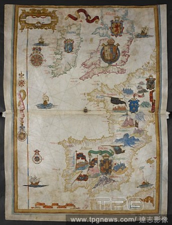
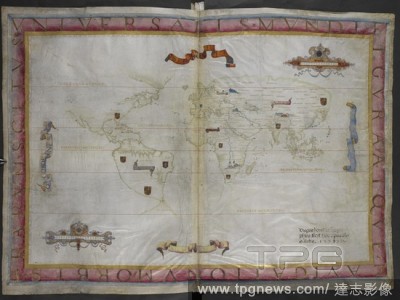
EditorialChart of western Europe, including the British Isles, Ireland, France, Spain, Portugal, the western Mediterranean Sea, and part of North Africa. With armorial decoration. Queen Mary Atlas. 1558. Source: Add. 5415 A, ff.9v-10.
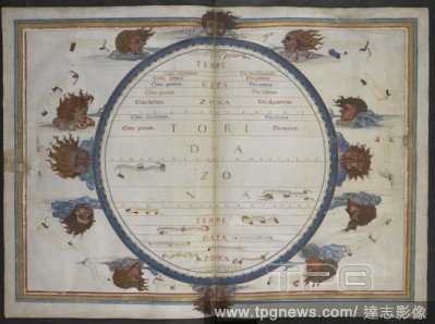
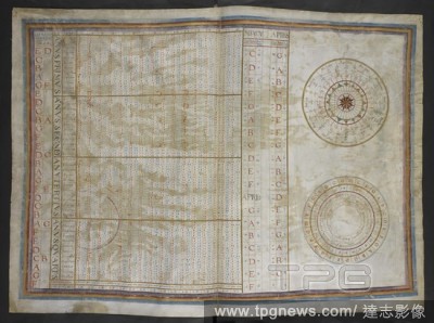
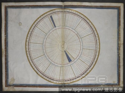
EditorialCircular table shewing the seven climates, the zones, and the winds. Queen Mary atlas. 1558. Each map f. 7 in. x 1 f. 8 in. Source: Add. 5415 A, ff.5v-6.
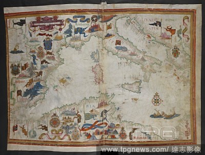
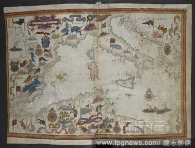
EditorialMap of the coast of the Mediterranean and Adriatic from the Straits of Gibraltar to the Morea. Queen Mary atlas. 1558. Source: Add. 5415 A, ff.11v-12.
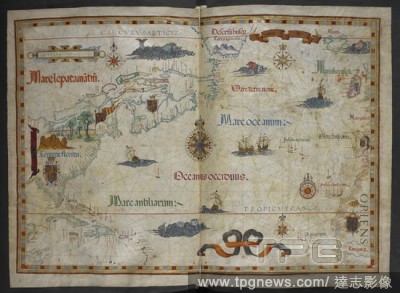
EditorialMap of part of the North and South Atlantic Ocean, flanked by South America and Africa. Queen Mary atlas. 1558. Source: Add. 5415 A, ff.13v-14.
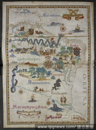
EditorialMap of South America showing the upper part of the Amazon River, with Indians in their settlements and the Spanish expeditionary force camp. Queen Mary atlas. 1558. Source: Add. 5415 A, ff.23v-24.
EditorialChart of the North Atlantic Ocean from Florida on the west to Iceland, Ireland and the Iberian peninsula on the east. Queen Mary Atlas. 1558. Source: Add. 5415 A, ff.19v-20.
EditorialChart of western Europe, including the British Isles, Ireland, France, Spain, Portugal, the western Mediterranean Sea, and part of North Africa. With armorial decoration. Queen Mary Atlas. 1558. Source: Add. 5415 A, ff.9v-10.
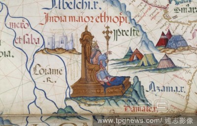
Editorial[Detail] Prester John sitting on his throne in Ethiopia; part of a map of East Africa. He was a mythical king, reportedly descended from one of the Three Magi, and said to rule over a Christian kingdom, amidst the pagans, imagined to be Ethiopia. Queen...
EditorialHomem de Iramba. A man from Iramba, the Singida Region of central Tanzania. Dahomey and the Dahomans: being the journals of two missions to the King of Dahomey. London, 1851. Source: 10097.d.21.
EditorialHomem do Nano. An African male. Dahomey and the Dahomans: being the journals of two missions to the King of Dahomey. London, 1851. Source: 10097.d.21.
EditorialCircular table shewing the seven climates, the zones, and the winds. Queen Mary atlas. 1558. Each map f. 7 in. x 1 f. 8 in. Source: Add. 5415 A, ff.5v-6.
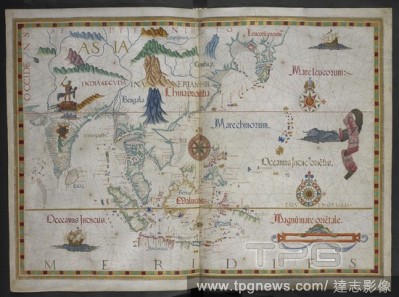
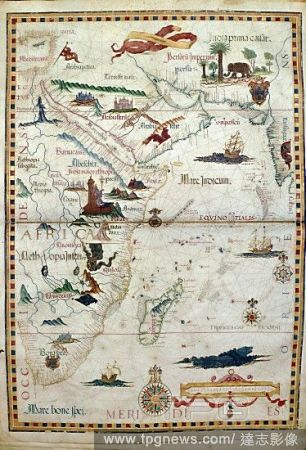
EditorialMap of the Indian Ocean showing parts of Arabia, East Africa, Persia, Western India and Madagascar; in Ethiopia, Prester John is depicted on his throne. Queen Mary Atlas. 1558. Source: Add. 5415 A, ff.15v-16.
EditorialHomem do Humbe. An African male. Dahomey and the Dahomans: being the journals of two missions to the King of Dahomey. London, 1851. Source: 10097.d.21.
EditorialHomem do Humbe. An African man wearing beads. Dahomey and the Dahomans: being the journals of two missions to the King of Dahomey. London, 1851. Source: 10097.d.21.
EditorialMap of the coast of the Mediterranean and Adriatic from the Straits of Gibraltar to the Morea. Queen Mary atlas. 1558. Source: Add. 5415 A, ff.11v-12.
EditorialHomem coróca (de face). An African man. Dahomey and the Dahomans: being the journals of two missions to the King of Dahomey. London, 1851. Source: 10097.d.21.
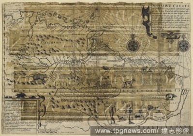
EditorialA map of Guiana. Nieuwe Caerte van het wonderbaer ende goudrijeke landt Guiana, gelegen onder de Linie AEqinoctiael, tusschen Brasilien ende Peru: nieuwelick besocht door Sir Water [sic] Ralegh Ridder van Engelandt, in het jaer 1594, 95 ende 1596. J. H...
EditorialArabia, East Africa, Persia, West India and Madagaskar. A detailed and labelled map, also showing Prester (priest) John (sitting on his throne, centre left), a mythical Christian priest-king of a legendary vast empire in Central Asia. From a collection...
EditorialArabia, East Africa, Persia, West India and Madagaskar. A detailed and labelled map, also showing Prester (priest) John (sitting on his throne, centre left), a mythical Christian priest-king of a legendary vast empire in Central Asia. From a collection...


 Loading