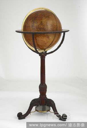
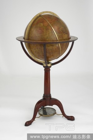
EditorialTerrestial globe on a stand. [A Celestial Globe, 18 inches in diameter, with dedicatory title as follows:] Britanniarum Regi Augustissimo Georgio Tertio Astronomorum Patrono Munificentissimo, Celeberrimo, Globum hunc Caelestem, novam et emendatiorem ca...
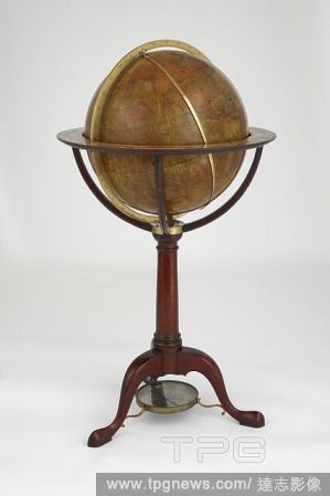
EditorialCelestial globe, on a stand. [A Celestial Globe, 18 inches in diameter, with dedicatory title as follows:] Britanniarum Regi Augustissimo Georgio Tertio Astronomorum Patrono Munificentissimo, Celeberrimo, Globum hunc Caelestem, novam et emendatiorem ca...
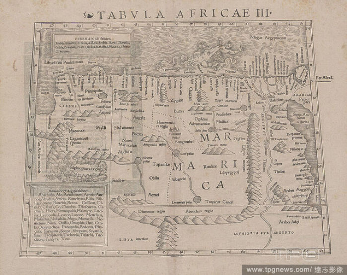
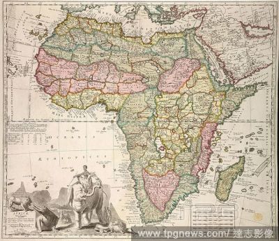
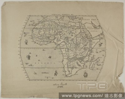
EditorialAfricae Tabula XII. Unknown Artist (English, 19th century); after Livio Sanuto (Italian, 1520-1576). Date: 1889. Dimensions: 255 ? 322 mm. Engraving in black on cream laid paper. Origin: England.
EditorialAfricae Tabula XII. Unknown Artist (English, 19th century); after Livio Sanuto (Italian, 1520-1576). Date: 1889. Dimensions: 255 ? 322 mm. Engraving in black on cream laid paper. Origin: England.
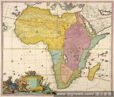
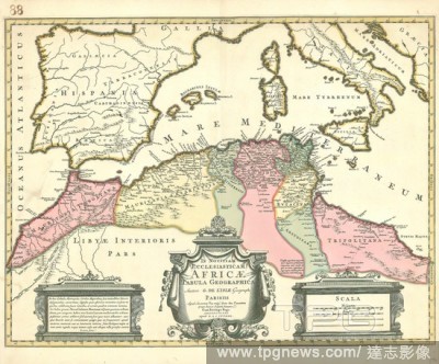
EditorialMap, Imperium Turcicum; complectens Europae, Asiae et Africae, Arabiae, que regiones ac provincias plurimas:, Guillaume Sanson (-1703), Copperplate print.
EditorialAfricae Tabula XII. Unknown Artist (English, 19th century); after Livio Sanuto (Italian, 1520-1576). Date: 1889. Dimensions: 255 ? 322 mm. Engraving in black on cream laid paper. Origin: England.
EditorialTerrestial globe on a stand. [A Celestial Globe, 18 inches in diameter, with dedicatory title as follows:] Britanniarum Regi Augustissimo Georgio Tertio Astronomorum Patrono Munificentissimo, Celeberrimo, Globum hunc Caelestem, novam et emendatiorem ca...
EditorialA 17th century map of Africa. Africae Descriptio Nova. Will. Trevethen sculp. London : Henry Seile, 1652. 425 x 338 mm., fol. Source: 10003.f.5, befre page 1, book 4.
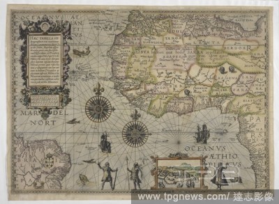
EditorialA 16th century map of Africa. Haec Tabella Hydrographice oras maritimas Africae a promontorio dicto Capo de Cantin, Angolam usque ob oculos ponit ... Johannes a Doetechum fecit. [Amsterdam] : [Cornelis Claesz], [ca. 1595]. Attributed to Petrus Planciu...
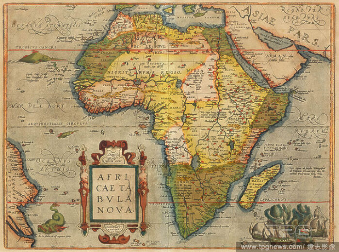
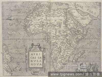
EditorialAfricae tabvla nova. 16th century map of Africa, by Ortelius. Theatrvm Orbis Terrarvm. Anvers : De l'Imprimerie de Christofle Plantin, pour Abraham Ortel, autheur mesme de ce liure, 1587. Source: Maps.C.2.d.2 before page 5.
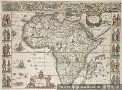
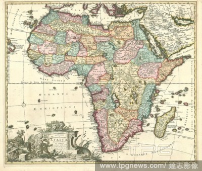
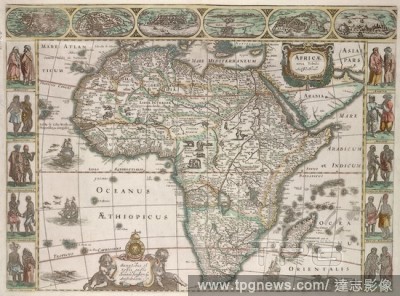
EditorialA map of Africa, with maps of principal cities in the upper border. Africae nova Tabula, auctore Jud. Hondio, apud Janssonium. 1632. Source: Maps K.Top.117.3.
EditorialCelestial globe, on a stand. [A Celestial Globe, 18 inches in diameter, with dedicatory title as follows:] Britanniarum Regi Augustissimo Georgio Tertio Astronomorum Patrono Munificentissimo, Celeberrimo, Globum hunc Caelestem, novam et emendatiorem ca...


 Loading