EditorialAn illustration of Richard III and the Ghosts. The Complete Works of Shakespeare. Edited by W. C. Bryant, assisted by E. A. Duyckinck, containing ... photogravure illustrations from original designs by F. O. C. Darley and A. Chappel, etc. New York : Am...
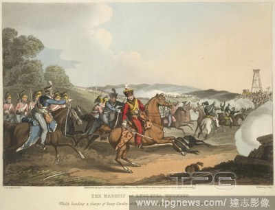
EditorialThe Marquis of Anglesey. Historic, military, and naval anecdotes of ... par. London, 1819. The Marquis of Anglesey wounded, whilst heading a charge of heavy cavalry at the Battle of Waterloo, during the Napoleonic wars. Image taken from Historic, mili...
EditorialTaking a French eagle. Historic, military, and naval anecdotes of ... par. London, 1819. The taking a French eagle of the 8th infantry of the line, at Barrosa, by a sergeant Masterman, of the 87th, or Prince of Wales's own Irish, during the Napoleonic ...
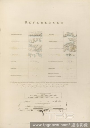
EditorialTopographical features. [A Chart of Nantucket Island... 1776. Various topographical features. Image taken from: [A Chart of Nantucket Island and part of Martha's Vineyard]. Published in 1776 . Source: Maps.184.m.3.(37). Language: English.
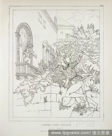
EditorialRomeo and Juliet. Skizzen zu Shakspeare's dramatischen Werken. Gezei. Cassel und Leipzig, [1838-40?]. Romeo and Juliet: outline engraving after L.S. Ruhl. Image taken from Skizzen zu Shakspeare's dramatischen Werken. Gezeichnet, gestochen und radirt v...
EditorialBoston. [A Chart of Nantucket Island... 1776. Various views of Boston including the Bay and the Harbour. Image taken from: [A Chart of Nantucket Island and part of Martha's Vineyard]. Published in 1776 . Source: Maps.184.m.3.(37), page 26. Language: E...
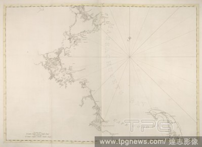
EditorialMassachussetts Bay. [A Chart of Nantucket Island... 1776. A map of Massachussetts Bay and Cape Cod Bay. Image taken from: [A Chart of Nantucket Island and part of Martha's Vineyard]. Published in 1776 . Source: Maps.184.m.3.(37), page 35. Language: En...
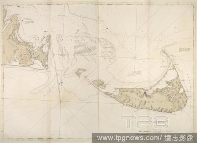
EditorialNantucket Island. [A Chart of Nantucket Island... 1776. A map of Nantucket Island and part of Martha's Vineyard. Image taken from: [A Chart of Nantucket Island and part of Martha's Vineyard]. Published in 1776 . Source: Maps.184.m.3.(37), page 37. Lan...
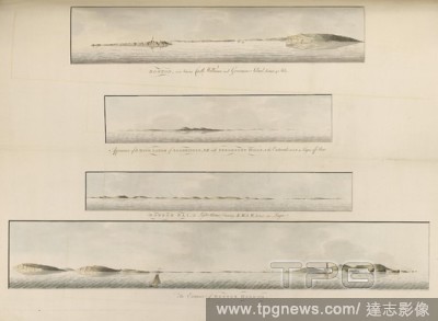
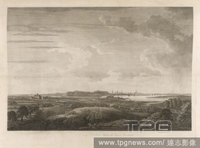
EditorialBoston. [A Chart of Nantucket Island... 1776. A view of Boston taken on the road to Dorchester. Image taken from: [A Chart of Nantucket Island and part of Martha's Vineyard]. Published in 1776 . Source: Maps.184.m.3.(37), page 24. Language: English.


 Loading