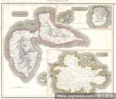
Editorial1815, Thomson Map of Guadaloupe, Antigua, Marie Galante, West Indies , John Thomson, 1777 - 1840, was a Scottish cartographer from Edinburgh, UK.
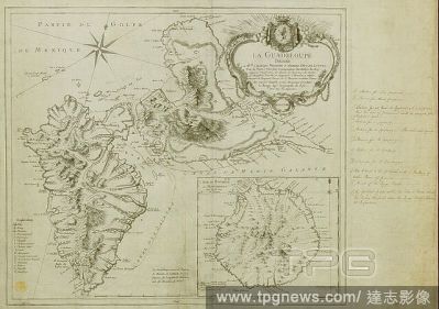
EditorialA map of Guadeloupe created in the context of the Seven Year's War, its West Indies Campaign, and the invasion of Guadeloupe in 1759. Includes an inset of Marie Galante Island. LE GUADELOUPE. Paris : [Georges-Louis Le Rouge], Rue des Augustins, 1753. S...
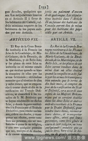
EditorialPreliminary articles of the Treaty concluded at Fontainebleau on 3 November 1762 between the kingdoms of France and Spain. France ceded to Spain the historic North American territory of Louisiana, one of the administrative divisions of New France (the ...
EditorialPreliminary articles of the Treaty concluded at Fontainebleau on 3 November 1762 between the kingdoms of France and Spain. France ceded to Spain the historic North American territory of Louisiana, one of the administrative divisions of New France (the ...
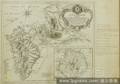
Editorial1815, Thomson Map of Guadaloupe, Antigua, Marie Galante, West Indies , John Thomson, 1777 - 1840, was a Scottish cartographer from Edinburgh, UK.
EditorialA map of Guadeloupe created in the context of the Seven Year's War, its West Indies Campaign, and the invasion of Guadeloupe in 1759. Includes an inset of Marie Galante Island. LE GUADELOUPE. Paris : [Georges-Louis Le Rouge], Rue des Augustins, 1753. S...
Editorial1815, Thomson Map of Guadaloupe, Antigua, Marie Galante, West Indies , John Thomson, 1777 - 1840, was a Scottish cartographer from Edinburgh, UK.


 Loading