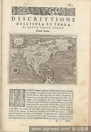
EditorialNew World, Map of North America, Fig. 37, p. 161, Porro, Girolamo (ill.), 1575, Thomaso Porcacchi, Girolamo Porro: L' isole piu famose del mondo. Il secondo libro. In Venetia: apresso gli Heredi di Simon Galignani, 1590.
EditorialWorld map. Miscellaneous Writings. England [St Alban's Abbey and Wymondham]; between. [Whole folio] Circular world map, with Jerusalem in the centre. Signature of Sir Robert Cotton Image taken from Miscellaneous Writings. Originally published/produce...
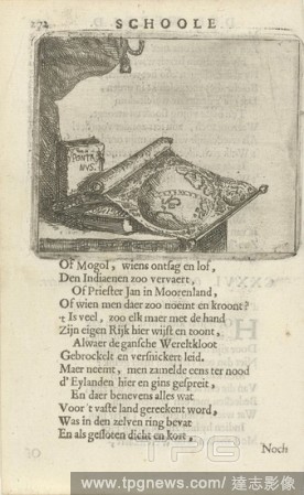
EditorialWorld map and books CXXVI. On seeing a World Map (title on object), A table with a world map and some books. Pent from a book in which 36 prints with phrases. Print used in: F. van Hoogstraten, The school of the world, 1682, map of the world, Arnold Ho...
EditorialNew World, Map of North America, Fig. 37, p. 161, Porro, Girolamo (ill.), 1575, Thomaso Porcacchi, Girolamo Porro: L' isole piu famose del mondo. Il secondo libro. In Venetia: apresso gli Heredi di Simon Galignani, 1590.
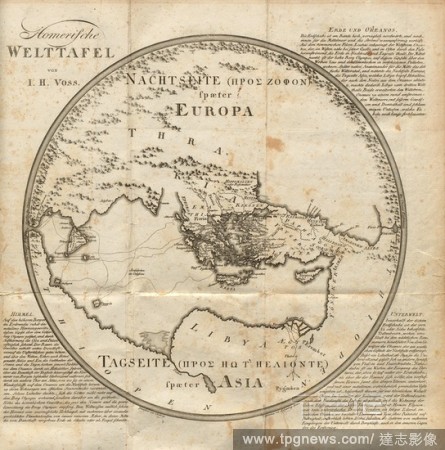
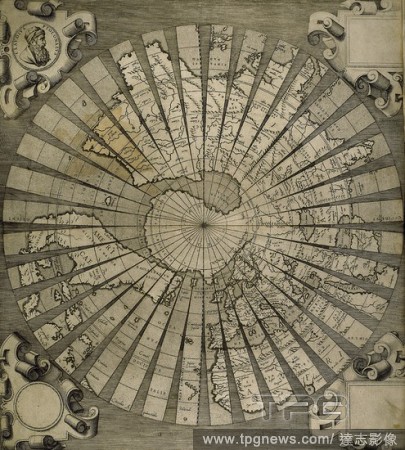
EditorialHomeric world table, World Map after Homer in Volume 2, Signed: Drawn by Hellwag., Engraved by F. Ramberg., Berlin, Fig. 1, Hellwag (del.); Ramberg, F. (sculp.), 1802, Johann Heinrich Voss: Homers Werke. K?nigsberg: Bei Friedrich Nicolovius, 1802.
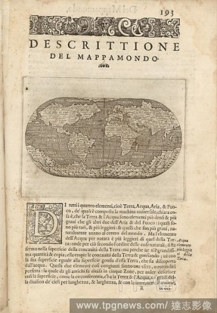
EditorialDescriptive of the World Map, World map, Fig. 45, p. 193, Porro, Girolamo (ill.), 1575, Thomaso Porcacchi, Girolamo Porro: L' isole piu famose del mondo. Il secondo libro. In Venetia: apresso gli Heredi di Simon Galignani, 1590.
EditorialCyrestis, Print, Cyrestis is a butterfly genus in the family Nymphalidae. They are known as map butterflies, so named because the wing-markings of some species resemble the lines of latitude and longitude of a world map. Cyrestis is a widespread genus ...
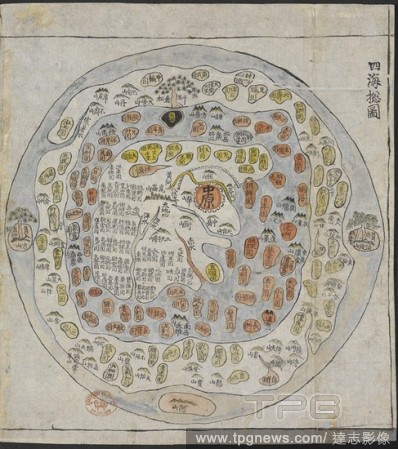
EditorialA Korean World Map. Chonhado/World Atlas. Korea, 19th Century. A Korean World Map, printed and hand-coloured, from an atlas of Korea with preliminary maps of the world, China, Japan and Ryuku islands. Image taken from Chonhado/World Atlas. Originally...
EditorialWorld map. Miscellaneous Writings. England [St Alban's Abbey and Wymondham]; between. [Whole folio] Circular world map, with Jerusalem in the centre. Signature of Sir Robert Cotton Image taken from Miscellaneous Writings. Originally published/produce...
EditorialDrawing of the Hereford World Map in its original frame, with folding doors, and decorated with painted figures. At the top of the map is a Day of Judgement scene. Sketches relating to the Antiquities and Architectecture of England, Vol. XVIII. England...
EditorialThe Tiberius Map. Mappa Mundi; only surviving world map from Anglo-Saxon England. It is divided into the three continents of Europe, Asia and Africa, with the Mediterranean Sea in the centre.The outline and detail of the British Isles are relatively ac...
EditorialWorld map. Tracts on Astronomy, etc. England [Salisbury, co. Wilts.]; late 11th or earl. [Whole folio] A world map in a computus manuscript Image taken from Tracts on Astronomy, etc. Originally published/produced in England [Salisbury, co. Wilts.]; l...
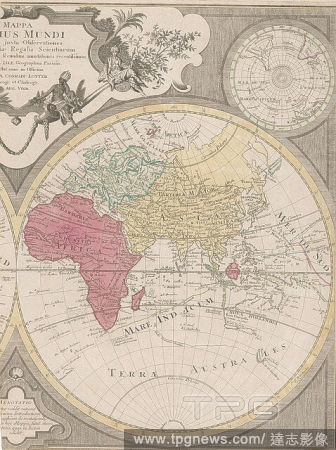
EditorialWorld map. D. Domino Leonardo ab Eck ... P. Apianus ... Mathe. [Ingoldstadt], 1530. World map. Image taken from D. Domino Leonardo ab Eck P. Apianus Mathematicus hanc universaliorem cogniti orbis tabulam ex recentibus observationibus confectam dedicat...
EditorialPortrait of Juan de la Cosa (c.1460-1510), Spanish cartographer, conquistador and explore who made the earliest extant European world map to incorporate the territories of the Americas that were discovered in the 15th century.. Madrid.
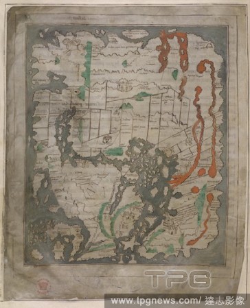
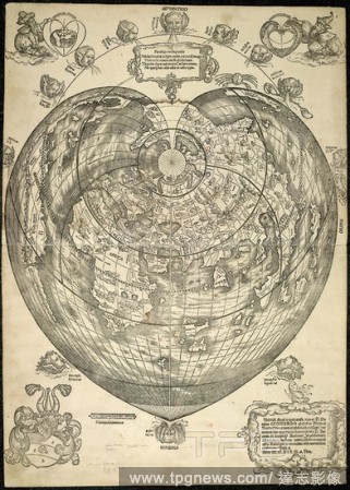
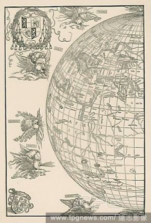
EditorialWorld Map of Johannes Stabius (Mappa mundi). Dated 1515. Woodblock (printed from four blocks), 645 x 850mm. For the right part see 33-02-03/18.
EditorialPortrait of Juan de la Cosa (c.1460-1510), Spanish cartographer, conquistador and explore who made the earliest extant European world map to incorporate the territories of the Americas that were discovered in the 15th century.. Madrid.


 Loading