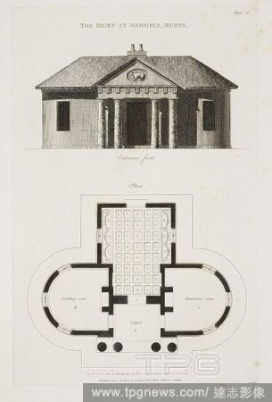
EditorialThe front entrance and floor plan of the dairy at Hammels, Herts. Plans, Elevations, and Sections of Buildings executed in ... Norfolk, Suffolk, Yorkshire, Staffordshire, Warwickshire, Hertfordshire, et caetera. London, 1788. Source: 56.i.8, plate 43. ...
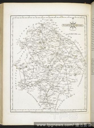
EditorialA map of Warwickshire. Cary's New and Correct English Atlas, being a new Set of County Maps from actual Surveys, etc. [With descriptive texts]. London : John Cary, 1787. Source: Maps C.24.f.1. Language: English.
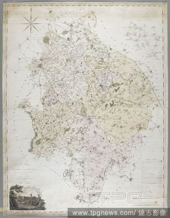
EditorialA Map of Warwickshire, 1787. A Map of Warwickshire, drawn from an actual survey taken in the years 1787, 8, 9 by W. Yates and Sons. Warwick, 1793. Source: Maps K.Top.42.76.11.Tab.


 Loading