EditorialCoverlet, 1840, Sarah Douglas Smith (American, active c. 1840), United States, Illinois, Christian County, Stonington, Illinois, Cotton and wool, plain weave with supplementary patterning wefts (overshot), two loom widths joined, fringed, 249.1 x 167.5...
EditorialMiss Denison of Stonington, Connecticut (possibly Matilda Denison). Dated: c. 1790. Dimensions: overall: 87.7 x 68.7 cm (34 1/2 x 27 1/16 in.) framed: 102.9 x 84.1 x 4.3 cm (40 1/2 x 33 1/8 x 1 11/16 in.). Medium: oil on canvas.
EditorialMiss Denison of Stonington, Connecticut (possibly Matilda Denison). Dated: c. 1790. Dimensions: overall: 87.7 x 68.7 cm (34 1/2 x 27 1/16 in.) framed: 102.9 x 84.1 x 4.3 cm (40 1/2 x 33 1/8 x 1 11/16 in.). Medium: oil on canvas.
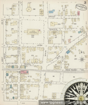
EditorialImage 3 of Sanborn Fire Insurance Map from Stonington, New London County, Connecticut. Jan 1886. 4 Sheet(s), America, street map with a Nineteenth Century compass.
EditorialImage 1 of Sanborn Fire Insurance Map from Stonington, New London County, Connecticut. Aug 1895. 5 Sheet(s), America, street map with a Nineteenth Century compass.
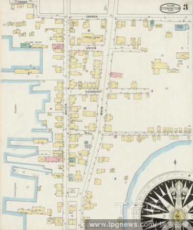
EditorialImage 3 of Sanborn Fire Insurance Map from Stonington, New London County, Connecticut. Aug 1895. 5 Sheet(s), America, street map with a Nineteenth Century compass.
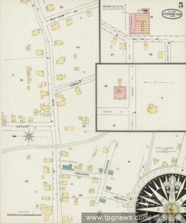
EditorialImage 5 of Sanborn Fire Insurance Map from Stonington, New London County, Connecticut. Aug 1895. 5 Sheet(s), America, street map with a Nineteenth Century compass.
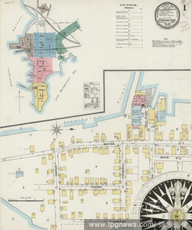
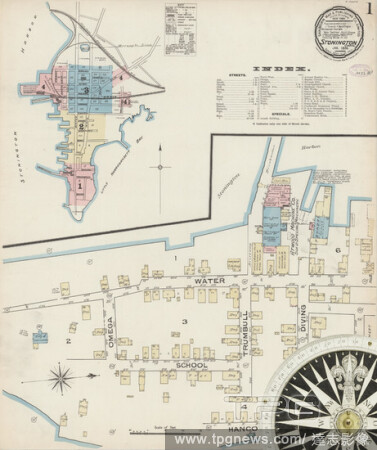
EditorialImage 1 of Sanborn Fire Insurance Map from Stonington, New London County, Connecticut. Jan 1886. 4 Sheet(s), America, street map with a Nineteenth Century compass.
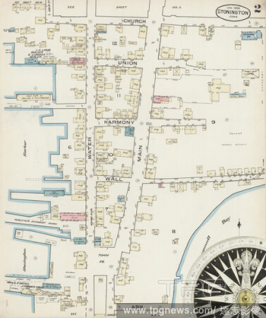
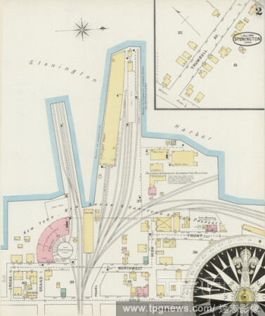
EditorialImage 2 of Sanborn Fire Insurance Map from Stonington, New London County, Connecticut. Jan 1886. 4 Sheet(s), America, street map with a Nineteenth Century compass.
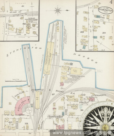
EditorialImage 4 of Sanborn Fire Insurance Map from Stonington, New London County, Connecticut. Jan 1886. 4 Sheet(s), America, street map with a Nineteenth Century compass.
EditorialImage 2 of Sanborn Fire Insurance Map from Stonington, New London County, Connecticut. Aug 1895. 5 Sheet(s), America, street map with a Nineteenth Century compass.
EditorialImage 4 of Sanborn Fire Insurance Map from Stonington, New London County, Connecticut. Aug 1895. 5 Sheet(s), America, street map with a Nineteenth Century compass.
EditorialCoverlet, 1840, Sarah Douglas Smith (American, active c. 1840), United States, Illinois, Christian County, Stonington, Illinois, Cotton and wool, plain weave with supplementary patterning wefts (overshot), two loom widths joined, fringed, 249.1 x 167.5...
EditorialMiss Denison of Stonington, Connecticut (possibly Matilda Denison). Dated: c. 1790. Dimensions: overall: 87.7 x 68.7 cm (34 1/2 x 27 1/16 in.) framed: 102.9 x 84.1 x 4.3 cm (40 1/2 x 33 1/8 x 1 11/16 in.). Medium: oil on canvas.


 Loading