
filter
-
Brand
- By Category
- Direction
- Date Range
50Events
Pictures
Events

Editorial Chris Crawley, the maintenance manager of Pawtucket, R.I., at McCoy Stadium on Tuesday, May 11, 2021. (Rachel Hulin/The New York Times)
- 2021-05-13
- 1

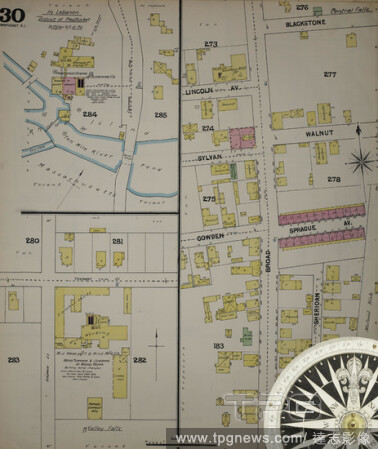
Editorial Image 38 of Sanborn Fire Insurance Map from Pawtucket, Providence County, Rhode Island. 1890. 38 Sheet(s). Includes Central Falls. Bound, America, street map with a Nineteenth Century compass.
- 2021-02-20
- 1

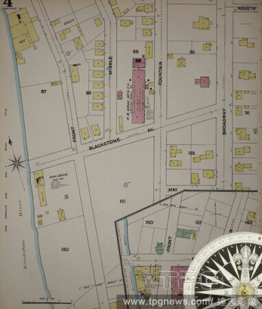
Editorial Image 4 of Sanborn Fire Insurance Map from Pawtucket, Providence County, Rhode Island. Nov 1884. 16 Sheet(s), America, street map with a Nineteenth Century compass.
- 2021-02-20
- 1
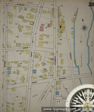
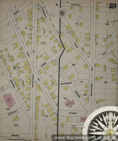
Editorial Image 21 of Sanborn Fire Insurance Map from Pawtucket, Providence County, Rhode Island. 1890. 38 Sheet(s). Includes Central Falls. Bound, America, street map with a Nineteenth Century compass.
- 2021-02-20
- 1
Editorial Image 6 of Sanborn Fire Insurance Map from Pawtucket, Providence County, Rhode Island. 1890. 38 Sheet(s). Includes Central Falls. Bound, America, street map with a Nineteenth Century compass.
- 2021-02-20
- 1
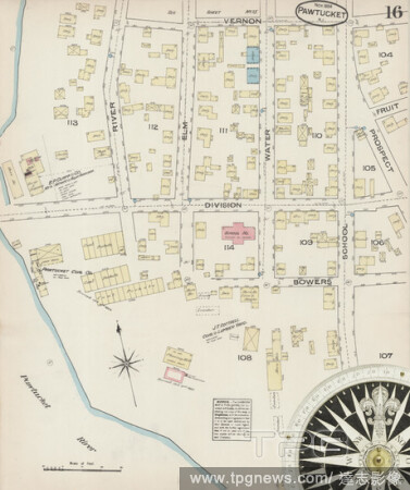
Editorial Image 16 of Sanborn Fire Insurance Map from Pawtucket, Providence County, Rhode Island. Nov 1884. 16 Sheet(s), America, street map with a Nineteenth Century compass.
- 2021-02-20
- 1

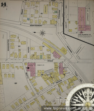
Editorial Image 14 of Sanborn Fire Insurance Map from Pawtucket, Providence County, Rhode Island. Nov 1884. 16 Sheet(s), America, street map with a Nineteenth Century compass.
- 2021-02-20
- 1
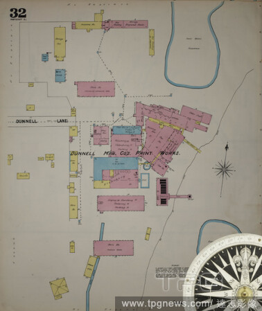
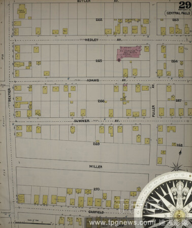
Editorial Image 32 of Sanborn Fire Insurance Map from Pawtucket, Providence County, Rhode Island. 1890. 38 Sheet(s). Includes Central Falls. Bound, America, street map with a Nineteenth Century compass.
- 2021-02-20
- 2
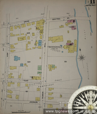
Editorial Image 11 of Sanborn Fire Insurance Map from Pawtucket, Providence County, Rhode Island. 1890. 38 Sheet(s). Includes Central Falls. Bound, America, street map with a Nineteenth Century compass.
- 2021-02-20
- 2

Editorial Image 2 of Sanborn Fire Insurance Map from Pawtucket, Providence County, Rhode Island. 1890. 38 Sheet(s). Includes Central Falls. Bound, America, street map with a Nineteenth Century compass.
- 2021-02-20
- 1

Editorial Image 3 of Sanborn Fire Insurance Map from Pawtucket, Providence County, Rhode Island. Nov 1884. 16 Sheet(s), America, street map with a Nineteenth Century compass.
- 2021-02-20
- 1

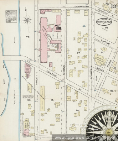
Editorial Image 13 of Sanborn Fire Insurance Map from Pawtucket, Providence County, Rhode Island. 1890. 38 Sheet(s). Includes Central Falls. Bound, America, street map with a Nineteenth Century compass.
- 2021-02-20
- 1
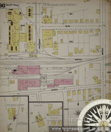
Editorial Image 36 of Sanborn Fire Insurance Map from Pawtucket, Providence County, Rhode Island. 1890. 38 Sheet(s). Includes Central Falls. Bound, America, street map with a Nineteenth Century compass.
- 2021-02-20
- 1

Editorial Image 31 of Sanborn Fire Insurance Map from Pawtucket, Providence County, Rhode Island. 1890. 38 Sheet(s). Includes Central Falls. Bound, America, street map with a Nineteenth Century compass.
- 2021-02-20
- 1
Editorial Image 13 of Sanborn Fire Insurance Map from Pawtucket, Providence County, Rhode Island. Nov 1884. 16 Sheet(s), America, street map with a Nineteenth Century compass.
- 2021-02-20
- 1
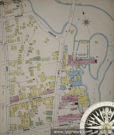
Editorial Image 8 of Sanborn Fire Insurance Map from Pawtucket, Providence County, Rhode Island. 1890. 38 Sheet(s). Includes Central Falls. Bound, America, street map with a Nineteenth Century compass.
- 2021-02-19
- 2

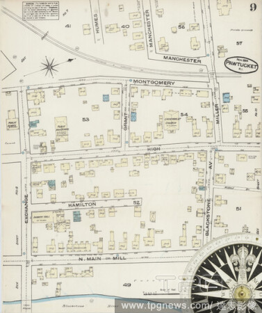
Editorial Image 7 of Sanborn Fire Insurance Map from Pawtucket, Providence County, Rhode Island. 1890. 38 Sheet(s). Includes Central Falls. Bound, America, street map with a Nineteenth Century compass.
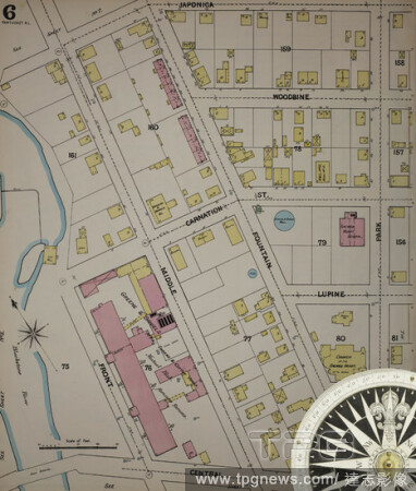
- 2021-02-19
- 6

Editorial Image 16 of Sanborn Fire Insurance Map from Pawtucket, Providence County, Rhode Island. 1890. 38 Sheet(s). Includes Central Falls. Bound, America, street map with a Nineteenth Century compass.
- 2021-02-19
- 2

Editorial Image 20 of Sanborn Fire Insurance Map from Pawtucket, Providence County, Rhode Island. 1890. 38 Sheet(s). Includes Central Falls. Bound, America, street map with a Nineteenth Century compass.
- 2021-02-19
- 2
Editorial Image 30 of Sanborn Fire Insurance Map from Pawtucket, Providence County, Rhode Island. 1890. 38 Sheet(s). Includes Central Falls. Bound, America, street map with a Nineteenth Century compass.
- 2021-02-19
- 2
Editorial Image 14 of Sanborn Fire Insurance Map from Pawtucket, Providence County, Rhode Island. 1890. 38 Sheet(s). Includes Central Falls. Bound, America, street map with a Nineteenth Century compass.
- 2021-02-19
- 6
Editorial Image 29 of Sanborn Fire Insurance Map from Pawtucket, Providence County, Rhode Island. 1890. 38 Sheet(s). Includes Central Falls. Bound, America, street map with a Nineteenth Century compass.
- 2021-02-19
- 2

Editorial Image 19 of Sanborn Fire Insurance Map from Pawtucket, Providence County, Rhode Island. 1890. 38 Sheet(s). Includes Central Falls. Bound, America, street map with a Nineteenth Century compass.
- 2021-02-19
- 2

Editorial Image 8 of Sanborn Fire Insurance Map from Pawtucket, Providence County, Rhode Island. Nov 1884. 16 Sheet(s), America, street map with a Nineteenth Century compass.
- 2021-02-19
- 2
Editorial Image 4 of Sanborn Fire Insurance Map from Pawtucket, Providence County, Rhode Island. 1890. 38 Sheet(s). Includes Central Falls. Bound, America, street map with a Nineteenth Century compass.
- 2021-02-19
- 2

Editorial Image 34 of Sanborn Fire Insurance Map from Pawtucket, Providence County, Rhode Island. 1890. 38 Sheet(s). Includes Central Falls. Bound, America, street map with a Nineteenth Century compass.
- 2021-02-19
- 2
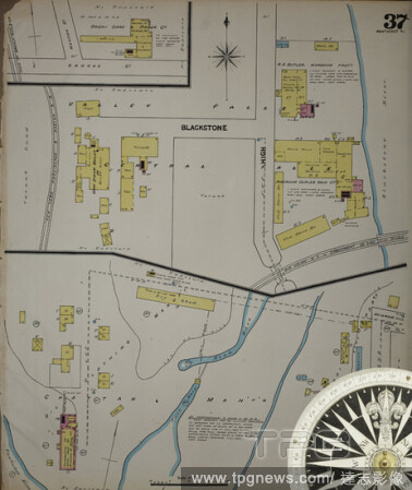
Editorial Image 37 of Sanborn Fire Insurance Map from Pawtucket, Providence County, Rhode Island. 1890. 38 Sheet(s). Includes Central Falls. Bound, America, street map with a Nineteenth Century compass.
- 2021-02-19
- 2

Editorial Image 6 of Sanborn Fire Insurance Map from Pawtucket, Providence County, Rhode Island. Nov 1884. 16 Sheet(s), America, street map with a Nineteenth Century compass.
- 2021-02-19
- 2

Editorial Image 12 of Sanborn Fire Insurance Map from Pawtucket, Providence County, Rhode Island. Nov 1884. 16 Sheet(s), America, street map with a Nineteenth Century compass.
- 2021-02-19
- 2

Editorial Image 28 of Sanborn Fire Insurance Map from Pawtucket, Providence County, Rhode Island. 1890. 38 Sheet(s). Includes Central Falls. Bound, America, street map with a Nineteenth Century compass.
- 2021-02-19
- 4
Editorial Image 10 of Sanborn Fire Insurance Map from Pawtucket, Providence County, Rhode Island. Nov 1884. 16 Sheet(s), America, street map with a Nineteenth Century compass.
- 2021-02-19
- 2
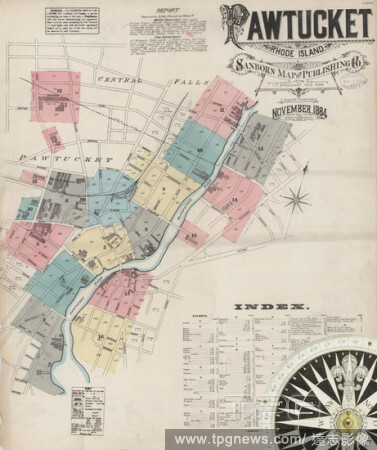
Editorial Image 1 of Sanborn Fire Insurance Map from Pawtucket, Providence County, Rhode Island. Nov 1884. 16 Sheet(s), America, street map with a Nineteenth Century compass.
- 2021-02-19
- 4

Editorial Image 11 of Sanborn Fire Insurance Map from Pawtucket, Providence County, Rhode Island. Nov 1884. 16 Sheet(s), America, street map with a Nineteenth Century compass.
- 2021-02-19
- 2
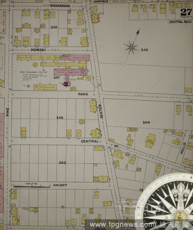
Editorial Image 27 of Sanborn Fire Insurance Map from Pawtucket, Providence County, Rhode Island. 1890. 38 Sheet(s). Includes Central Falls. Bound, America, street map with a Nineteenth Century compass.
- 2021-02-19
- 2

Editorial Image 15 of Sanborn Fire Insurance Map from Pawtucket, Providence County, Rhode Island. 1890. 38 Sheet(s). Includes Central Falls. Bound, America, street map with a Nineteenth Century compass.
- 2021-02-19
- 2

Editorial Image 12 of Sanborn Fire Insurance Map from Pawtucket, Providence County, Rhode Island. 1890. 38 Sheet(s). Includes Central Falls. Bound, America, street map with a Nineteenth Century compass.
- 2021-02-19
- 2

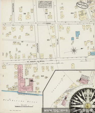
Editorial Image 10 of Sanborn Fire Insurance Map from Pawtucket, Providence County, Rhode Island. 1890. 38 Sheet(s). Includes Central Falls. Bound, America, street map with a Nineteenth Century compass.
- 2021-02-19
- 4

Editorial Image 5 of Sanborn Fire Insurance Map from Pawtucket, Providence County, Rhode Island. 1890. 38 Sheet(s). Includes Central Falls. Bound, America, street map with a Nineteenth Century compass.
- 2021-02-19
- 2
Editorial Image 23 of Sanborn Fire Insurance Map from Pawtucket, Providence County, Rhode Island. 1890. 38 Sheet(s). Includes Central Falls. Bound, America, street map with a Nineteenth Century compass.
- 2021-02-19
- 1
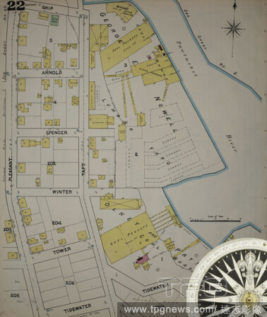
Editorial Image 22 of Sanborn Fire Insurance Map from Pawtucket, Providence County, Rhode Island. 1890. 38 Sheet(s). Includes Central Falls. Bound, America, street map with a Nineteenth Century compass.
- 2021-02-19
- 1
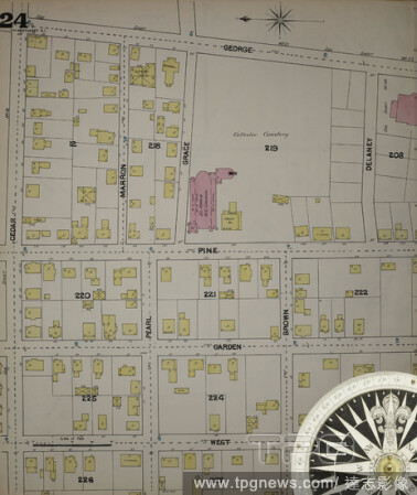
Editorial Image 24 of Sanborn Fire Insurance Map from Pawtucket, Providence County, Rhode Island. 1890. 38 Sheet(s). Includes Central Falls. Bound, America, street map with a Nineteenth Century compass.
- 2021-02-19
- 1

Editorial Image 33 of Sanborn Fire Insurance Map from Pawtucket, Providence County, Rhode Island. 1890. 38 Sheet(s). Includes Central Falls. Bound, America, street map with a Nineteenth Century compass.
- 2021-02-19
- 1

Editorial Image 5 of Sanborn Fire Insurance Map from Pawtucket, Providence County, Rhode Island. Nov 1884. 16 Sheet(s), America, street map with a Nineteenth Century compass.
- 2021-02-19
- 1

Editorial Image 17 of Sanborn Fire Insurance Map from Pawtucket, Providence County, Rhode Island. 1890. 38 Sheet(s). Includes Central Falls. Bound, America, street map with a Nineteenth Century compass.
- 2021-02-19
- 1

Editorial Image 1 of Sanborn Fire Insurance Map from Pawtucket, Providence County, Rhode Island. 1890. 38 Sheet(s). Includes Central Falls. Bound, America, street map with a Nineteenth Century compass.
- 2021-02-19
- 1
Editorial Image 9 of Sanborn Fire Insurance Map from Pawtucket, Providence County, Rhode Island. Nov 1884. 16 Sheet(s), America, street map with a Nineteenth Century compass.
- 2021-02-19
- 1

Editorial Empty seats at McCoy Stadium, the home of the Pawtucket Red Sox for 50 years, on Father's Day, June 21, 2020, in Pawtucket, R.I. (Cody O'Loughlin/The New York Times)
- 2020-07-04
- 1

Editorial Suzanne Arena, who’s 16-year-old daughter attends Saint Raphael Academy, in her home in Pawtucket, Rhode Island, on March 5, 2020. (Ryan David Brown/The New York Times)
- 2020-03-09
- 1
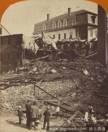
Editorial Fire at the Dexter Yarn Co., Balling Room Bldg on East Ave., Pawtucket, R.I., June '83...Looking from the rear., H.E. Thygeson (American, active Pawtucket, Rhode Island 1880s), June 1883, Albumen silver print.
- 2019-11-19
- 1

Editorial *EXCLUSIVE* Charlie Hunnam shows a glimpse of his underwear on the set of 'Jungleland'
- 2018-10-03
- 13
 Loading