
filter
-
Brand
- By Category
- Direction
- Date Range
66Events
Pictures
Events
Editorial
- 2023-11-01
- 1
Editorial
- 2023-11-01
- 1
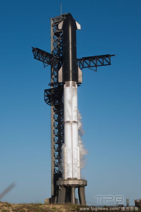
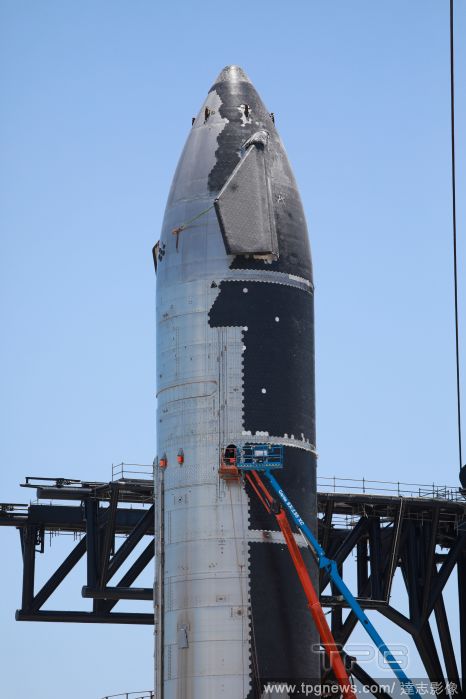
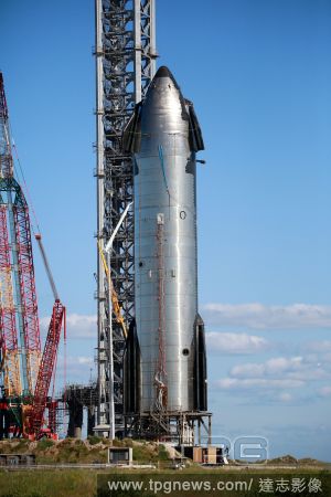
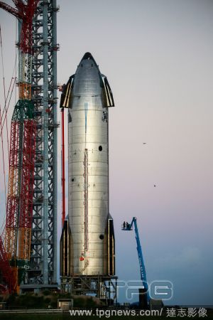
Editorial SpaceX Prepares Launch Mount Ahead Of Second Integrated Starship Launch, Brownsville, Texas, United States - 17 Jul 2023
- 2023-07-19
- 1
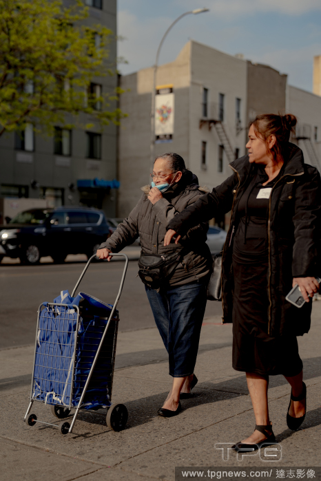
Editorial Minerva Vitale, left, who said she trusts the Brownsville Safety Alliance to respond to crime on the streets, in the Brownsville neighborhood of Brooklyn, April 27, 2023. (Amir Hamja/The New York Times)
- 2023-06-05
- 2

Editorial Minerva Vitale, left, who said she trusts the Brownsville Safety Alliance to respond to crime on the streets, in the Brownsville neighborhood of Brooklyn, April 27, 2023. (Amir Hamja/The New York Times)
- 2023-05-13
- 1

Editorial Minerva Vitale, left, who said she trusts the Brownsville Safety Alliance to respond to crime on the streets, in the Brownsville neighborhood of Brooklyn, April 27, 2023. (Amir Hamja/The New York Times)
- 2023-04-27
- 28

Editorial Minerva Vitale, left, who said she trusts the Brownsville Safety Alliance to respond to crime on the streets, in the Brownsville neighborhood of Brooklyn, April 27, 2023. (Amir Hamja/The New York Times)
- 2023-04-21
- 1
Editorial Minerva Vitale, left, who said she trusts the Brownsville Safety Alliance to respond to crime on the streets, in the Brownsville neighborhood of Brooklyn, April 27, 2023. (Amir Hamja/The New York Times)
- 2023-04-20
- 1
Editorial Minerva Vitale, left, who said she trusts the Brownsville Safety Alliance to respond to crime on the streets, in the Brownsville neighborhood of Brooklyn, April 27, 2023. (Amir Hamja/The New York Times)
- 2023-04-20
- 1
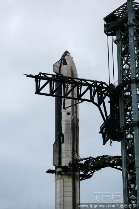
Editorial SpaceX Makes Final Adjustments Ahead Of Booster 7's 33 Engine Static Fire Test, Brownsville, Texas, United States - 08 Feb 2023
- 2023-02-10
- 1
Editorial SpaceX Preps For Booster's 33 Engine Static Fire Test, Brownsville, Texas, United States - 24 Jan 2023
- 2023-01-27
- 4

Editorial SpaceX Prepares For Starship Wet Dress Rehearsal Of Orbital Launch, Brownsville, Texas, United States - 22 Jan 2023
- 2023-01-25
- 4

Editorial Construction Continues At SpaceX In Preparation For Orbital Launch, Brownsville, Texas, United States - 07 Dec 2022
- 2022-12-08
- 1

Editorial SpaceX Starship 24 At Dawn, Brownsville, Texas, United States - 07 Sep 2022
- 2022-09-08
- 1

Editorial SpaceX Continues Working Through Labor Day In Preparation For Static Fire, Brownsville, Texas, United States - 05 Sep 2022
- 2022-09-07
- 5

Editorial SpaceX Super Heavy Booster 7, Brownsville, Texas, United States - 13 Jul 2022
- 2022-07-15
- 2

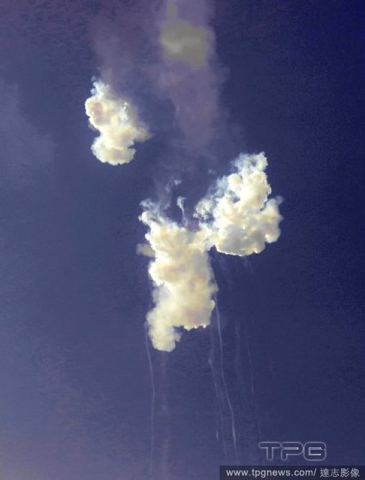
Editorial Damage From Explosion At SpaceX's South Texas Launch Facility, Brownsville, Texas, United States - 12 Jul 2022
- 2022-07-13
- 2
Editorial SpaceX's New Rocket: Starship 24, Brownsville, Texas, United States - 31 May 2022
- 2022-06-02
- 1

Editorial Close-up Look At SpaceX Starship 20, Brownsville, Texas, United States - 28 Mar 2022
- 2022-03-29
- 2

Editorial Details Of SpaceX's New Booster And Thermal Protection System, Brownsville, Texas, United States - 27 Mar 2022
- 2022-03-29
- 2

Editorial SpaceX Starship Plans Thwarted Again By FAA Review Delays, Brownsville, Texas, United States - 26 Mar 2022
- 2022-03-28
- 2
Editorial The Sun Rises Over The World's Largest Rocket: SpaceX Starship/ Super Heavy, Brownsville, Texas, United States - 11 Feb 2022
- 2022-02-12
- 2

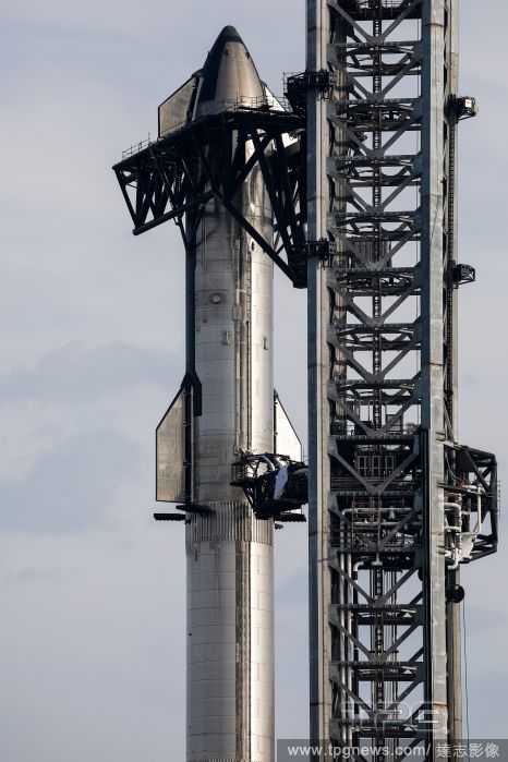
Editorial SpaceX Starship And Its "Super Heavy" Booster Are Fully Stacked, Brownsville, Texas, United States - 10 Feb 2022
- 2022-02-11
- 1
Editorial Daily Life At SpaceX Boca Chica, Brownsville, Texas, United States - 28 Jan 2022
- 2022-01-29
- 4

Editorial SpaceX Moves Starship 20 Near Orbital Launch Table, Brownsville, Texas, United States - 27 Jan 2022
- 2022-01-28
- 3
Editorial SpaceX Starship Continues Testing, Brownsville, Texas, United States - 30 Dec 2021
- 2021-12-31
- 5
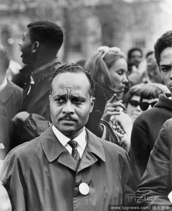
Editorial The Rev. C. Herbert Oliver at a demonstration at City Hall in New York involving the experimental school board, of which he was chairman, that was created in 1967 to give more local control over education to the mainly Black families of the Ocean Hill-Brownsville area of Brooklyn in New York. (Jack Manning/The New York Times)
- 2021-12-12
- 1

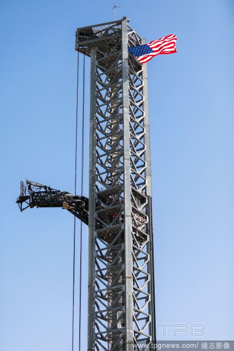
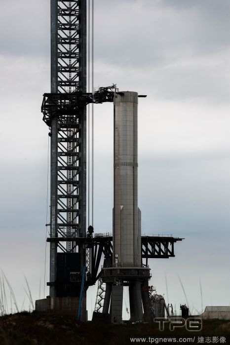
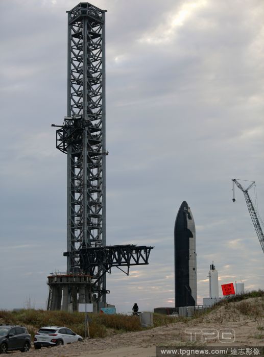
Editorial SpaceX Puts Finishing Touches On Starship Launch Tower, Brownsville, Texas, United States - 19 Oct 2021
- 2021-10-20
- 3
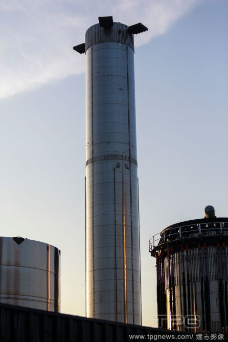
Editorial SpaceX Starship 20 Testing Amid Environmental Review, Brownsville, Texas, United States - 18 Oct 2021
- 2021-10-20
- 6

Editorial U.S. Mexico Port of Entry, Matamoros - 10 Jan 2019
- 2021-09-08
- 1
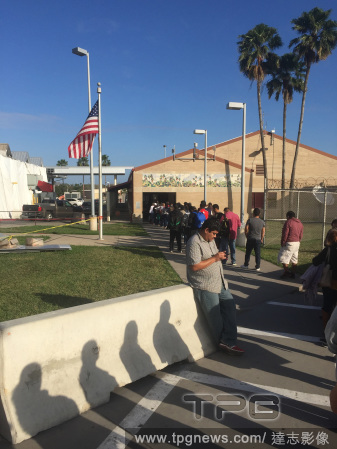
Editorial Pedestrians queue for U.S. Immigration at Brownsville, Texas, Matamoros, Mexico - 10 Jan 2019
- 2021-09-07
- 1
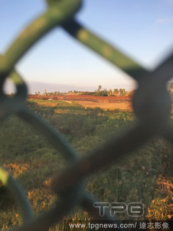
Editorial Fence along border with Mexico, Matamoros - 10 Jan 2019
- 2021-09-06
- 1

Editorial Starship SN20 Ahead Of First Orbital Launch, Brownsville, United States - 24 Aug 2021
- 2021-08-27
- 2
Editorial SpaceX Starship Prepares For First Orbital Launch, Brownsville, United States - 23 Aug 2021
- 2021-08-26
- 1

Editorial From left, Lizzi and Stephanie Reid while skateboarding at Betsy Head Park in the Brownsville neighborhood of Brooklyn, March 21, 2021. (Lanna Apisukh/The New York Times)
- 2021-08-16
- 1

Editorial SpaceX: Booster 3 And Starbase Construction, Brownsville, Texas, United States - 13 Jul 2021
- 2021-07-14
- 2

Editorial 2020 USA Boxing National Championships
- 2021-04-06
- 1

Editorial Brownsville, Cameron, Texas, United States, Opius brownsvillensis Fischer, Animalia, Arthropoda, Insecta, Hymenoptera, Braconidae.
- 2021-02-22
- 1
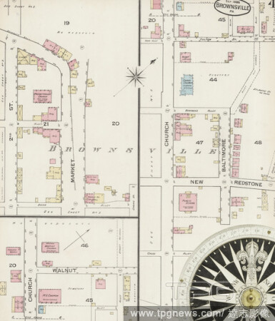
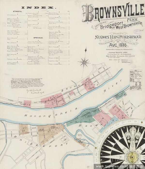
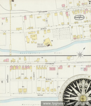
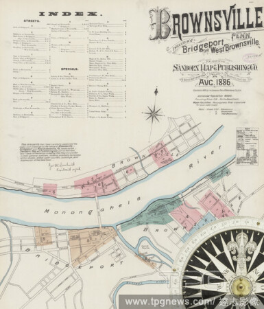
Editorial Image 4 of Sanborn Fire Insurance Map from Brownsville, Fayette County, Pennsylvania. Aug 1886. 6 Sheet(s). Includes Bridgeport, West Brownsville, America, street map with a Nineteenth Century compass.
- 2021-02-20
- 1
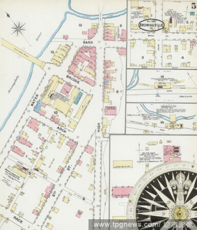
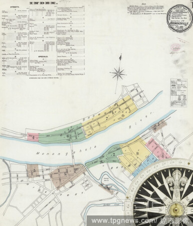
Editorial Image 5 of Sanborn Fire Insurance Map from Brownsville, Fayette County, Pennsylvania. Aug 1886. 6 Sheet(s). Includes Bridgeport, West Brownsville, America, street map with a Nineteenth Century compass.
- 2021-02-20
- 1

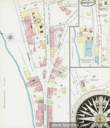
Editorial Image 4 of Sanborn Fire Insurance Map from Brownsville, Fayette County, Pennsylvania. Oct 1891. 6 Sheet(s). Includes Bridgeport, West Brownsville, America, street map with a Nineteenth Century compass.
- 2021-02-20
- 1
Editorial Image 5 of Sanborn Fire Insurance Map from Brownsville, Fayette County, Pennsylvania. Jul 1896. 8 Sheet(s). Includes Bridgeport, West Brownsville, America, street map with a Nineteenth Century compass.
- 2021-02-20
- 1
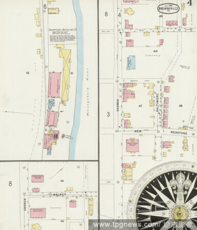
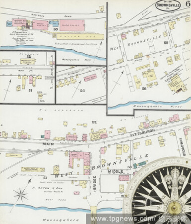
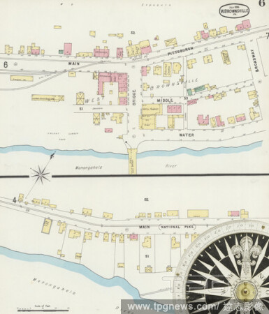
Editorial Image 7 of Sanborn Fire Insurance Map from Brownsville, Fayette County, Pennsylvania. Jul 1896. 8 Sheet(s). Includes Bridgeport, West Brownsville, America, street map with a Nineteenth Century compass.
- 2021-02-20
- 1
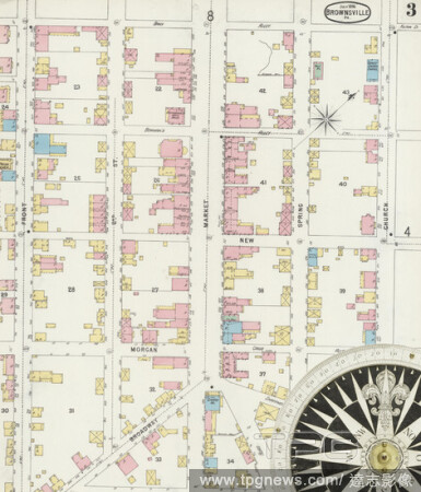
Editorial Image 3 of Sanborn Fire Insurance Map from Brownsville, Fayette County, Pennsylvania. Jul 1896. 8 Sheet(s). Includes Bridgeport, West Brownsville, America, street map with a Nineteenth Century compass.
- 2021-02-20
- 1
Editorial Image 4 of Sanborn Fire Insurance Map from Brownsville, Fayette County, Pennsylvania. Jul 1896. 8 Sheet(s). Includes Bridgeport, West Brownsville, America, street map with a Nineteenth Century compass.
- 2021-02-19
- 2

Editorial Image 8 of Sanborn Fire Insurance Map from Brownsville, Fayette County, Pennsylvania. Jul 1896. 8 Sheet(s). Includes Bridgeport, West Brownsville, America, street map with a Nineteenth Century compass.
- 2021-02-19
- 2

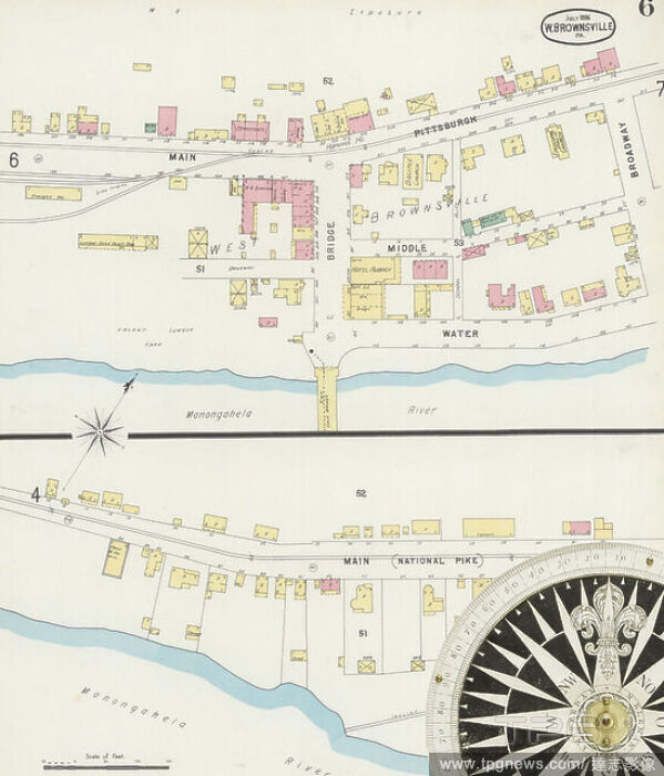
Editorial Image 6 of Sanborn Fire Insurance Map from Brownsville, Fayette County, Pennsylvania. Aug 1886. 6 Sheet(s). Includes Bridgeport, West Brownsville, America, street map with a Nineteenth Century compass.
- 2021-02-19
- 2
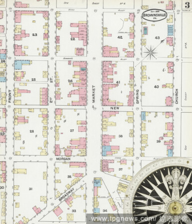
Editorial Image 3 of Sanborn Fire Insurance Map from Brownsville, Fayette County, Pennsylvania. Oct 1891. 6 Sheet(s). Includes Bridgeport, West Brownsville, America, street map with a Nineteenth Century compass.
- 2021-02-19
- 2

Editorial Image 2 of Sanborn Fire Insurance Map from Brownsville, Fayette County, Pennsylvania. Aug 1886. 6 Sheet(s). Includes Bridgeport, West Brownsville, America, street map with a Nineteenth Century compass.
- 2021-02-19
- 2
Editorial Image 5 of Sanborn Fire Insurance Map from Brownsville, Fayette County, Pennsylvania. Oct 1891. 6 Sheet(s). Includes Bridgeport, West Brownsville, America, street map with a Nineteenth Century compass.
- 2021-02-19
- 2
Editorial Image 6 of Sanborn Fire Insurance Map from Brownsville, Fayette County, Pennsylvania. Oct 1891. 6 Sheet(s). Includes Bridgeport, West Brownsville, America, street map with a Nineteenth Century compass.
- 2021-02-19
- 2
Editorial Image 1 of Sanborn Fire Insurance Map from Brownsville, Fayette County, Pennsylvania. Oct 1891. 6 Sheet(s). Includes Bridgeport, West Brownsville, America, street map with a Nineteenth Century compass.
- 2021-02-19
- 2
Editorial Image 2 of Sanborn Fire Insurance Map from Brownsville, Fayette County, Pennsylvania. Oct 1891. 6 Sheet(s). Includes Bridgeport, West Brownsville, America, street map with a Nineteenth Century compass.
- 2021-02-19
- 2

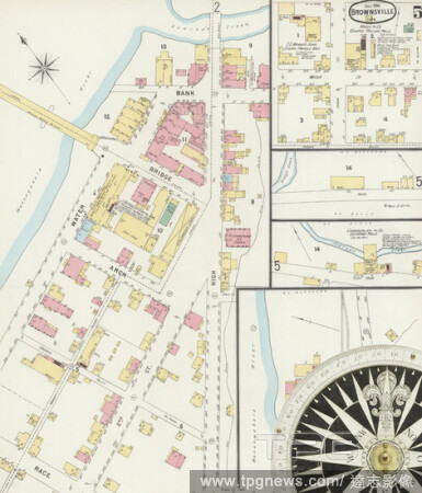
Editorial Image 2 of Sanborn Fire Insurance Map from Brownsville, Fayette County, Pennsylvania. Jul 1896. 8 Sheet(s). Includes Bridgeport, West Brownsville, America, street map with a Nineteenth Century compass.
- 2021-02-19
- 2
Editorial Image 1 of Sanborn Fire Insurance Map from Brownsville, Fayette County, Pennsylvania. Aug 1886. 6 Sheet(s). Includes Bridgeport, West Brownsville, America, street map with a Nineteenth Century compass.
- 2021-02-19
- 2
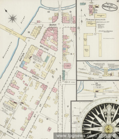
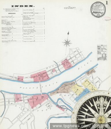
Editorial Image 1 of Sanborn Fire Insurance Map from Brownsville, Fayette County, Pennsylvania. Jul 1896. 8 Sheet(s). Includes Bridgeport, West Brownsville, America, street map with a Nineteenth Century compass.
- 2021-02-19
- 2

Editorial Image 3 of Sanborn Fire Insurance Map from Brownsville, Fayette County, Pennsylvania. Aug 1886. 6 Sheet(s). Includes Bridgeport, West Brownsville, America, street map with a Nineteenth Century compass.
- 2021-02-19
- 2
Editorial Image 6 of Sanborn Fire Insurance Map from Brownsville, Fayette County, Pennsylvania. Jul 1896. 8 Sheet(s). Includes Bridgeport, West Brownsville, America, street map with a Nineteenth Century compass.
- 2021-02-19
- 1
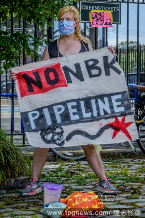
Editorial NYC: Caravan against the North Brooklyn Pipeline
- 2020-06-12
- 3

Editorial Brooklyn principal dies from coronavirus complications
- 2020-03-24
- 1

Editorial Fence along border with Mexico
- 2019-01-17
- 1

Editorial U.S. Mexico Port of Entry
- 2019-01-17
- 2
 Loading