EditorialMap, Galliae seu Franciae tabula, qua omnes provinciae, viae angiariae, et aliae res notatu dignae distinct? et accurat? ostenduntur, Nicolaes Jansz. Visscher (1618-1679), Copperplate print.
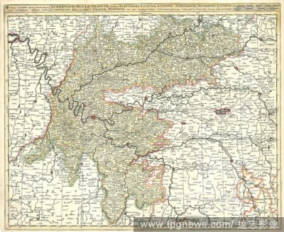
EditorialMap, Gubernatio insulae Franciae, divisa in electiones Lutetiae, Augustae Suessionum, Novioduni, Lauduni, Compendii, Bellovaci, Dresiae, Nemursii etc. cum circumjacentibus gubernationibus, Gerhard Valk (-1726), Copperplate print.
EditorialA map of England and Wales with an alphabetical table of all the cities and market towns in England and Wales. [Angliae totius tabula cum distantijs notioribus in Itinerantium usum accommodata. Johannes Adams ... descripsit. An Alphabetical Table of al...
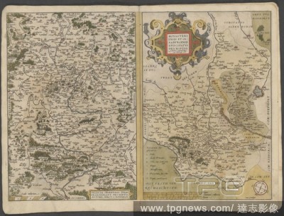
EditorialEastern France and Osnabrück. The Mercator atlas of Europe. 1570-1572. Map of Eastern France. Franciae Orientalis (Vulgo Franckenlant) descriptio [left hand page]. Map of the bishopric of Osnabrück. Monasteriensis et Osnaburgensis Episcopatus descrip...


 Loading