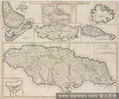
EditorialA map of the English Empire in the Ocean of America, or the West Indies. A new Map of the English Empire in the Ocean of America, or the West Indies (the Islands of Jamaica, Barbadoes, Bermudas, Tobago, St. Christopher's, and Antigua). London : Chr. Br...
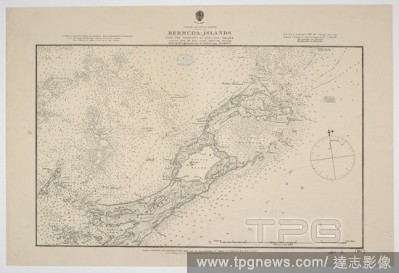
EditorialA chart of the Bermuda Islands. Bermudas Islands from the Narrows to Ireland Island. [Admiralty Chart]. London, 1884. Source: Maps SEC.6.(867.). Language: English.
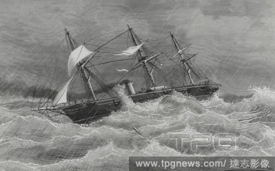
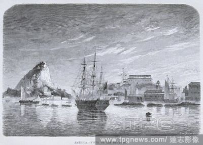
EditorialMarina Espa?ola. Viaje de la fragata de guerra "Navas de Tolosa" a los puertos del Pac?fico. El buque corriendo el hurac?n del 26 de octubre de 1882 en aguas del oc?ano atl?ntico, a la altura de Las Bermudas. Dibujo por Cortellini S?nchez. Grabado. La ...
EditorialMarina Espa?ola. Viaje de la fragata de guerra "Navas de Tolosa" a los puertos del Pac?fico. El buque corriendo el hurac?n del 26 de octubre de 1882 en aguas del oc?ano atl?ntico, a la altura de Las Bermudas. Dibujo por Cortellini S?nchez. Grabado. La ...
EditorialA map of the Bermudas, or Somers' Islands. The Bermudas, or Somers' Islands. London : Imray, Laurie, Norie & Wilson, 1922. Source: Maps 79485.(8.). Language: English.
EditorialA map of the English Empire in the Ocean of America, or the West Indies. A new Map of the English Empire in the Ocean of America, or the West Indies (the Islands of Jamaica, Barbadoes, Bermudas, Tobago, St. Christopher's, and Antigua). London : Chr. Br...
EditorialA chart of the Bermuda Islands. Bermudas Islands from the Narrows to Ireland Island. [Admiralty Chart]. London, 1884. Source: Maps SEC.6.(867.). Language: English.


 Loading