
filter
-
Brand
- By Category
- Direction
- Date Range
159Events
Pictures
Events

Editorial EXCLUSIVE: Photographer discovers abandoned ?time capsule? villa untouched for 100 years
- 2023-10-04
- 14
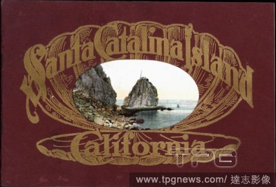
Editorial Booklet - 'Santa Catalina Island, California', California, U.S.A., 1911, 'Santa Catalina Island, California' is a booklet published by Newman Post Card Co. in California, U.S.A. in 1911. It contains colour images of Santa Catalina Island. This is one o...
- 2020-01-15
- 1
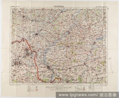
Editorial Maps - Military, Belgium, Tournai, Scale 1:100,000, 1912, Two large folded maps, identical content, titled 'Tournai 5', Belgium, scale 1/100,000. They were printed for the Geographical Staff, General Staff, number 2364, and were 'Photo-etched at the Or...
- 2020-01-15
- 1
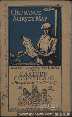
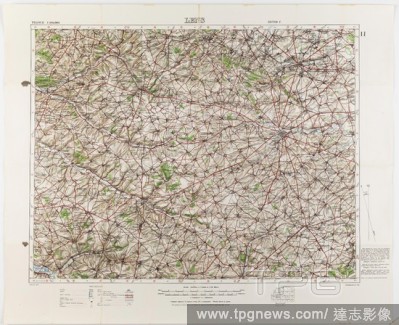
Editorial Map - 'Ordnance Survey Map, Eastern Counties (S)', Southampton, England, 1911, 'Ordnance Survey Map, Eastern Counties (S)' is a map published by the Ordance Survey Office in Southampton, England, of the Eastern Counties of England including Suffolk, Es...
- 2020-01-15
- 1
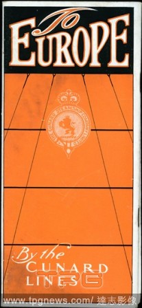
Editorial Booklet - 'To Europe by the Cunard Lines', New York, U.S.A., 1911, 'To Europe by the Cunard Lines', issued by The Cunard Steamship Company Limited in New York, U.S.A. in 1911, provides travel information about the ships travelling different routes from...
- 2020-01-15
- 1
Editorial Booklet - 'Coronation Booklet', RMS Lusitania & RMS Mauretania, Liverpool, England, 1911, 'Coronation Booklet' was issued by The Cunard Steamship Company Limited in Liverpool, England in 1911. It contains information about, and images of, the ships the...
- 2020-01-15
- 1
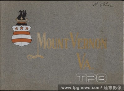
Editorial Booklet - 'Mount Vernon, Va.', An Illustrated Handbook, Virginia, U.S.A., 1910, 'Mount Vernon, Va.' is a booklet issued by the Mount Vernon Ladies' Association in Virginia, U.S.A. in 1910. It provides information and photographs of Mount Vernon, the ho...
- 2020-01-15
- 1
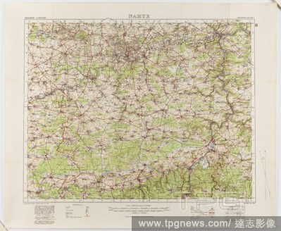
Editorial Map - Military, Belgium, Namur 8, General Staff no. 2364, Scale 1:100,000, World War I, 1910, Military map of Belgium, Namur area (a hand-written inscription identifies it as Namur 8 district), scale 1:100,000, published in 1910. The map is labelled Ge...
- 2020-01-15
- 1
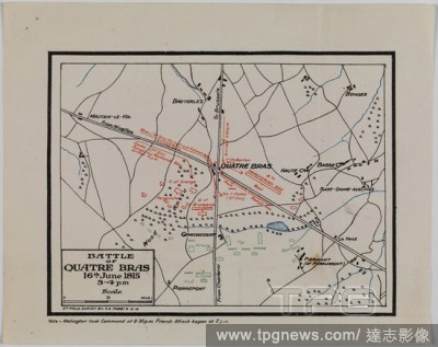
Editorial Map - Battle of Quatre Bras, Waterloo Campaign, 16 Jun 1815, 5th Field Survey, 8 Feb 1919, Map depicting the Battle of Quatre Bras, 16 June 1815. It was fought two days before the Battle of Waterloo. Part of a set of information about the Waterloo Camp...
- 2020-01-15
- 1
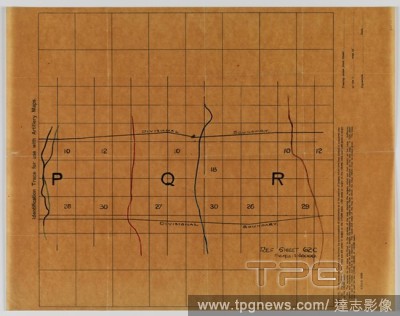
Editorial Identification Trace Map - Military, 'For Use With Artillery Maps', Sheet 62c, Scale 1:40,000, World War I, 1914-1918, Alternative Name(s): Map Overlay Medium light brown map on tracing paper, World War I, titled 'Identification trace for use with arti...
- 2019-11-18
- 1

Editorial Leaflet - 'Hotel Del Monte', California, U.S.A., 1911, 'Hotel Del Monte', issued by Hotel Del Monte in Monterey, California, U.S.A., in 1911, provides travel information about Del Monte and about the hotel itself, claimed to be 'The Most Beautiful Summ...
- 2019-11-18
- 1

Editorial Map Set - Waterloo Campaign, 1815, Dispatched to 4th Australian Division, Mar 1919, Alternative Name(s): Battle of Waterloo Set of information about the Waterloo Campaign, 1815, comprising three maps, two tables and two memos. They were sent from the h...
- 2019-11-18
- 1
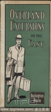
Editorial Leaflet - 'Overland Excursions to the East, Burlington Route', Omaha, Nebraska, U.S.A., 1911, 'Overland Excursions to the East, Burlington Route', a leaflet issued by Burlington Route in Nebraska, U.S.A. in 1911, provides information for east-bound tra...
- 2019-11-18
- 1
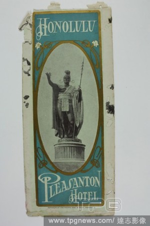
Editorial Leaflet - 'Honolulu, Pleasanton Hotel', Honolulu, Hawaii, U.S.A., 1911, 'Honolulu, Pleasanton Hotel' is a leaflet issued by the Pleasanton Hotel in Honolulu, Hawaii, U.S.A. in 1911. This is one of about eighty travel brochures, maps, railway timetables...
- 2019-11-18
- 1
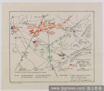
Editorial Map - Position of Armies in Front of Waterloo, 18 Jun 1815, Field Survey 25 Jan 1919, Map depicting the position of armies in front of Waterloo on 18 June 1815. Part of a set of information about the Waterloo Campaign, 1815, comprising three maps, two ...
- 2019-11-18
- 1
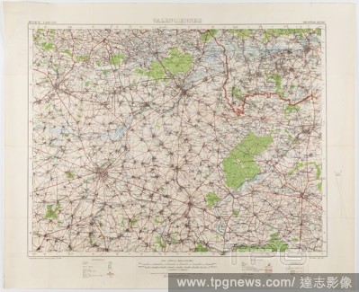
Editorial Map - Military, Belgium, Lens 11, Scale 1:100,000, World War I, 27 Oct 1916, World War I map of Belgium, Lens 11, scale 1:100,000, with corrections dated 27 October 1916. Lens is located in the Belgian province of Hainaut. Maps of this scale lacked the...
- 2019-11-18
- 1

Editorial Leaflet - 'Pebble Beach', Monterey County, California, U.S.A., 1911, 'Pebble Beach' is a leaflet issued by the Pacific Improvement Company in Monterey County, California, U.S.A, in 1911. It provides travel information about Pebble Beach Lodge, as well ...
- 2019-11-18
- 1
Editorial Map - Military, Belgium, Valenciennes 12, Scale 1:100,000, World War I, 1914-1918, Military map of Belgium, Valenciennes 12 region, scale 1:100,000. The map would have been used during World War I. Maps of this scale lacked the detail needed for trench...
- 2019-11-18
- 1
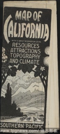
Editorial Map - 'Map of California', California, U.S.A, 1911, 'Map of California' is a fold-out map of California, U.S.A. issued in 1911 by Southern Pacific, a major American railway company. The map also includes information of Califronia's resources, attractio...
- 2019-11-18
- 1
Editorial Map Set - Waterloo Campaign, 1815, Dispatched to 4th Australian Division, Mar 1919, Alternative Name(s): Battle of Waterloo Set of information about the Waterloo Campaign, 1815, comprising three maps, two tables and two memos. They were sent from the h...
- 2019-11-18
- 1
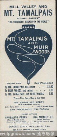
Editorial Leaflet - 'Mill Valley and Mt. Tamalpais Scenic Railway', Mill Valley, California, U.S.A., 1911, 'Mill Valley and Mt. Tamalpais Scenic Railway' is a leaflet issued by Mt. Tamalpais and Muir Woods Railway in Mill Valley, California, U.S.A in 1911. The l...
- 2019-11-18
- 1
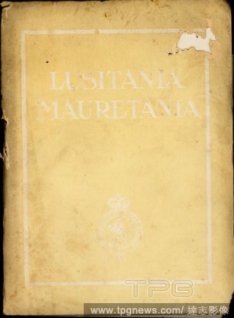
Editorial Booklet - 'Lusitania, Mauretania', Ship Information, New York, USA, 1911, 'Lusitania, Mauretania', a booklet issued by The Cunard Steamship Company Limited in New York, U.S.A in 1911, provides information about, and black and white photographs of, the ...
- 2019-11-18
- 1
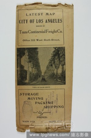
Editorial Map - 'Latest Map, City of Los Angeles', Los Angeles, California, U.S.A., 1911, 'Latest Map, City of Los Angeles', is a fold-out map of Los Angeles issued by the Trans-Continental Freight Company, Los Angeles, U.S.A, in 1911. This is one of about eight...
- 2019-11-18
- 1
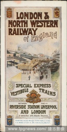
Editorial Booklet - 'London & North Western Railway of England', London, England, 1911, 'London & North Western Railway of England' is a booklet issued by the London and North Western Railway in London, England in 1911. It provides travel information for passeng...
- 2019-11-18
- 1
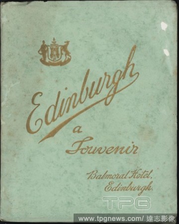
Editorial Booklet - 'Edinburgh, A Souvenir, Balmoral Hotel', Edinburgh, Scotland, 1911, 'Edinburgh, A Souvenir' is a booklet issued by Balmoral Hotel in Edinburgh, Scotland, in 1911. It provides information about the hotel and includes a guide to Edinburgh. This...
- 2019-11-18
- 1
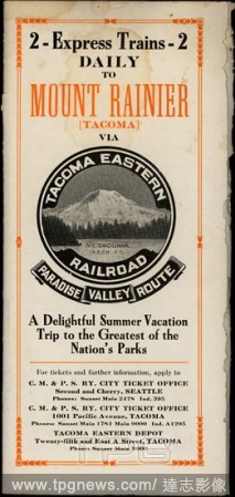
Editorial Booklet - 'Tacoma Eastern Railroad', Tacoma, Washington, U.S.A., 1911, 'Tacoma Eastern Railroad', a booklet issued by Tacoma Eastern Railroad in Washington, U.S.A. in 1911, provides travel information about the journey from Tacoma to The National Park ...
- 2019-11-18
- 1

Editorial Map on the New World - navae insolarum. 1540. Madrid, national library (maps).
- 2019-08-02
- 1
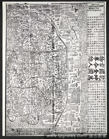
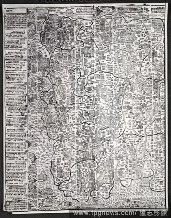
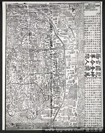
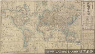
Editorial A comprehensive map delineating heaven and earth and the myriad countries of the world and ancient and modern human affairs . Ch'ien-k'un wan-kuo ch'u?an-t'u ku-chin jen-wu shih-chi / Ch'ang-chou fu Wu-hsi hsien ju-hsu?eh hsu?n-tao ssu jen Liang Cho...
- 2019-07-16
- 1
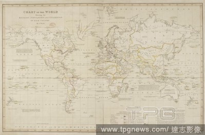
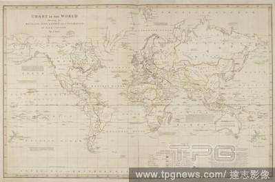
Editorial Chart of the World showing the religion, population and civilization of each country. Chart of the World showing the religion, population and civilization of each country. London, J. Hatchard, 1815. Source: Maps.950.(23).
- 2019-07-16
- 1

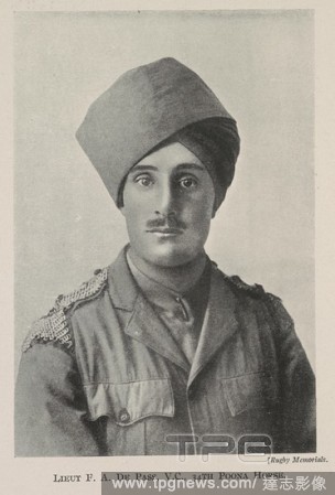
Editorial Lieut. F.A. De Pass, V.C.; 34th Poona Horse.' Frank Alexander de Pass VC (April 26, 1887 - November 25, 1914) was an English recipient of the Victoria Cross. He was the first person of the Jewish faith and the first Indian Army officer to receive the V...
- 2019-07-16
- 1
Editorial A comprehensive map delineating heaven and earth and the myriad countries of the world and ancient and modern human affairs . Ch'ien-k'un wan-kuo ch'u?an-t'u ku-chin jen-wu shih-chi / Ch'ang-chou fu Wu-hsi hsien ju-hsu?eh hsu?n-tao ssu jen Liang Cho...
- 2019-07-09
- 1
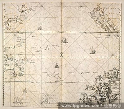
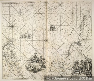
Editorial Pacific Ocean. [A Maritime Atlas of the World, by] F. de Wit. Tab. Amsterdam : Frederick de Wit, [1690]. Map of the Pacific Ocean. Image taken from [A Maritime Atlas of the World, by] F. de Wit. Tabulae Maritimae, ofte Zee-Kaerten. Originally publish...
- 2019-01-24
- 1
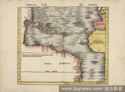
Editorial Map of Oceanvs Occidentalis. A map of the Eastern Ocean. The atlantic ocean and the Americas. Terra Incognita. West Africa. . Map of the Ancient World. Lithographed from an atlas to Ptolemy’s Geography ... Rome, 1478]. Strasbourg. Published in 1513. ...
- 2019-01-23
- 1
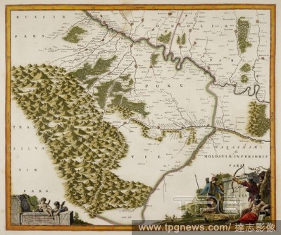
Editorial Map of Pokutia. A town. Illustration from an Atlas. . Atlas sive exactissimae Totius Orbis Tabulae. Netherlands. Published in 1646-1693. The maps have been specially, and beautifully, coloured by hand. The titlepage of each volume is in MS. Atlas sive ...
- 2019-01-23
- 1

Editorial 'A Complete Tour Round the World'. A map game. The Royal Geographical Pastime: exhibiting a complete tour round the World. London, 1770. Source: Maps * 950.(22.). Language: English.
- 2018-12-06
- 2
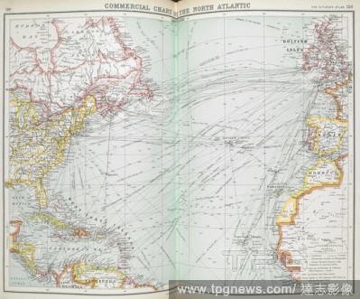
Editorial Commercial chart of the North Atlantic. [The Citizen's Atlas of the World, containing 120 pages of maps and plans. With a descriptive Gazetteer and geographical statistics. Edited by J.G. Bartholomew]. 1901-2. Source: Maps.44.d.5 pages 119-120.
- 2018-12-06
- 1
Editorial A comprehensive map delineating heaven and earth and the myriad countries of the world and ancient and modern human affairs . Ch'ien-k'un wan-kuo ch'u?an-t'u ku-chin jen-wu shih-chi / Ch'ang-chou fu Wu-hsi hsien ju-hsu?eh hsu?n-tao ssu jen Liang Cho...
- 2018-12-06
- 2
Editorial Chart of the World showing the religion, population and civilization of each country. Chart of the World showing the religion, population and civilization of each country. London, J. Hatchard, 1815. Source: Maps.950.(23).
- 2018-12-06
- 1

Editorial First World War map of the Austro-Italian Frontier, 1915. Stanford's War Maps. No. 14. The Seat of War on the Austro-Italian Frontier. Scale, 1 : 1,140,000 = 18 English miles to 1 inch. London, 30 June 1915. Source: Maps 1035.(90.) no.14.
- 2018-12-06
- 1
Editorial A Korean World Map. Chonhado/World Atlas. Korea, 19th Century. A Korean World Map, printed and hand-coloured, from an atlas of Korea with preliminary maps of the world, China, Japan and Ryuku islands. Image taken from Chonhado/World Atlas. Originally...
- 2018-12-06
- 1

Editorial A map produced during the Second World War, showing Vire, in the Basse-Normandie region, northwestern France. France 1:50,000. War Office. General staff. Geographical section. [London] : Ordnance Survey, 1942. Source: Maps MOD GSGS 4250. Sheet 6F/6. Su...
- 2018-12-06
- 1
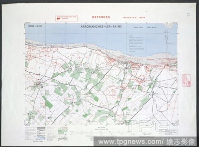
Editorial Arromanches - Les Bains. the French coast. A map of the Second World War. It was on the beach of Arromanches that, during the Invasion of Normandy immediately after D-Day, the Allies established an artificial temporary "Mulberry" harbour, named as Port...
- 2018-12-06
- 1
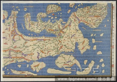
Editorial World map. Charta Rogeriana--Weltkarte des Idrisi--vom Jahr 1. Stuttgart, 1928. Section of Idrisi world map. Image taken from Charta Rogeriana--Weltkarte des Idrisi--vom Jahr 1154 n. Ch. Wiederhergestellt und herausgegeben von Konrad Miller. (Explanat...
- 2018-12-06
- 1
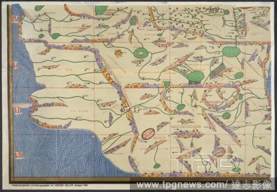
Editorial World map. Charta Rogeriana--Weltkarte des Idrisi--vom Jahr 1. Stuttgart, 1928. Section of Idrisi world map. Image taken from Charta Rogeriana--Weltkarte des Idrisi--vom Jahr 1154 n. Ch. Wiederhergestellt und herausgegeben von Konrad Miller. (Explanat...
- 2018-12-06
- 1

Editorial St. Aubin. Saint-Aubin, France. Juno beach. A map of the Second War World. On D-Day the infantry of the North Shore Regiment of New Brunswick landed there, and were backed up by the armour of the Fort Garry Horse (also known as the 10th Armoured Regime...
- 2018-12-06
- 1
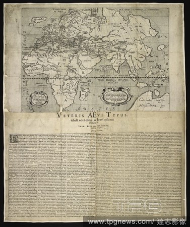
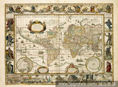
Editorial A map of the world. Primae Continentis Descriptio Vetus universalis, etc. Joan. Strubius ... design. Wilhelm Schwan coelavit. [With text.] Veteris AEvi Typus, tabula? nova? editus & brevi epitome illustratus a? Joan. Strubio. Brunsvigae : Godfridt M...
- 2018-12-06
- 1
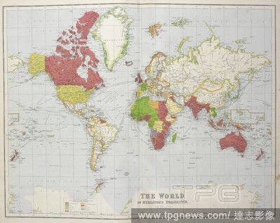
Editorial World map. Our Empire Atlas showing British Possessions at home and abroad. Edinburgh; London : W. & A.K. Johnston, 1897. Source: Maps.19.b.21, 5. Language: English.
- 2018-12-06
- 1
Editorial World map. [A General Atlas of Modern Geography]. [Constantinople], [1867?]. Twin-hemisphere world map. Image taken from [A General Atlas of Modern Geography]. Originally published/produced in [Constantinople], [1867?]. . Source: Maps.42.d.1,.
- 2018-12-06
- 1
Editorial World Map. Le Théatre du Monde ou Nouvel Atlas. Amsterdam, 1638-1640. Blaeu's World Map, entitled America. Image taken from Le Théatre du Monde ou Nouvel Atlas. Originally published/produced in Amsterdam, 1638-1640. Source: Maps.4.Tab.8, 9, 1.
- 2018-12-06
- 1
Editorial The world on Mercator's projection. London, Liverpool : George Philip & Son, [1920]. Source: Maps.146.c.8 no.2.
- 2018-12-06
- 1
Editorial Lieut. F.A. De Pass, V.C.; 34th Poona Horse.' Frank Alexander de Pass VC (April 26, 1887 - November 25, 1914) was an English recipient of the Victoria Cross. He was the first person of the Jewish faith and the first Indian Army officer to receive the V...
- 2018-12-06
- 2
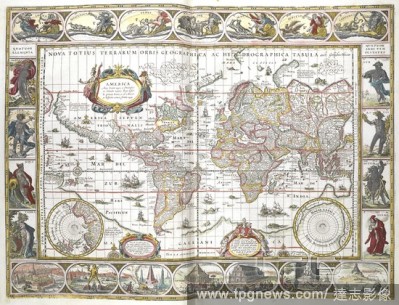
Editorial Map of the world. Figures and landscapes in the border. Le Theatre du Monde ou Nouvel Atlas ... par G. et J. Blaeu. Amsterdam, 1638- 1640. Source: Maps.4.Tab.8.(1).
- 2018-12-06
- 1
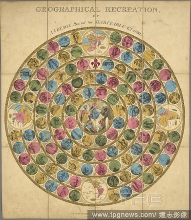
Editorial An illustrated circular diagram for the purposes of a game. Geographical recreation or a voyage round the habitable globe. London : John Harris at the Juvenile Library, Oct 1st 1809. Board game representing world travel and including 4 maps of continen...
- 2018-12-06
- 1
Editorial A map of the world showing the voyages of Captain Cook. Tallis's Illustrated Atlas, and Modern History of the World, Geographical, Political, Commercial, and Statistical. Edited by R. Montgomery Martin. London : John Tallis and Co., 1851. Source: Maps ...
- 2018-12-06
- 1
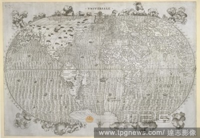
Editorial World map. Universale. [By] Giacomo [Gastaldo] Cosmographo. [. Venetia, 1546. World map. Image taken from Universale. [By] Giacomo [Gastaldo] Cosmographo. [On the elliptical projection].. Originally published/produced in Venetia, 1546. . Source: Maps...
- 2018-12-06
- 1
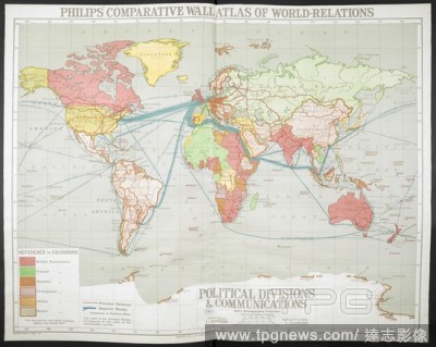
Editorial A map of the world . Philips' Comparative Series of Wall Atlases. World relations. Relief of Land. (Political Divisions & Communications. Climate, May 1--Oct. 31. Climate Nov. 1--April 30. Temperature. Annual Rainfall and Range of Temperature with July...
- 2018-12-06
- 1
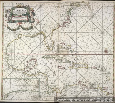
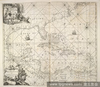
Editorial America. [A Maritime Atlas of the World, by] F. de Wit. Tab. Amsterdam : Frederick de Wit, [1690]. Map of America and the West Indies. Image taken from [A Maritime Atlas of the World, by] F. de Wit. Tabulae Maritimae, ofte Zee-Kaerten. Originally pub...
- 2018-12-06
- 1
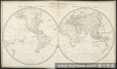
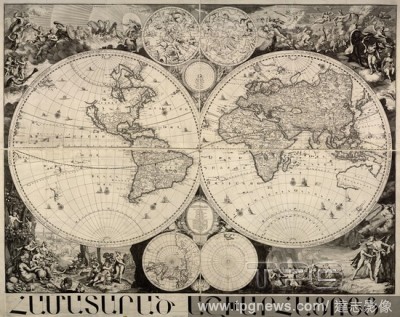
Editorial A twin hemisphere map of the world. A Map of the World, with the latest discoveries: by Dr. J. Blair, as a supplement to his Tables of Chronology. [In hemispheres, on the stereographic projection]. 1779. Source: Maps K.Top.4.33. Language: English.
- 2018-12-06
- 1
Editorial A historical map of the world, or a chronological, geographical and genealogical map of the States and Empires of the world. Mappe-Monde Historique, ou Carte Chronologique, geographique et ge?ne?alogique des E?tats et Empires du Monde [by Jean Darto...
- 2018-12-06
- 1
Editorial Cruelly village, on the French coast. A map of the Second World War. The 4th/7th Royal Dragoon Guards, were among the first soldiers to land on Gold Beach. The Guards, in amphibious DD Sherman Tanks, arrived five minutes before H-Hour, at 7.20am on Jun...
- 2018-12-06
- 1
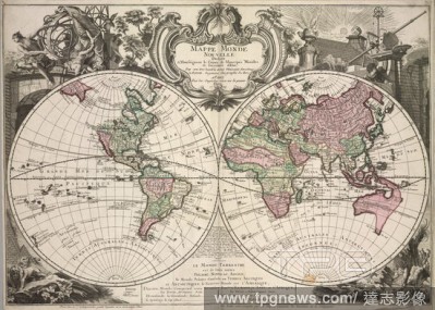
Editorial A twin hemisphere world map. Source: Maps *920.(89).
- 2018-12-06
- 1

Editorial A graphic index on a map of the Second World War. France, Belgium & Holland : index to 1:50,000 series. [London] : [SHAEF Survey Directorate], [1944]. Source: Maps.14317.(253) 7.
- 2018-12-06
- 1
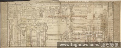
Editorial 'A new map of China, from the latest authorities by John Carey, engraver'. . Cary's New Universal Atlas, containing distinct Maps of all the principal States and Kingdoms throughout the World, etc. [With list of subscribers. The maps are dated 1709-180...
- 2018-12-06
- 1
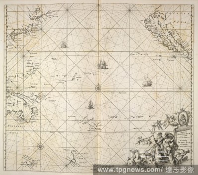
Editorial Pacific Ocean. [A Maritime Atlas of the World, by] F. de Wit. Tab. Amsterdam : Frederick de Wit, [1690]. Map of the Pacific Ocean. Image taken from [A Maritime Atlas of the World, by] F. de Wit. Tabulae Maritimae, ofte Zee-Kaerten. Originally publish...
- 2018-12-06
- 1
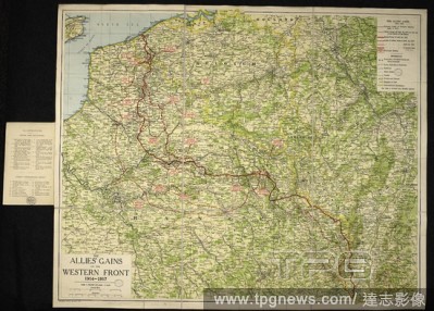
Editorial A map of the First World War: The Allies' gains on the Western Front, 1914-1917. The Allies' gains on the Western Front, 1914-1917. Scale, 1 : 633,000, 10 miles = 1 inch. ([With] numerous-official photographs). London : G. Philip & Son, [1918]. 880 x 7...
- 2018-12-06
- 1
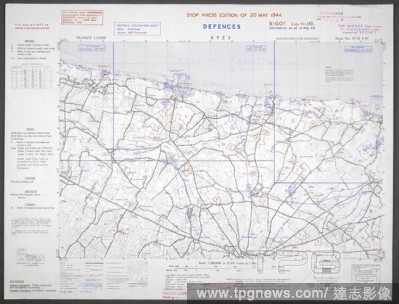
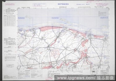
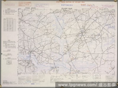
Editorial Ryes, French coast. 'Gold beach'. A map of the Second World War. France 1:25,000 Defences, Bigot. [London] : War Office, 1944. Source: Maps 14317.(259.) 37/18 SW.
- 2018-12-06
- 1
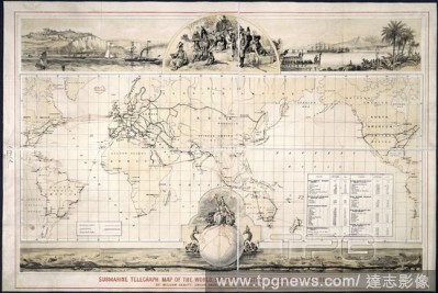
Editorial Submarine telegraph map. Submarine Telegraph Map of the World showing exist. London, Bates, Hendy & Co., 1876. Source: Maps.957.(14),.
- 2018-12-06
- 1

Editorial Title page of 'An Epitome of Ortelius his Theatre of the World'. An Epitome of Ortelius his Theatre of the World ... With new Mappes wanting in the Latin editions. London : J. Norton, [1610]. Source: Maps C.2.b.11, title page. Language: English.
- 2018-12-06
- 1
Editorial America. [A Maritime Atlas of the World, by] F. de Wit. Tab. Amsterdam : Frederick de Wit, [1690]. Map of America and the West Indies. Image taken from [A Maritime Atlas of the World, by] F. de Wit. Tabulae Maritimae, ofte Zee-Kaerten. Originally pub...
- 2018-12-06
- 2
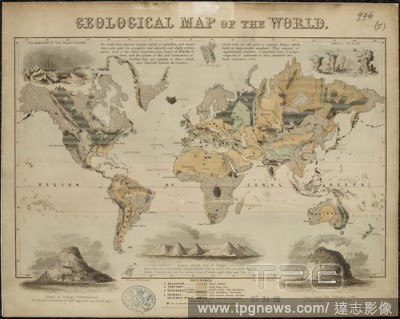
Editorial Geological Map of the World. Geological Map of the World. London, J. Reynolds, (1849?). Source: Maps.946.(5),. Language: English.
- 2018-12-06
- 1
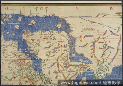
Editorial World map. Charta Rogeriana--Weltkarte des Idrisi--vom Jahr 1. Stuttgart, 1928. Section of Idrisi world map. Image taken from Charta Rogeriana--Weltkarte des Idrisi--vom Jahr 1154 n. Ch. Wiederhergestellt und herausgegeben von Konrad Miller. (Explanat...
- 2018-12-06
- 1
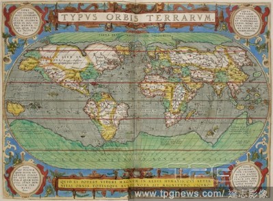
Editorial World map. Theatrum Orbis Terrarum. Antwerp, 1606. Typus Orbis Terrarum. Image taken from Theatrum Orbis Terrarum. Originally published/produced in Antwerp, 1606. . Source: Maps.9.Tab.8, 1.
- 2018-12-06
- 1

Editorial Iles St Marcouf, France. A map of the Second World War. ?les Saint-Marcouf are a group of two small uninhabited islands off the coast of Normandy, France. The islands became the first French territory that seaborne Allied forces took on D-Day. At 04:...
- 2018-12-06
- 1

Editorial Isigny, France. A map of the Second World War. Isigny-sur-Mer. Isigny was more than 60% destroyed by two bombardments on 8 June 1944. Isigny played its part in the D-Day landings: twenty small Dutch coasters, Schuyts, were employed by the Americans to...
- 2018-12-06
- 1

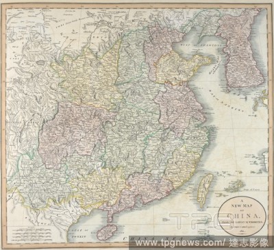
Editorial A map of China. Cary's New Universal Atlas, containing distinct Maps of all the principal States and Kingdoms throughout the World, etc. [With list of subscribers. The maps are dated 1709-1807]. 1811. Source: Maps 40.f.11, plate 43. Language: English.
- 2018-12-06
- 1
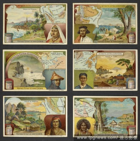
Editorial Six trading trades depicting: De?troit de Malacca - De?troit de Bab-el-Mandeb - De?troit de Bering - De?troit de Coe?e - De?troit de Magellan - De?troit de Torre?s. Contents: On verso: geographical descriptions and recipes. Physical Descript...
- 2018-12-06
- 1
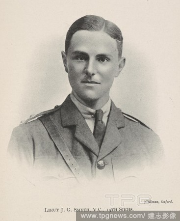
Editorial Lieut J.G. Smyth, V.C., 15th Sikhs. Brigadier Sir John George Smyth, 1st Baronet, VC MC PC (25 October 1893 – 26 April 1983) was a British Indian Army officer and Conservative Member of Parliament. He was a lieutenant in the 15th Ludhiana Sikhs, 3rd ...
- 2018-12-06
- 1
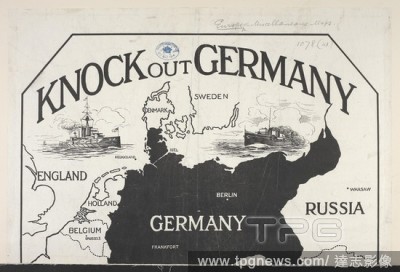
Editorial A pictorial map of the First World War. Knock out Germany. An instructive partial map of Europe with Germany silhouetted, etc. [London] : S[p]ecially prepared for the Toy Target Company, [1914]. 345 x 365 mm. . Source: Maps.1078.(41).
- 2018-12-06
- 1
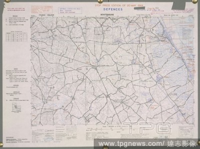
Editorial Montebourg, France. A map of the Second World War. Montebourg was liberated on the 19 June 1944. . France 1:25,000 Defences, Bigot. [London] : War Office, 1944. Source: Maps 14317.(259.) 31-20 SE.
- 2018-12-06
- 1
Editorial World map. [A General Map of the World on Mercator's projecti. [Yedo?], [1860?]. World map. Image taken from [A General Map of the World on Mercator's projection].. Originally published/produced in [Yedo?], [1860?]. . Source: Maps.920.(150),.
- 2018-12-06
- 1
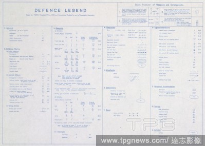
Editorial Defence legend for a map of the Second World War. France 1:25,000 Defences, Bigot. [London] : War Office, 1944. Source: Maps.14317.(259) sheet 4.
- 2018-12-06
- 1
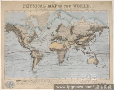
Editorial A physical map of the world. Physical Map of the World. London : J. Reynolds, 1849. Source: Maps 950.(34.). Language: English.
- 2018-12-06
- 1
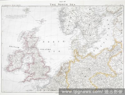
Editorial First World War map of the North Sea, 1914. Stanford's War Maps. No. 5. Map of the North Sea. Scale 50,8235 miles - 1 inch, or 1:3,220,177 of nature. London, 12 August 1914. Source: Maps.1035.(90) no.5.
- 2018-12-06
- 1
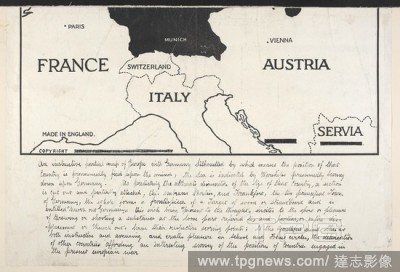
Editorial A map of the First World War, showing France,Switzerland,Italy,Austria and Serbia. Knock out Germany. An instructive partial map of Europe with Germany silhouetted, etc. [London] : S[p]ecially prepared for the Toy Target Company, [1914]. 345 x 365 mm. ...
- 2018-12-06
- 1
Editorial South America. [A Maritime Atlas of the World, by] F. de Wit. Tab. Amsterdam : Frederick de Wit, [1690]. Map of South America. Image taken from [A Maritime Atlas of the World, by] F. de Wit. Tabulae Maritimae, ofte Zee-Kaerten. Originally published/p...
- 2018-12-06
- 1
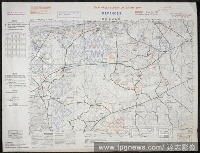
Editorial Defences - Dozulé, France. A map of the Second World War. No.48 Commando RM past the village of Dozule after the D-Day landings. . France 1:25,000 Defences, Bigot. [London] : War Office, 1944. Source: Maps 14317.(259.).
- 2018-12-06
- 1
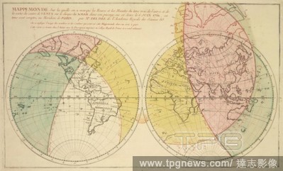
Editorial A world map on which are marked the hours and minutes of the true times of Venus's orbit around the Sun. Mappemonde, sur laquelle on a marque? les heures et les minutes du tems vrai de l'entre?e et de la sortie du centre de Venus sur le disque du Sol...
- 2018-12-06
- 2

Editorial This German map of Liverpool dates back to the Second World War. It is one of a series of maps used by German bomber pilots in their night-time missions over Britain. Only the most obvious features are included on the map: towns, railway lines, major r...
- 2018-12-06
- 1
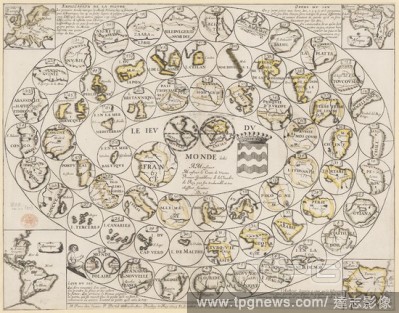
Editorial Game of the World. Le Jeu du Monde ... Par ... Du Val. Paris, 1645. Source: Maps * 999.(27.).
- 2018-12-06
- 1
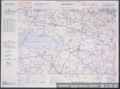
Editorial Trevieres, France. 'Omaha beach. A map of the Second World War. Trévières was the 38th (American) Regimental Combat Team objective. France 1:25,000 Defences, Bigot. [London] : War Office, 1944. Source: Maps 14317.(259.) 34/18 SE.
- 2018-12-06
- 1
Editorial A twin hemisphere world map. Mappe Monde nouvelle. 1744. Source: Maps K.Top.4.26.
- 2018-12-06
- 1

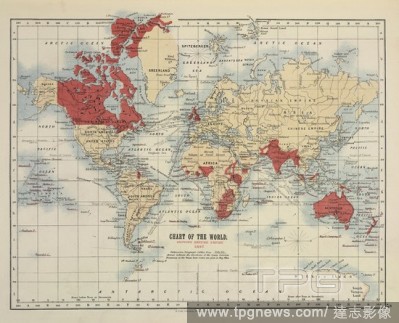
Editorial The world - commercial highways & european colonies. With plans showing 'the races of mankind' and 'the religions of mankind.' . Philips' London School Board Atlas. A series of 40 coloured plates, containing over 90 maps and plans, printed in colours...
- 2018-12-06
- 1
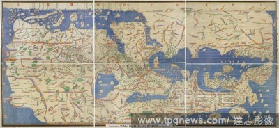
Editorial World map. El Idrisi map (1154): reconstruction by Konrad Mil. Stuttgart, 1928. World Map. Image taken from El Idrisi map (1154): reconstruction by Konrad Miller. Charta Rogeriana--Weltkarte des Idrisi--vom Jahr 1154 n. Ch. Wiederhergestellt und herau...
- 2018-12-06
- 1
Editorial A map of Surrey. A prospect of the most famous parts of the world ... together with all the provinces, counties, and shires, contained in that large Theater of Great Britaines Empire. Performed by John Speed. London : Printed by M. and S. Simmons, and ...
- 2018-12-06
- 1
Editorial Ste. Mere Eglise. Sainte-Mère-église, France. A map of the Second World War. In the early morning of 6 June 1944 mixed units of the U.S. 82nd Airborne and U.S. 101st Airborne Divisions occupied the town in Operation Boston, giving it the claim to be ...
- 2018-12-06
- 1
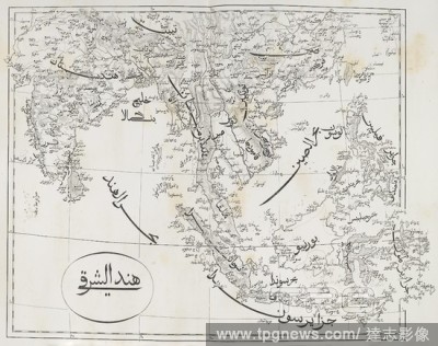
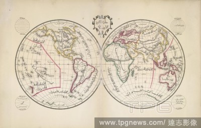
Editorial India and South-East Asia. [A Collection of Arabic Maps, without title, of th. [Beyrout], [1860?]. Map of India and South-East Asia. Image taken from [A Collection of Arabic Maps, without title, of the various Countries in the World].. Originally pub...
- 2018-12-06
- 1
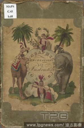
Editorial Illustrated front cover. Geographical recreation or a voyage round the habitable globe. London : John Harris at the Juvenile Library, Oct 1st 1809. Board game representing world travel and including 4 maps of continents. Previously owned and donated by...
- 2018-12-06
- 2
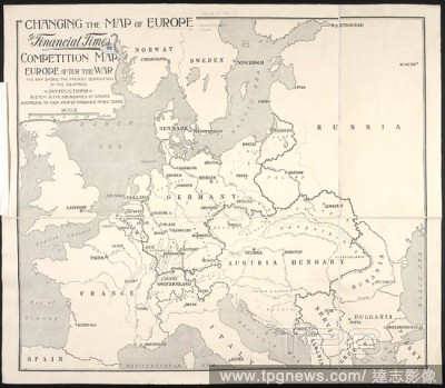
Editorial A map of the First World War. Changing the Map of Europe. The Financial Times Competition. Europe after the war ... Scale, 300 miles[ = 105 mm]. London, 1914. 610 x 520 mm.; Scale, 300 miles[ = 105 mm]. Source: Maps 1078.(40).
- 2018-12-06
- 1
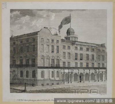
Editorial North west aspect of Lackington, Allena & Co's Temple of the Muses, Finsbury Square - The finest shop in the world being 140 feet in front. N.W. Aspect of Lackington, Allen, and Co.'s Temple of the Muses, Finsbury Square. London, 1829. London. A book s...
- 2018-12-06
- 1
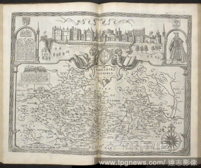
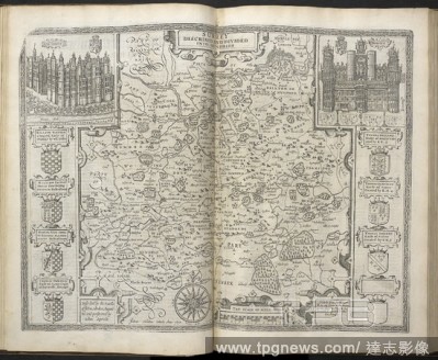
Editorial A map of Berkshire. A prospect of the most famous parts of the world ... together with all the provinces, counties, and shires, contained in that large Theater of Great Britaines Empire. Performed by John Speed. London : Printed by M. and S. Simmons, a...
- 2018-12-06
- 1
 Loading