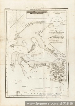
EditorialPlan of the Harbour and Adjacent Territories of Mosambique, Map of the harbor and surrounding areas of Mozambique, based on the geometric surveys of Henry Salt, after p. 24, p. 48, Outhett, John (del.); Macpherson, Alexander (sculp.), 1809, Henry Salt:...
EditorialDrawn plan of Stratford Place, showing the houses &c. and the alteration of the sewer, 1772. . 1772. [ca. 1800]. Pen and ink with wash on tracing paper with additions in pencil. Copied from a plan of 1772; leaseholders' names and dimension of indivi...
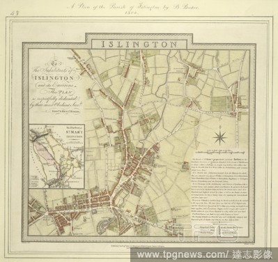
EditorialMap of the borough of Islington with inset plan of the parish of St Mary's on the left of the plate and note giving information about the borough down the right side of the plate. The plan shows the New River, a man made water course supplying London w...
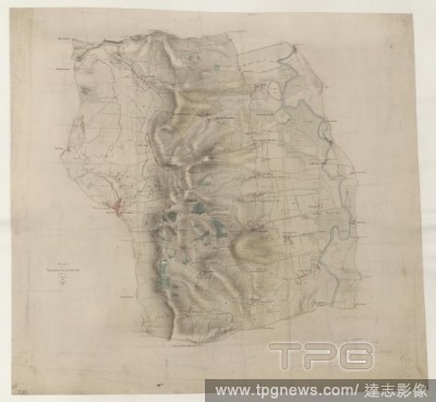
EditorialThis plan covers an area of 82.625 square miles in Nottinghamshire and Lincolnshire. The county boundary is indicated by a red pecked line following the course of the River Trent down the right of the sheet. Land use is indicated by colours instead of ...


 Loading