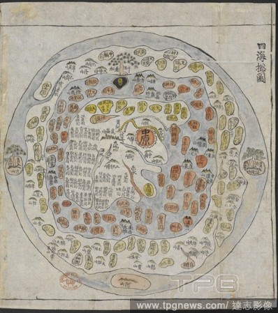
EditorialA Korean World Map. Chonhado/World Atlas. Korea, 19th Century. A Korean World Map, printed and hand-coloured, from an atlas of Korea with preliminary maps of the world, China, Japan and Ryuku islands. Image taken from Chonhado/World Atlas. Originally...

 Loading