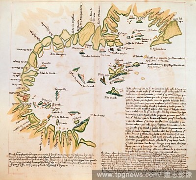
EditorialThe Bay of Panama. Charts of Pacific Coasts of America. England [London]; circa 1685. [Whole chart] Chart of the Bay of Panama, between Point Guarachine and the island of Gallera Image taken from Charts of Pacific Coasts of America. Originally publis...
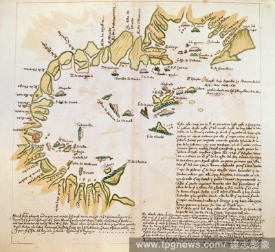
EditorialThe Bay of Panama. Charts of Pacific Coasts of America. England [London]; circa 1685. [Whole chart] Chart of the Bay of Panama, between Point Guarachine and the island of Gallera Image taken from Charts of Pacific Coasts of America. Originally publis...

 Loading