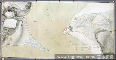
EditorialArderseer and Channary. A colored survey of the points of Arderseer and Ch. 1752. A colored survey of the points of Arderseer and Channary, in the Murray Firth, shewing the situation of Fort George, and the soundings of the channel. Image taken from A...
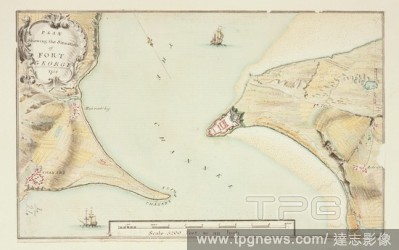
EditorialPlan of Fort George. A colored survey of the points of Arderseer and Ch. 1752. A plan showing the situation of Fort George. Image taken from A colored survey of the points of Arderseer and Channary, in the Murray Firth, shewing the situation of Fort G...
EditorialA survey of part of the Murray (Moray) Firth. A SURVEY of PART of the MURRAY FIRTH Shewing the Situation of the NEW FORT at ARDERSEER. [Place of production not identified] : [producer not identified], [about 1748.]. Source: Maps K.Top.50.22. Language: ...
EditorialArderseer and Channary. A colored survey of the points of Arderseer and Ch. 1752. A colored survey of the points of Arderseer and Channary, in the Murray Firth, shewing the situation of Fort George, and the soundings of the channel. Image taken from A...
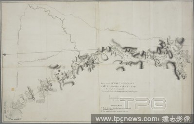
EditorialA survey from Fort George at Arderseer to Bellamoor in Strath Spey. Survey from fort GEORGE at ARDESEER to BELLAMOOR in STRATH SPEY : Measuring thirty miles and a half Also showing the Angles of the Surveys made in that Country last year. [Scotland] : ...


 Loading