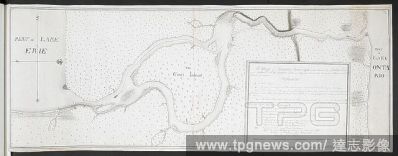
A map of Niagara River May 1760'. Part of Lake Erie. . 'A map of Niagara River May 1760 Geo. Demler Lieut 60th Regimt'. 1:63360. 'Scale of 8 miles' (= 8 inches). Map oriented with West at top. Amherst no. A 55. R.U.S.I. no. A 27.33A. Laid down in the

 Loading