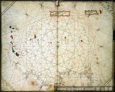
Chart of the Eastern Atlantic. Portolano. Italy; 1463. [Whole chart] Chart of the west coasts of Spain, Portugal, and Africa to the Canary Islands, including Madeira and the Azores Image taken from Portolano. Originally published/produced in Italy; 1

 Loading