
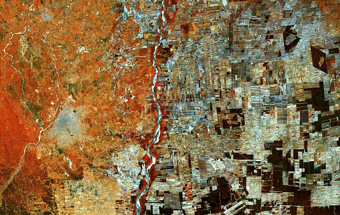
Deforestation in Bolivia, satellite image. This area of Bolivia was once covered by trees but has now been cleared for resettlement schemes and agriculture. Bolivia's city of Santa Cruz is at lower left. Rapid deforestation has resulted in the region being transformed from dense forest into a large mosaic of fields. As well as countless rectangular fields, radial features can be seen where individual farmers have worked outwards from a central hub of communal land. Image data obtained on 30 September 2017, by the Copernicus Sentinel-2A satellite.
| px | px | dpi | = | cm | x | cm | = | MB |
Details
Creative#:
TOP25469191
Source:
達志影像
Authorization Type:
RM
Release Information:
須由TPG 完整授權
Model Release:
N/A
Property Release:
N/A
Right to Privacy:
No
Same folder images:
 Loading