
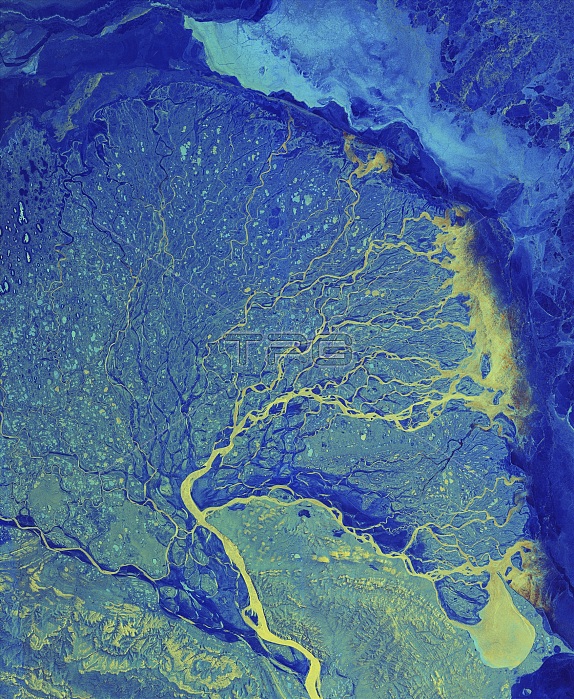
Lena River Delta, satellite image, satellite image. The Lena River flows 4400 kilometres from south-central Russia, to this delta on the Arctic coast of north-west Russia. At the delta, the water spreads out through numerous channels, depositing its silt to build the land of the delta, before emptying into the Laptev Sea. The delta is frozen in the winter, but in summer it is a thriving wetland. Hundreds of small lakes and ponds are visible dotted around the tundra, with a large amount of ice present at the peak of the Arctic winter. Image data obtained on 14 January 2019, by the Copernicus Sentinel-1 satellites.
| px | px | dpi | = | cm | x | cm | = | MB |
Details
Creative#:
TOP25469187
Source:
達志影像
Authorization Type:
RM
Release Information:
須由TPG 完整授權
Model Release:
N/A
Property Release:
N/A
Right to Privacy:
No
Same folder images:
 Loading