
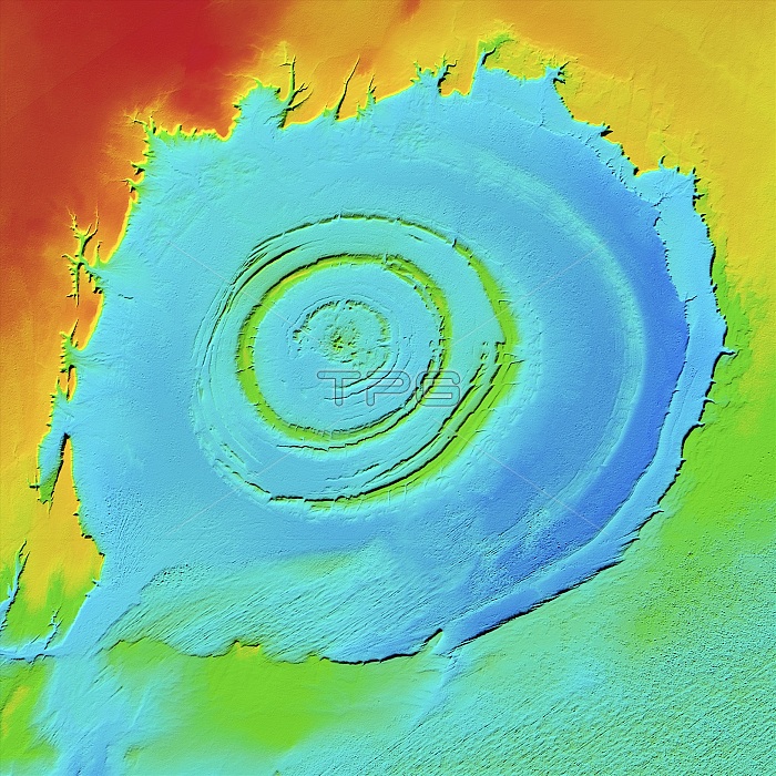
Richat Structure, LiDAR satellite image. The Richat Structure is an eroded volcanic dome in the deserts of Mauritania. As the volcanic dome eroded, concentric layers of rock were exposed. The structure is 485 metres high, and nearly 50 kilometres across. It is in the Maur Adrar Desert, in the Western Sahara. LiDAR combines optical and laser imaging to produce digital elevation maps (DEMs), with differences in elevation shown by the colour-coding of the image. Image data obtained by the radar and optical sensors on the Advanced Land Observation Satellite (ALOS) of the Japan Aerospace Exploration Agency (JAXA).
| px | px | dpi | = | cm | x | cm | = | MB |
Details
Creative#:
TOP25469169
Source:
達志影像
Authorization Type:
RM
Release Information:
須由TPG 完整授權
Model Release:
N/A
Property Release:
N/A
Right to Privacy:
No
Same folder images:
 Loading