
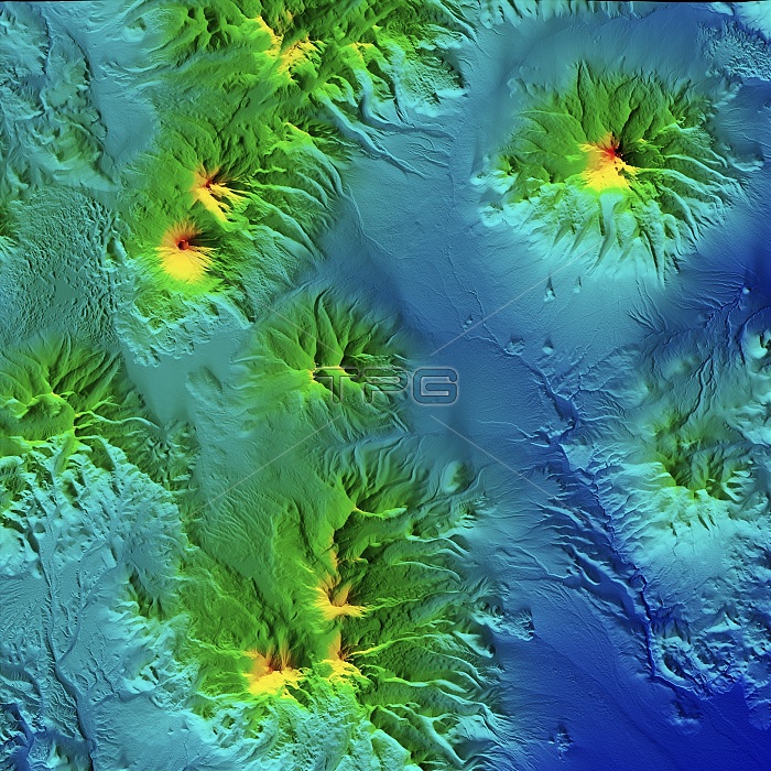
Volcanoes in Chile and Bolivia, LiDAR satellite image. The dormant stratovolcano of Parinacota (upper left) lies on the border between Bolivia and Chile. It reaches an elevation of 6380 metres. At upper right is the extinct stratovolcano of Nevado Sajama (6542 metres) in Bolivia. At lower left is the volcano of Guallatiri (6071 metres) in Chile. This area is part of the Andean Volcanic Belt. LiDAR combines optical and laser imaging to produce digital elevation maps (DEMs), with differences in elevation shown by the colour-coding of the image. Image data obtained by the radar and optical sensors on the Advanced Land Observation Satellite (ALOS) of the Japan Aerospace Exploration Agency (JAXA).
| px | px | dpi | = | cm | x | cm | = | MB |
Details
Creative#:
TOP25469168
Source:
達志影像
Authorization Type:
RM
Release Information:
須由TPG 完整授權
Model Release:
N/A
Property Release:
N/A
Right to Privacy:
No
Same folder images:
 Loading