
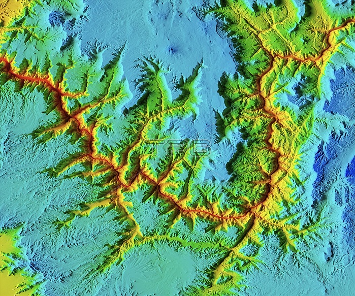
Grand Canyon, LiDAR satellite image. Located in Arizona, USA, the 6-million-year-old Grand Canyon system is a set of gorges eroded from the rock by the Colorado River. It extends for hundreds of kilometres, is nearly 30 kilometres wide, and at its deepest is 1.5 kilometres deep. LiDAR combines optical and laser imaging to produce digital elevation maps (DEMs), with differences in elevation shown by the colour-coding of the image. Image data obtained by the radar and optical sensors on the Advanced Land Observation Satellite (ALOS) of the Japan Aerospace Exploration Agency (JAXA).
| px | px | dpi | = | cm | x | cm | = | MB |
Details
Creative#:
TOP25469165
Source:
達志影像
Authorization Type:
RM
Release Information:
須由TPG 完整授權
Model Release:
N/A
Property Release:
N/A
Right to Privacy:
No
Same folder images:
 Loading