
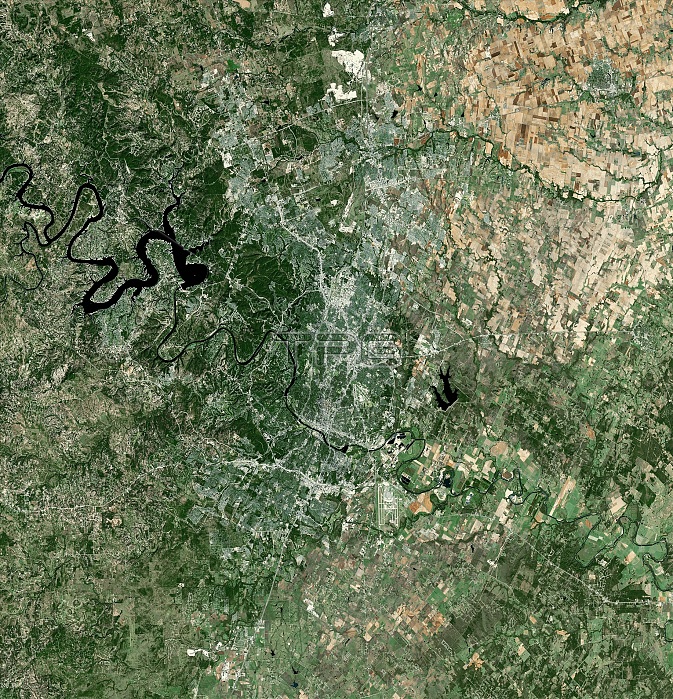
Austin, Texas, USA, and its surroundings, satellite image. North is at top. Austin is the capital of the US state of Texas. As of 2013, it had a population of 885,400 and an area of 704 square kilometres. The river flowing from upper left to lower right is the Colorado River. The reservoir at upper left is Lake Travis (behind Mansfield Dam, completed in 1941), the largest of the Highland Lakes formed by dams on the Colorado. Forested areas are dark green, bare ground is brown, urban areas are grey, and water is black. This image covers an area around 70 kilometres across. Image created using NaturalVue data obtained from the Landsat 7 satellite.
| px | px | dpi | = | cm | x | cm | = | MB |
Details
Creative#:
TOP15094490
Source:
達志影像
Authorization Type:
RM
Release Information:
須由TPG 完整授權
Model Release:
No
Property Release:
No
Right to Privacy:
No
Same folder images:
 Loading