
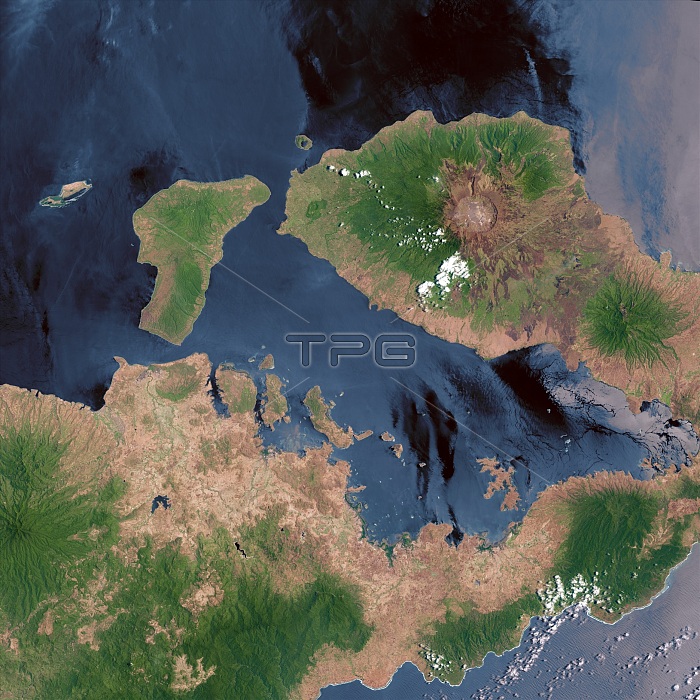
Mount Tambora. Landsat 8 satellite imageof Mount Tambora volcano (upper right), Sumbawa Island, Indonesia. The volcano's caldera (brown circle), an area of collapsed land resulting from a volcanic eruption, measures 6 kilometres across and is 800 metres deep. The caldera was formed in 1815 after a huge explosion that ejected massive amounts of ash and sulphur dioxide into the atmosphere. Global cooling caused by the eruption led to 1816 being called 'the year without a summer'. Image obtained by Landsat 8's Operational Land Imager (OLI), in October 2013.
| px | px | dpi | = | cm | x | cm | = | MB |
Details
Creative#:
TOP13924931
Source:
達志影像
Authorization Type:
RM
Release Information:
須由TPG 完整授權
Model Release:
N/A
Property Release:
No
Right to Privacy:
No
Same folder images:
18151816201321stcenturyasiaasiancalderacoastcoastalcollapsecollapsedearthobservationfromspacegeographicalgeographygeologicalgeologyindonesiaindonesianirislandlandsat8mounttamborano-onenobodyoctobersatellitesatelliteimageseastratovolcanosumbawaislandtruecolourvolcanicvolcanovolcanologyvulcanologyyearwithoutasummer
818151816201321staasiaasiancalderacenturycoastcoastalcollapsecollapsedcolourearthfromgeographicalgeographygeologicalgeologyimageindonesiaindonesianirislandislandlandsatmountno-onenobodyobservationoctobersatellitesatelliteseaspacestratovolcanosumbawasummertamboratruevolcanicvolcanovolcanologyvulcanologywithoutyear
 Loading