
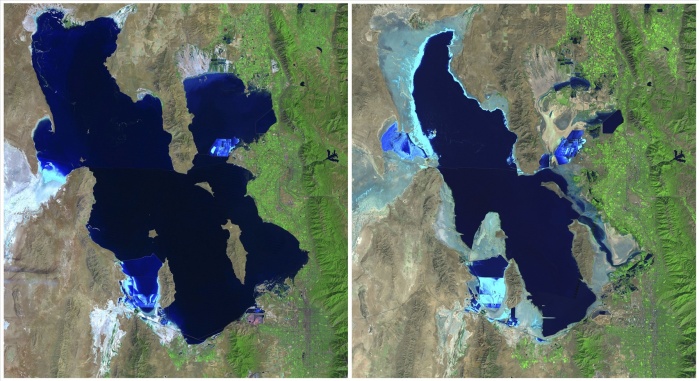
Great Salt Lake, USA, 1985-2010. Landsat satellite photographs showing the loss of water from the Great Salt Lake in Utah, USA. The image on the left was taken in 1985 and on the right 2010. The Great Salt Lake is susceptible to seasonal variations in times of drought or heavy rainfall.
| px | px | dpi | = | cm | x | cm | = | MB |
Details
Creative#:
TOP09417829
Source:
達志影像
Authorization Type:
RM
Release Information:
須由TPG 完整授權
Model Release:
No
Property Release:
No
Right to Privacy:
No
Same folder images:
 Loading