
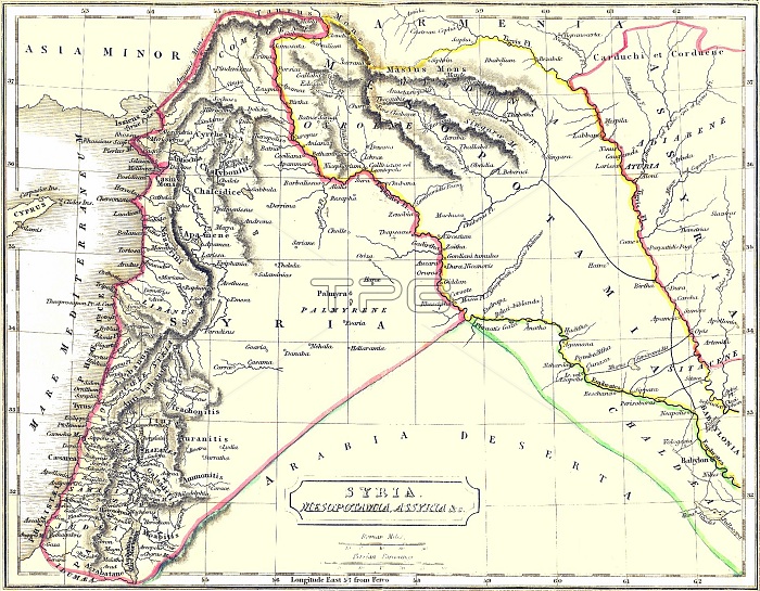
Map of ancient Syria published in 1900. The boundaries of Syria are shown to include Palestine as far as Gaza, all of Lebanon, and Antakya in Turkey. This corresponds quite closely to Syria before the French Mandate was imposed in 1920. Lebanon was separated from Syria by the French in 1926, and Turkey occupied Antakya unilaterally in 1939.
| px | px | dpi | = | cm | x | cm | = | MB |
Details
Creative#:
TPG32688280
Source:
達志影像
Authorization Type:
RF
Release Information:
須由TPG 完整授權
Model Release:
No
Property Release:
No
Right to Privacy:
No
Same folder images:
 Loading