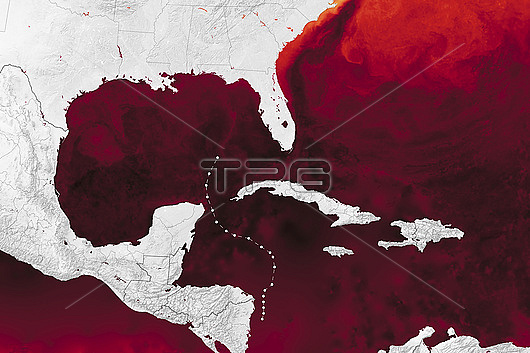
Map of sea surface temperatures in the Caribbean Sea, Gulf of Mexico and Atlantic Ocean on the 23rd September 2024, as Hurricane Helene developed in the western Caribbean Sea. The path of Helene as it developed into a hurricane on the 25th September is shown by the dotted line. Sea surface temperatures above 27.8 degrees Celsius (C), the temperature generally required to sustain and intensify hurricanes, are red, with black areas measuring greater than 32 degrees C. Helene passed off the coast of Mexicos Yucatan Peninsula on the 23rd September as a tropical storm, causing major flooding. As it entered the Gulf of Mexico it intensified, eventually making landfall in Florida, USA, as a category 4 hurricane on 26th September. The high winds and storm surges caused extensive damage and several fatalities. Rising sea temperatures, which can lead to more quickly intensifying hurricanes, have been attributed to climate change due to human activity. Multiscale Ultrahigh Resolution Sea Surface Temperature (MUR SST) project,
| px | px | dpi | = | cm | x | cm | = | MB |
Details
Creative#:
TOP30048966
Source:
達志影像
Authorization Type:
RM
Release Information:
須由TPG 完整授權
Model Release:
N/A
Property Release:
N/A
Right to Privacy:
No
Same folder images:

 Loading