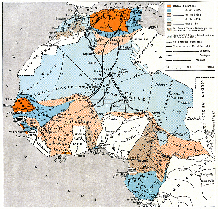
Map of French colonial Africa (French colonial empire) in 1930; with occupation dates from before 1871 until 1914: Western and Equatorial Africa; Morocco; Algeria; Tunisia (Maghreb - Sahara); Senegal; Sudan; Ivory Coast; Upper Volta; Guinea; Togo; Dahomey; Gabon; Cameroon; Congo; Niger; Mauritania; Chad; etc. - colonies; possessions and protectorates of France. Map drawn up by Major Pollacchi in 1930.
| px | px | dpi | = | cm | x | cm | = | MB |
Details
Creative#:
TOP29987289
Source:
達志影像
Authorization Type:
RM
Release Information:
須由TPG 完整授權
Model Release:
no
Property Release:
no
Right to Privacy:
No
Same folder images:

 Loading