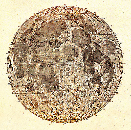
Map of the Moon by the German astronomer Tobias Mayer (1723-1762), published in 1775 in Opera Indeita. The map is divided up into a co-ordinate system of longitude and latitude. The map shows the cratered highlands (light areas) and the lowland lunar maria (dark areas). The mapping of the Moon with telescopes started with Galileo in 1610, and then developed further during the 17th and 18th centuries as telescopes improved.
| px | px | dpi | = | cm | x | cm | = | MB |
Details
Creative#:
TOP29978834
Source:
達志影像
Authorization Type:
RM
Release Information:
須由TPG 完整授權
Model Release:
no
Property Release:
Right to Privacy:
No
Same folder images:
1700s177518thcenturyartworkastronomicalastronomycartographycirclecircularco-ordinateco-ordinatescratercratersdiagramdrawingequipmentgermanhistoricalhistoryhistoryofscienceillustrationlatitudelongitudelunarmapmaremariamoonno-onenobodyoperaindeitaresearchroundselenographicalselenographyspacesurfacetobiasmayertopographicaltopographynobodyno-one
1700s177518thartworkastronomicalastronomycartographycenturycirclecircularco-ordinateco-ordinatescratercratersdiagramdrawingequipmentgermanhistoricalhistoryhistoryillustrationindeitalatitudelongitudelunarmapmaremariamayermoonno-oneno-onenobodynobodyofoperaresearchroundscienceselenographicalselenographyspacesurfacetobiastopographicaltopography

 Loading