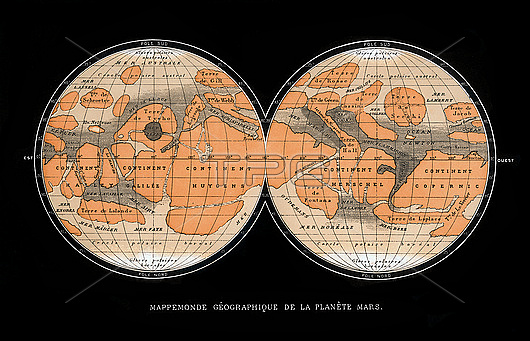
Map of Mars published in Paris in 1881. The first accurate telescope observations of Mars were made in 1877 and 1881 when Mars was at its closest to Earth (a situation called an opposition). The map (north at bottom) does show the dark and light areas thought to be seas and continents, but now known to be highlands (dark) and lowlands (light). The map features are named for famous astronomers. The Mer Sciaparelli (upper right) is now known as Valles Marineris, and Terre de Secchi (upper left) is an impact basin now named Hellas Planitia.
| px | px | dpi | = | cm | x | cm | = | MB |
Details
Creative#:
TOP29943717
Source:
達志影像
Authorization Type:
RM
Release Information:
須由TPG 完整授權
Model Release:
N/A
Property Release:
N/A
Right to Privacy:
No
Same folder images:

 Loading