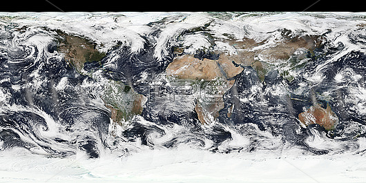
Satellite image of how the Earth looked from space on 14 October 2015. Image obtained by the Suomi National Polar-orbiting Partnership (NPP) satellite.
| px | px | dpi | = | cm | x | cm | = | MB |
Details
Creative#:
TOP29909692
Source:
達志影像
Authorization Type:
RM
Release Information:
須由TPG 完整授權
Model Release:
N/A
Property Release:
N/A
Right to Privacy:
No
Same folder images:
14october20152000s2010s201521stcenturyafricaafricanasiaasianaustraliaaustralianbluemarblecartographycloudscloudycompositecontinentcontinentsearthobservationeuropeeuropeanflatflatmapfromspacegeographicalgeographygloballatinamericamapmeteorologicalmeteorologynasano-onenobodynorthamericanorthamericannppoceanoceansmoctobersatellitesatelliteimagesouthamericasuominationalpolar-orbitingpartnershipweatherworldworldwide
142000s2010s2015201521stafricaafricanamericaamericaamericaamericanasiaasianaustraliaaustralianbluecartographycenturycloudscloudycompositecontinentcontinentseartheuropeeuropeanflatflatfromgeographicalgeographyglobalimagelatinmapmapmarblemeteorologicalmeteorologynasanationalno-onenobodynorthnorthnppobservationoceanoceansmoctoberoctoberpartnershippolar-orbitingsatellitesatellitesouthspacesuomiweatherworldworldwide

 Loading