
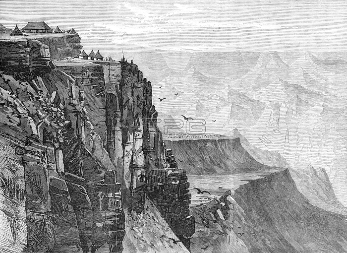
The Abyssinian Expedition: view from a point near the Kings House, Magdala, 1868. Engraving of a sketch by Major Baigrie showing ...the precipitous cliffs and ledges or platforms of rock on the side of Magdala...The view is taken from a point near one of the houses occupied by King Theodore, from which he could see the approach of the British troops as they came down the rugged declivity from the plateau of Dalanta and crossed the Bashilo on Good Friday morning...Magdala, with its connected hilltops of Selassee and Fahla...forms a detached portion of the elevated table-land, cut off from it by the valley or ravine of the Bashilo. The steepness of the descent from Dalanta to the Bashilo is as much as 3800 ft. in four miles; and we may, therefore, understand what a difficult and arduous task it was to bring the troops, with their guns and stores, down that portion of the road...The second ledge or platform, which appears half-way up, is that of Islamgee, where King Theodores camp is plainly visible, consisting of an assemblage of huts, built of reeds or grass, in the shape of conical beehives. From "Illustrated London News", 1868.
| px | px | dpi | = | cm | x | cm | = | MB |
Details
Creative#:
TOP29822397
Source:
達志影像
Authorization Type:
RM
Release Information:
須由TPG 完整授權
Model Release:
no
Property Release:
no
Right to Privacy:
No
Same folder images:
 Loading